Warning - the Watanic Bowmen club has archery events on adjoining land, near a couple of the waypoints on the southern side of the area. Be careful.
|
|
|
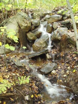
I stumbled across this neat little waterfall.
Expect puddles, even if it hasn’t rained.
|
The hunt for this cache will take you on a tour of the Horse Hill Nature Preserve in Merrimack. The area covers 563 acres which was bought by the town several years ago, for recreational use and conservation. The Master Plan for the property contains a wealth of information about the history, current use, and plans for the area.
The coordinates above are for parking at a trailhead. There are a total of five waypoints, plus the final cache. To get the coordinates of each waypoint, you must answer a multiple choice question. The questions all refer to some characteristic of the waypoint location. You can find the correct answers by plotting the coordinates on a map and then determining which one matches the question.
The correct answer will lead you to the next waypoint. The incorrect answers will lead you astray. There is a marker at each incorrect location indicating you are at the wrong spot.
All the waypoints and final cache are in the area bounded on the north by Amherst Rd, on the east by Naticook Rd, and on the southwest by Peaslee Rd. You do not have to cross any paved road to get to any of the waypoints. The terrain is varied. There are some nice wide trails, and some overgrown trails. Some parts have thorns and mud. Wetlands cover much of the preserve. Some moderate bushwhacking is required. Finding your way through the extensive trail network will be part of the adventure. You might be tempted to bushwhack more than is necessary. Sometimes it might save time, sometimes it won’t. Total walking distance is at least four miles. This trail map might help. The area is open at night, but I recommend searching only in daylight. I expect it will take four hours or more to complete the entire cache. I’d be interested in hearing how long it takes you.
Each waypoint is small, but out in the open. The final cache is a large ammo can.
All the coordinates are given in UTM Zone 19, WGS84/NAD83 datum. I used UTM because it is easier for me to visualize coordinates on a map when the north-south and east-west units of measurement are the same, unlike degrees of latitude and longitude.
Things to figure out before you go:
|
|
|
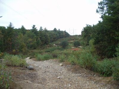
Trails under the power lines.
|
- How to read a topographic map
- How to locate a point on the map, given the UTM coordinates
- How to enter UTM coordinates into your GPS receiver
Things to bring with you:
- Long pants
- Hiking boots
- Orange vest during hunting season
- A good topographic map. A printout of a map from mytopo.com is sufficient. The topo map in my Magellan Meridian Gold GPSr is not even close to being good enough.
The first question:
To find the coordinates of waypoint 1, answer the following question. Which one of these is closest to a beaver dam?
- 292033E 4746139N
- 292168E 4746245N
- 292079E 4746371N
- 292254E 4746428N
Since your topo map probably doesn’t include beaver dams, you just have to use a little common sense along with your map to figure it out. The rest of the multiple choice questions are similar. Pay close attention to the exact wording of each question. It might help to write down each question so you can refer back to it in case you have second thoughts about your interpretation.