An accurate waypoint? Virtual Cache
-
Difficulty:
-

-
Terrain:
-
Size:  (virtual)
Please note Use of geocaching.com services is subject to the terms and conditions
in our disclaimer.
|
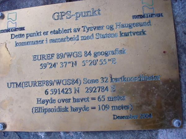
Her skal du kunne sjekke GPS-ens nøyaktighet. Tavlen er et samarbeid mellom Haugesund og Karmøy kommuner og Statens Kartverk. Det skal selvfølgelig være en nøyaktig posisjon.
Vi hadde med oss to GPS-er som begge hadde nøyaktig det samme avviket. Det blir morsomt å se hvor mange som får nøyaktig den samme posisjonen på sin GPS og om avvikene samler seg eller er spredt.
|
 |
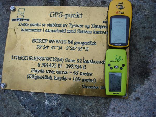 |
This board is placed by two local councils in cooperation with Statens Kartverk (the national office for maps and mesurement). The position is of course meant to be accurate. We brought two GPS' wich both showed the same other position!
It will be exiting to see how other GPSs will show this point or if they all show the same difference
|
Utfordringen:
1. Finn punktet
2. Fotografer din GPS sammen med platen. Prøv å vise på bildet hvilken posisjon din GPS gir.
3. Oppgi din GPS' posisjon i loggen i tillegg til på bildet |
The challenge:
1. Find the spot
2. Take a picture of your GPS with the plaque. Try to let the picture show the GPSs position.
3. Write your GPS' position in the log too. |
Additional Hints
(No hints available.)