
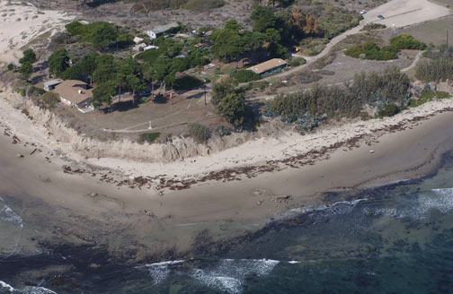
 The oil seeps off-shore of Coal Oil Point have been
described as the one of most prolific in the world. Coal Oil
Point is part of the University of California Natural Reserve
System and is used for numerous on-going research projects.
Please do not do anything that might affect these projects if
you come across them. The beach you’re headed toward has a set
of dunes that are closed to public access year round with
symbolic fences to protect the breeding habitat for the Snowy
Plover. You are welcome to enjoy them, however this cache is
focused on the natural oil seeps of the area. The parking lot
located closest to the cache requires a UCSB West Campus
parking permit so you’ll have to park elsewhere and walk/bike
in.
The oil seeps off-shore of Coal Oil Point have been
described as the one of most prolific in the world. Coal Oil
Point is part of the University of California Natural Reserve
System and is used for numerous on-going research projects.
Please do not do anything that might affect these projects if
you come across them. The beach you’re headed toward has a set
of dunes that are closed to public access year round with
symbolic fences to protect the breeding habitat for the Snowy
Plover. You are welcome to enjoy them, however this cache is
focused on the natural oil seeps of the area. The parking lot
located closest to the cache requires a UCSB West Campus
parking permit so you’ll have to park elsewhere and walk/bike
in.
When I got the coordinates of this cache, the rocks in the area
were covered with patches of tar. If there is no tar on these
rocks, look around, the amount and location of tar is variable with
the seasons. It shouldn’t take long to find some.
Typically this sight is associated with the aftermath of some
oil tanker or pipeline spill. However, the tar at this beach is
naturally occurring and has been occurring long before any oil
drilling was even considered in the area. A survey conducted
between Point Conception to Rincon identified some 2,000 natural
seeps offshore. In fact, natural oil seeps account for some of the
tar at beaches all long the Southern California coast.
Natural Oil seeps leak a variety of petroleum products.
Everything from natural gas to the heavy tar seen on the beaches
seep out of vents in the sea floor. The lighter portions, such as
natural gas, and light hydrocarbons dissolve into the sea water, or
dissipate into the atmosphere, leaving the heavy tar to wash up on
the beaches or sink back down to the ocean floor. It has been
suggested that the hydrocarbons that dissipate into the atmosphere
account for a majority of the smog-forming ozone in Santa Barbara
County.
At Coal Oil point the seeps are about 3 mile off shore where oil
and gas collect at the top of anticlines in the Miocene Monterey
Formation and leaks through fractures in overlying Pliocene Sisquoc
Formation. An anticline is a fold that slopes down on both sides to
form an arch, picture the highest portion of the waves in the
ocean. Through pressure and density differences, oil slowly
migrates through the rocks of the Monterey Formation to the highest
place it can go, the top of the anticline. At the top of the
anticline, the oil and gas continue to migrate upward through
cracks in Sisquoc Formation. On the sea floor these cracks are
typically about one-half a centimeter in diameter, but some as
large as a meter have been identified. Divers have described some
areas as looking “like a bunch of gopher holes."
At the ocean surface, the seeps range from undetectable to an
area of bubbling, like boiling water, ranging from 3 to 30 feet in
diameter. Oil slicks can also be observed. However, the intensity
and location of the seepage varies so location of the surface
presence changes over time, as well as the oil slicks and amount of
tar on the beaches. Some seeps have been known to stop and restart,
or migrate to new location.
Even with this variation, the amount of seepage at Coal Oil
Point is significant. Estimates range from 10 to 400 barrels of oil
per day are released into the channel from the various seeps near
Coal Oil Point. The Hydrocarbon Seeps Project at UCSB estimates 100
barrels (4,200 gallons) per day. In 1982 ARCO installed two huge
tents (100 ft squares) to capture gas seeping out of sea floor.
From 1985 to 1989, over 1.5 million cubic feet of gas was collected
per day.
These rates of seepage have been dropping in recent years,
possibly as a result of off-shore oil production. The oil and gas
are pushed out through the cracks in the sea floor due to the
pressure of all the oil and gas confined in the rock layers. The
off-shore oil production has been removing oil and gas and thus
reducing the pressure. As a result, the natural seepage has been
slowing. However, at other times oil recovery techniques that
involve increasing the pressure in the oil containing rock layers
to help move oil to a recoverable location, have actually increased
seep rates.
October, 2004
source: http://www.californiacoastline.org/
Logging requirements:
Send me a note with :
- The text "GCPCQ2 Coal Oil Point - Natural Oil Seeps" (or
something similar) on the first line
- The number of people in your group.
- If you have a camera, take a picture of the largest tar patch
you can find and post the approximate size . We’ll see what
differences are seen over time;
- As you look at the beach, the tar tends to be found in certain
places. Send me a note explaining why you think the tar is found
where it is.
The following sources were used to generate this
cache. There are also references to additional scientific papers
and research.
-
http://coaloilpoint.ucnrs.org/
-
http://www.countyofsb.org/energy/information/naturalSeepProjectSummary.asp
- http://seeps.geol.ucsb.edu/
-
http://www.mms.gov/omm/pacific/enviro/seeps1.htm
-
http://www.countyofsb.org/energy/information/NaturalSeepInventoryFinalReport.htm
-
http://www.countyofsb.org/energy/information/seepspaper.asp#naturalSeeps