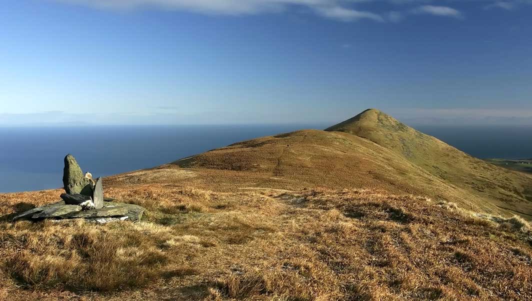
Photo: North Barrule, from the ridge near Clagh Ouyr.
To obtain the cache position requires a little thought and preparation, and the use of an Isle of Man map (the Ordnance Survey Landranger No.95 is recommended). You need to find the co-ordinates before leaving home. The supplied rough map is a real boon for this – have fun!
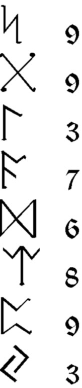
To help you get started, part of the co-ordinates are:
N 54° 1x.xxx
W 004° 2x.xxx
...and the following key is essential;
Thanks to 'Das Phantom' of Beihingen (Rita, Prinzessin aus Haithabu) for the map idea.
The shortest approach is from The Hibernian to the east, then over the summit - but this is a very hard ascent. It's worth knowing about the stile (see waypoint list), as you can climb up from the south this way (from Park Lewellyn: - SC439900): this is the easiest approach . The best route is via Clagh Ouyr, then along the fine ridge. Park at the Black Hut (SC405885). Whichever route you use, wear good boots and take adequate clothing for mountain walking - the weather can change suddenly and become quite severe, and it may be difficult to reach shelter very quickly. The ridge is very wet and boggy in places.
If you find the puzzle too frustrating, e-mail me for a clue, via my geocaching profile. I'm happy to give a bit of extra help. If you just want to include this cache in a walk and don't want to attempt the puzzle, ask me for the co-ordinates.
To save considerable wasted effort, check your derived final cache coordinates at Geochecker.com before setting out.