Català
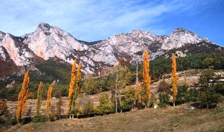
El Moixeró és una muntanya entre les comarques del
Berguedà i la Cerdanya, que es troba a la carena que
va del Tossa d’Alp al Cadí, dintre del Parc
Natural Cadí-Moixeró. El seu punt més alt és el cim de
Penyes Altes, de 2.260 m.
Per arribar-hi al tresor cal anar per la C-16 fins a
Bagà. Un cop dins el poble, agafar la BV-4024 durant
3,7 km., fins el trencat de Gréixer, coordenades N 42º
16.860 E 001º 50.942,
(995 m. d’alçada) on es pot deixar el vehicle.

En 10 minuts s’arriba a les cases de Gréixer, on comença el
camí de la Canal de la Serp, al punt N 42º
17.155 E 001º 50.942
(1.120 m).
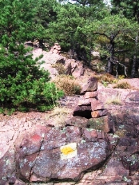
Seguir les marques
d’aquest camí, en forta pujada, durant una hora aproximadament,
fins arribar a una tartera, punt N 42º
18.135 E 001º 50.521
(1.750 m.).
Aquí el camí travessa la tartera; el seguim fins el punt N 42º
18.180 E 001º 50.580
(1.780 m), on el deixem per anar a buscar la evident canal de la
dreta, al punt, N 42º
18.169 E 001º 50.609
(1.800 m). Aquesta dreta canal s’ha de remuntar fins el coll, que
és a N 42º 18.200 E
001º 50.780 (1.975 m). El tresor és a poc més de 100 m. d’aquí, a
1.990 m. d’alçada.
És una excursió llarga, més de 2 hores, i dura, amb una forta
pujada, d’uns 1.000 m. de desnivell. El tram final pot resultar
difícil amb condicions climatològiques adverses. La recompensa son,
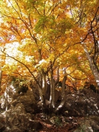
el paisatge que és magnífic, especialment a la tardor, i el
panorama que es gaudeix des de l’emplaçament del tresor, que és
grandiós.

Contingut original del tresor
: gorra, joc d’escacs, ampolla de vidre, follet, aplaudidors
inflables, insectes i tarjetes
pelaroques.
English
The Moixeró is a mountain between Berguedà and
Cerdanya regions, in natural Parc Natural
Cadí-Moixeró. The most high point is the Penyes Altes,
with 2.260 m.
For find this cache, go to C-16 until Bagà. Inside de
village, go to the BV-4024 until the crossroads of
Gréixer, coordinates N 42º
16.860
E 001º 50.942 (995 m
hight). Here, you can leave the care.


It takes 10 minutes to arrive to Gréixer, where starting the
way of Canal de la Serp, at N 42º
17.155 E 001º 50.942
(1.120 m).
Follow the marks on very steep for roughly one houre until the way
of stones, at N 42º
18.135 E 001º 50.521
(1.750 m.).
Here, the way croos the way of stones until coordinates N 42º
18.180 E 001º 50.580
(1.780 m). You leave for go to seek the obvious channel of right,
at N 42º 18.169 E 001º
50.609 (1.800 m). Go up this straight channel
until the mountain
pass, at N 42º 18.200 E
001º 50.780 (1.975 m). The cache is near, at 100 m. from here, and
at 1.990 m. hight.
This Is a long and hard trip, more of
2 houres, with a very
steep hill, of 1.000 m. The final section is difficult with
adversitys climate conditions. The reward arethe wonderful
landscape, especially at the autumn, and the big view from the
cache.
Contents original of cache
: cap, game of chess,
bottle of glass, magician, inflatables, insects and cards
pelaroques.