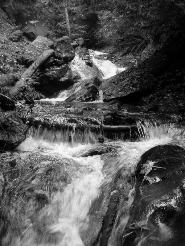
It is said that time flows like a river, and no where could that be more beautifully reflected than here. Journey into the past by taking the gentle incline along an old railroad grade past the foundation of the crusher to the Caroline Mine. Venture along the side of Fifteen Mile Creek to the location of the historic mine and witness the "gentle touches of air and water working at their leisure" just as they did before the coal mine was begun. Enjoy the rush of the creek and imagine the way things may have looked when work crews of men entered the mine to toil with their steel tools 60 to 75 years ago and then emerged covered in coal dust with blackened faces. Does the sealed mine entomb the past or do the whispers of the mine and chatter of the workers dance in your ears? Can you hear the miners emerging from the depths of the mine to spin their tales with the loggers down at the Rolling Log Tavern in Issaquah?
Years ago, this would have been a great cache to mountain bike to. Unfortunately, the trailhead prohibits bikes, so you'd need to lock it up. I hiked over from the Paraglider's Secret trailhead with _Shaddow_ and PhilNi, making a very long day on Tiger, but very well worth it.
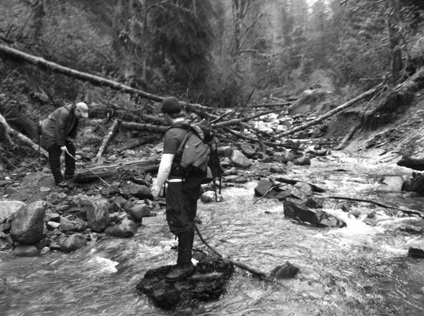 |
| PhilNi, _Shaddow_ and jim_carson traverse the washout |
Be advised that the trail connecting WP1 and WP2 is washed out. If you take this route, bring a buddy. We did and found it to be
the most memorable journey we took on Tiger Mountain. The alternate way to the final involves taking Grand Canyon Trail down from the top, using the occasional pink trail ribbons as your guide. You may want to install
Northwest Trails' topographic maps for Garmin and Delorme GPSes before you go.
The first waypoint for the cache is offset. Near the posted coordinates you will look for a brass survey cap. The information you find on it will be used to find the cache.
A = First digit in outer ring of text
B = Last digit of year stamped on inner-most ring
C = First number on inner ring following "WA"
D = First number on inner ring following "TM"
N47 29 . AB(C-4) W121 B(C+1) . D(C-4)C
As always, if there is any need of maintenance or questions, please drop me a message. (Ensure the "Respond via email" box is ticked so I don't have to login to geocaching.com via my phone.)
Enjoy your journey!