Přírodní památka Tůň u Kostelan se nachází na území Evropsky významné lokality Nedakonický les, představující rozsáhlý komplex lužních lesů Přírodní rezervace Kolébky, se slepými (tzv. parapotamony) a mrtvými (tzv. plesiopotamony) rameny v jinak intenzívně obhospodařované krajině o celkové rozloze 1 524,79 ha.
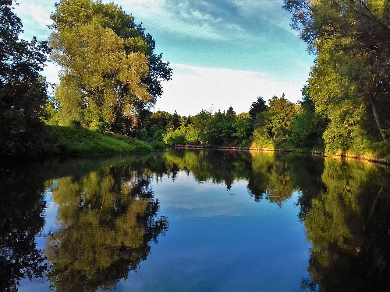
Obr. 1: Tůně u Kostelan (zdroj: obecní stránky Kostelany nad Moravou)
Slepá a mrtvá ramena vznikají postupným oddělováním části toku, u nějž převažuje dynamika proudící řeky nad „silou“ geologické struktury podloží. Dochází tak k postupnému omýlání břehů, u nichž je proud silnější (zahlubování koryt, tzv. výsepní břeh) a nahromaďování transportovaného materiálu u břehů s nižší kinetickou energií řeky (jesepní břeh). Vznik mrtvých ramen ilustruje schéma na obr. 2.
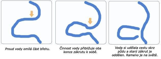
Obr. 2: Mechanismus vzniku mrtvého ramene (zdroj: Wikipedia)
Tůně jako příklad mrtvého ramene (v mnoha zdrojích označovaného jako rameno slepé) vznikly postupným napřimováním vodního toku řeky Moravy, které vyčlenilo několik slepých a později i mrtvých ramen. Nachází se v Dolnomoravském úvalu, v tzv. Hradišťském příkopu v nadmořské výšce 175 m, asi 200 m jihovýchodně od obce Kostelany (katastrální území Kostelany nad Moravou, součást chráněné akumulace podzemních vod Kvartér řeky Moravy). Jedná se významný mokřad, jedna z posledních lokalit kotvice plovoucí (Trapa natans) na Uherskohradišťsku. Jižní část území obce zasahuje až k vodním plochám štěrkopískových jezer v Ostrožské Nové Vsi.
Samotná lokalita leží v nivě řeky Moravy. Rameno podkovovitého tvaru je silně zahloubené, s příkrými břehy. Vzniklo postupným propojováním meandru akcelerovaným lidskou činností, kdy dynamika vodního toku byla silnější než geologické podloží břehů, čímž docházelo k oddělování meandru a napřimování vodního toku. Geologické podloží je v případě této lokality tvořeno usazeninami Vídeňské pánve, na kterých se nacházejí kvartérní sedimenty. Ty neměly dostatečnou odolnost vůči proudícímu toku řeky a po délce vodního toku tak vzniklo několik slepých a mrtvých ramen. Na mnoha místech pak ve spodních vrstvách najdeme fluviální štěrkopísky a na nich holocénní písčité povodňové hlíny. V případě Tůní bylo rameno významně modelováno antropogenní činností – konkrétně cílenou regulací řeky Moravy ve dvacátých letech 20. století.
Podmínky pro zalogování earthcache:
1. Čím je tvořeno Geologické podloží lokality a jaký vliv to mělo na vznik mrtvých/slepých ramen?
- a) Je tvořeno usazeninami Vídeňské pánve, na kterých se nacházejí kvartérní sedimenty.
- b) V jejich spodních vrstvách leží fluviální štěrkopísky a na nich holocenní písčité povodňové hlíny.
- c) Pod břehovými porosty jsou fluvizemě glejové.
2. Mrtvé rameno vzniklo výrazným přičiněním člověka. Došlo by k jeho současné podobě i bez přičinění člověka?
3. Změřte nadmořskou výšku u informační cedulky a porovnejte ji s okolním terénem. Je rameno spíše níže nebo výše než řeka Morava?
4. Změřte teplotu vody v rameni a v řece. Kde je vyšší a proč?
5. Na waypointu 1 najdete informační tabuli. Pro krajinu mrtvých ramen je typické velké množství hmyzu, vč. endemitů. Který ohrožený křídlatý druh vážky je na ní zobrazen?
6. Fotka z místa GPS nebo Vaše vlastní, udělá radost, ale není podmínkou.
__________________________________________________________________________
The nature monument Tůň u Kostelan is located in the area of the European Important Site Nedakonický les, representing a large complex of floodplain forests of the Kolébky nature reserve, with oxbow lakes in an otherwise intensively managed landscape with a total area of 1,524.79 ha.
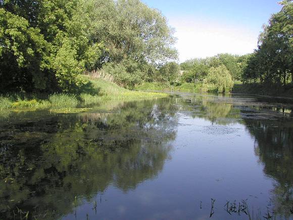
Fig. 1: Ponds near Kostelany (source: municipal website of Kostelany nad Moravou)
Oxbow lakes are formed by the gradual separation of a part of the stream where the dynamics of the flowing river prevails over the "force" of the geological structure of the bedrock. This results in a gradual scouring of the banks where the flow is stronger (channel deepening, so-called ut bank) and the accumulation of transported material at the banks with lower kinetic energy of the river (point bar). The formation of oxbow lakes is illustrated in the diagram in Figure 2.
Fig. 2: Mechanism of the oxbow lake as part of the meander evolution (source: Wikipedia)
Tně locality as an example of a oxbow lake was created by the gradual overwintering of the Morava River, which separated several “blind” and later “dead” arms (oxbow lakes). It is located in the Lower Morava Valley, in the so-called Hradiště Trench at an altitude of 175 m, about 200 m southeast of the village of Kostelany (cadastral area of Kostelany nad Moravou, part of the protected groundwater accumulation Quaternary of the Morava River). It is an important wetland, one of the last sites of the Water caltrop (Trapa natans) in the Uherské Hradiště region. The southern part of the municipality extends to the water areas of the gravel-sand lakes in Ostrožská Nová Ves.
The site itself lies in the floodplain of the Morava River. The horseshoe-shaped shoulder is heavily indented, with steep banks. It was formed by the gradual meander interconnection accelerated by human activity, when the dynamics of the water flow was stronger than the geological bedrock of the banks, which led to the separation of the meander and the overgrowth of the water flow. The geological bedrock at the site consists of sediments of the Vienna Basin overlying Quaternary sediments. These were not sufficiently resistant to the flow of the river and several oxbow lakes were created along the length of the watercourse. Fluvial gravels and Holocene sandy floodplain clays are found in many places in the lower layers. In the case of Tůně, the channel was significantly modelled by anthropogenic activity - specifically by the targeted regulation of the Morava River in the 1920s.
Conditions for earthcache logging
1. What is the underlying geology of the site and what influence did this have on the formation of the oxbow lakes?
Answer:
- a) It is made up of the sediments of the Vienna Basin, overlying Quaternary sediments.
- b) Fluvial gravels and Holocene sandy floodplain clays lie in their lower layers.
- c) Beneath the riparian vegetation are fluvial gley soils.
- d) The sediments are not among the hardest bedrock, so they are relatively easy to be "breached" by the river and form oxbow lakes.
2. The oxbow lake was created by a significant human effort. Would its present form have occurred without human intervention?
3. Measure the elevation at the information sign and compare it to the surrounding terrain. Is the lake rather lower or higher than the Morava River and why?
4. Measure the temperature of the water in the oxbow lake and in the river. Where is it higher and why?
5. At waypoint 1 you will find an information board. The oxbow lake landscape is characterised by a large number of insects, including endemics. Which endangered winged dragonfly species is shown on it?
6. A photo from the GPS site or your own will be appreciated, but is not a requirement.
Thanks Roraima for big help.