Let's continue the hiking series fun.
Meet at the posted coordinates at 8:00 AM on Saturday, March 6th. Lace up your hiking boots and prepare to get sore. Bring water, snacks and a can-do attitude. I'm guessing somewhere in the vicinity of seven to eight miles and somewhere around three hours, but we will not leave you out there if it takes longer.
No whining, look at those stars and those attributes. You know you want them and there aren't many other local options (trust me, I know this oh so well).
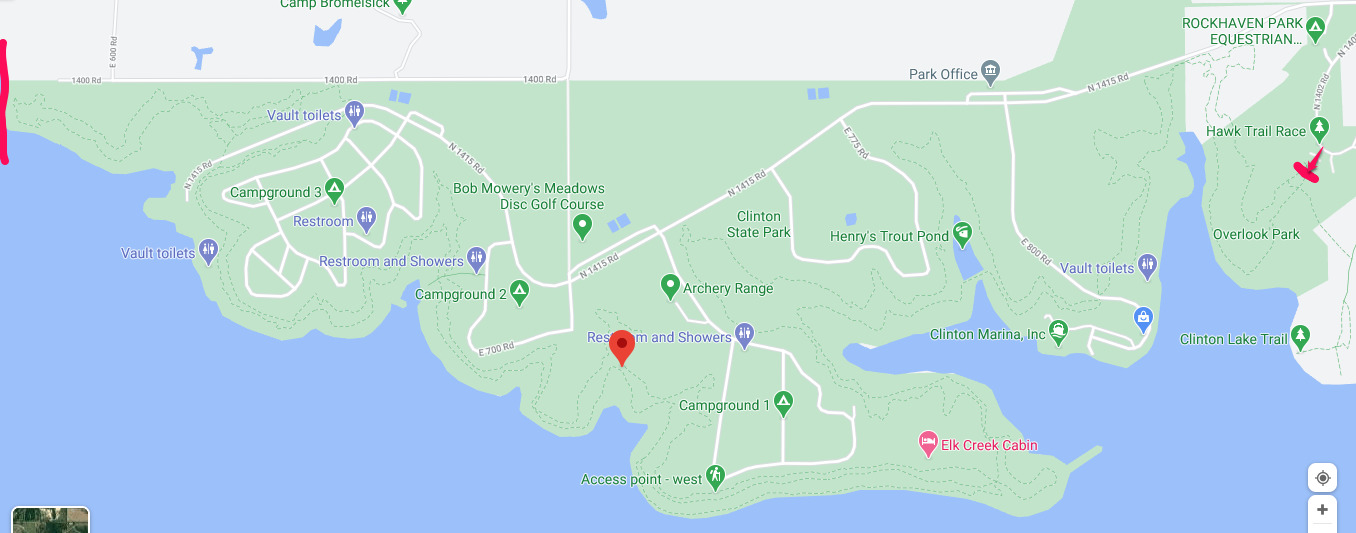
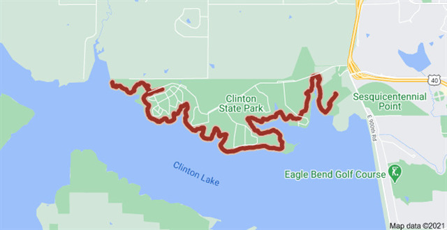
We will hike the blue trail to the western end and then bring the white trail back to the parking lot. There are some caches along the way that might make convenient rest stops, but that will not be the main purpose of this hike. Some of you may even be inspired by some locations and return with a container to place a cache for others to find (no pressure). Access to restrooms and water is not that far from the trail in a few select locations. The trail is rocky and uneven. Be prepared. You can also be prepared to see some amazing views and possibly spot a few bald eagles, amongst many other wildlife viewing opportunities.
Completion of the hike will be required to log attendance.
We will start near the arrow at the (east) right end of the map image seen below. The blue trail is the southern most dashed line along the image. We will hike to the end of the loop near the line at the west (left) end of image and head back. The white trail is the northern most dashed line. We will finish back where we started.
Afterwards, I plan to find a hamburger joint for some greasy food and a beverage, but you will be free to imbibe of your favorite choice of pain killer and head on about your day at this point.