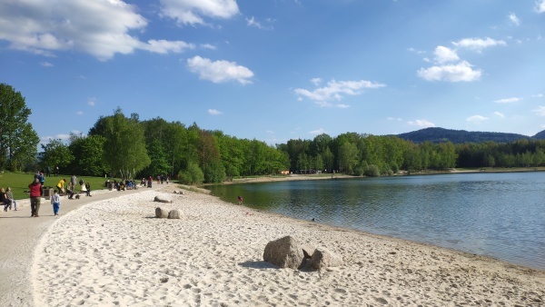
Stávající rekreační areál vznikl koncem 70. let minulého století na místě bývalého povrchového dolu na lignit.

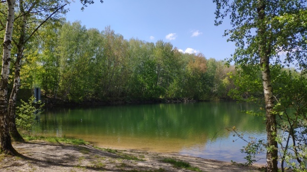
Nekvalitní uhlí se na okraji Hrádku nad Nisou těžilo již od konce 18. století nejdříve hlubinným způsobem a v padesátých letech 20. stol. byl otevřen povrchový lom. Ten byl na počátku sedmdesátých let opuštěn a prosakující voda lom zatopila. Vzniklo tak antropogenní jezero o ploše necelých 13 ha a hloubce přes 25 m.
Výhodná poloha blízko trojmezí, otevření hranic se sousedy, blízkost Lužických hor a kvalitní voda ke koupání a k vodním sportům vytvořily ideální podmínky pro rekreaci.
Kolem jezera je několik sezónních restaurací, dva kempy, chatová osada, jachetní oddíl, písečné a travnaté pláže, přírodní tělocvična, lanový park a optimální podmínky pro rybaření.
Necelý kilometr severně byl zpřístupněn mokřad s povalovými chodníčky. Samotné trojmezí Česka-Polska a Německa je nedaleko.
Tento potenciál tak vytváří jedinečný „genius loci“ Hrádku nad Nisou. Tak jak Hrádečáci říkají: „Pojďme na doly!“
Když vstupujete do areálu všimněte si letité aleje dubů, která je součástí Stezky stromů kolem Hrádku nad Nisou s délkou 22 km a 14 zastaveními.
The existing recreational area was established at the end of the 1970s on the site of a former surface lignite mine.
This low-quality coal has been mined on the outskirts of Hrádek nad Nisou since the end of the 18th century, first in a deep way and in the 1950s. a surface quarry was opened. It was abandoned in the early 1970s and seeping water flooded the quarry. This created an anthropogenic lake with an area of less than 13 ha and a depth of over 25 m.
The convenient location near the tri-border, the opening of borders with neighbors, the proximity of the Lusatian Mountains and quality water for swimming and water sports have created ideal conditions for recreation.

Around the lake there are several seasonal restaurants, two campsites, a cottage settlement, a yacht section, sandy and grassy beaches, a natural gym, a rope park and optimal conditions for fishing.
Less than a kilometer north, a wetland with attic sidewalks was accessible. The very border of the Czech Republic-Poland and Germany is nearby.
This potential is created by the unique "genius loci" of Hrádek nad Nisou. As the Hrádek family say: "Let's go to the Mine!"
When entering the area, notice the old oak alley, which is part of the Tree Trail around Hrádek nad Nisou with a length of 22 km and 14 stops.
Na keš se vydáme po vyluštění malého kvízu. So just a little quiz
Kvíz – Quiz
A = Kolik metrů přibližně uběhneme (ujdeme) kolem jezera Kristýny? Approximately how many meters will we run-walk around lake Kristýna?
1500 – 4                   2200 - 7              3500 - 8
B = Ve kterém roce byla Kristýna zatopena vodou při povodni z řeky Nisy? In which year was Kristýna flooded with water from the river Nisa?
1990 - 3                  2000 - 1               2010 - 0
C – Název silničky od parkoviště k jezeru? What is the name a little road from parking to the lake?
Jezerní - 2              Šimáčkova - 9          Havířská - 6
Cache GPS: N50°51.AB5', E14°49.AC2'
Kolem keše je o víkendu rušno, v létě zvlášť. The cache area is a busy place at the weekend, in the summer most. Doneste si tužtičku. No pencil.

Zdroje (Source):
www.luzicke-hory.cz
Česká geologická služba
www.mapy.cz

Ostatní fotografie autor.
Translate: Uncle Google 😊