Langs de locatie waar in de 15e eeuw de stadsmuur van Amsterdam stond, ligt een in 2020 geplaatste serie van 10 caches + bonus. Wanneer je op Amsterdam Centraal aankomt, is dit een mooie wandelroute langs de oude begrenzing van de middeleeuwse stad (langs het Singel en de Kloveniersburgwal), die tevens nummer 5 in de Canon van Amsterdam is. Vergeet niet de reference points te bezoeken, dat maakt de route nou juist zo leuk!
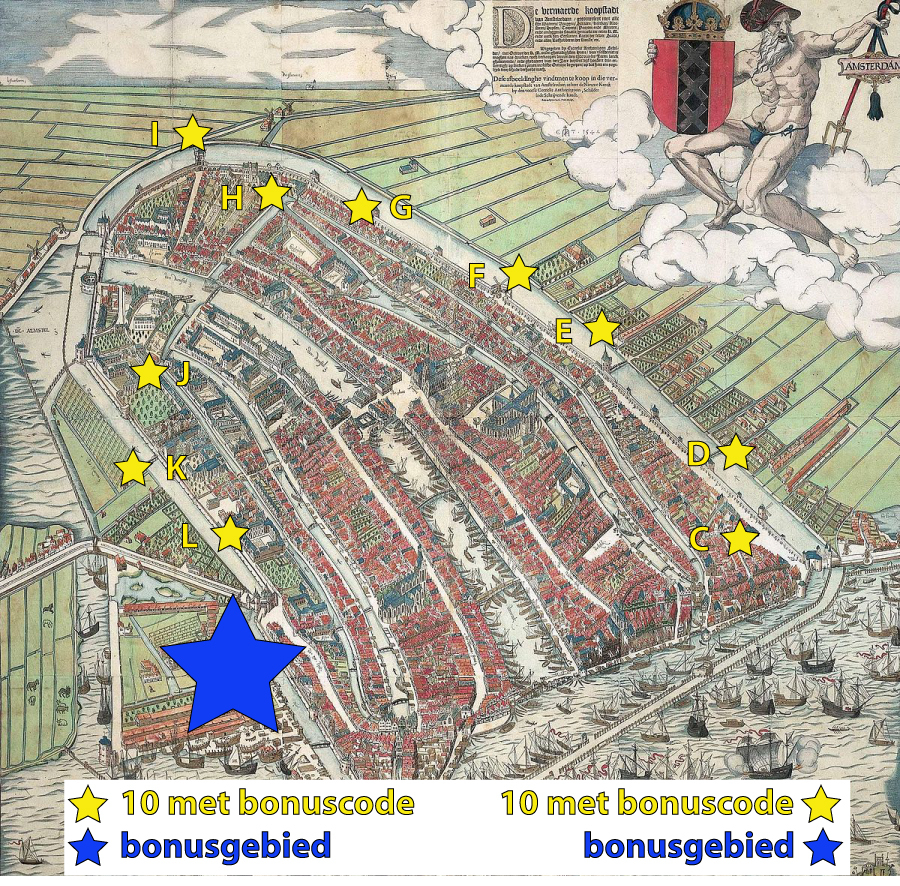
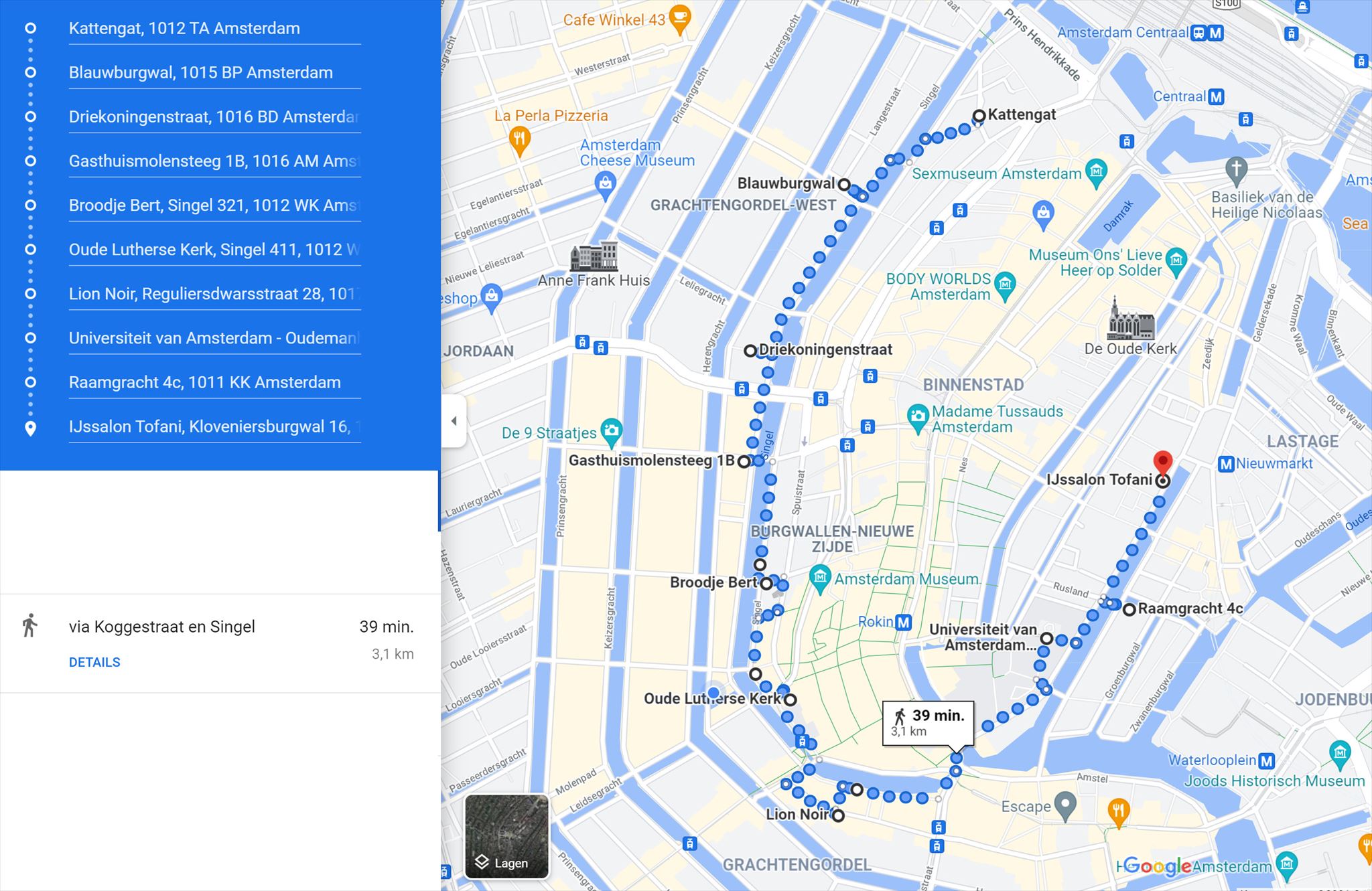
Vergeet niet de bonusletters te noteren die op de logrollen van deze cache-serie (C t/m L) vermeld staan voor de BONUSCACHE. De BONUS CACHE bevindt zich ergens in de buurt van cache L en is te vinden door het invullen van de formule van de BONUSCACHE die je kunt vinden op de geocache-kaart. Op de oude kaart van Amsterdam hierboven zie je de locaties van de caches C t/m L van deze serie. Onderstaand de meest optimale looproute op de kaart: exclusief zoektocht naar bonuscache is de route 3 km lang.
Along the location of the old city wall of the 15th century is a series of caches placed in 2020. When you arrive at Amsterdam Central, this is a nice walking route along the old borders of the medieval city (along Singel and Kloveniersburgwal). Don't forget to visit the reference points with their explanation. This makes this route extra nice.
Don't forget to write down the bonus letters that are listed on the log rolls of the caches named C to L. The BONUS CACHE is somewhere near cache L and can be found when filling in the code of the BONUS CACHE which you can find on the geocache-map. On the first map above you can see the locations of the caches C to L of this series. On the second map you see the optimal walking route on the map: excluding searching the bonus cache, the route is 3 km long.
Vlakbij de cachelocatie staat een bijzonder gebouw: het Geelvinck gebouw, tot stand gekomen na een op 27 april 1943 neergestort vliegtuig, een gebeurtenis die ook in het Dagboek van Anne Frank wordt beschreven. De gevel van dit voor grachtengordelbegrippen reusachtige bedrijfspand is onlangs op ingeieuze wijze gemonderniseerd. Het terugliggend gevelvlak is voorzien van gefrijnd beton dat een contrast vormt met het meer naar voren liggend deel. Noemenswaardig is ook de autolift die tot op het dak van het gebouw rijkt. In de huidige situatie is voor het dakvlak geen parkeerfunctie meer weggelegd. Links van het Geelvinck-pand staat overigens Muntstaete, niet te verwarren met Rivierstaete, met de kenmerkende spellingwijze waar Van Kooten en De Bie het eens te kwaad over hadden in het fantastische youtubefragment "Spelling deel 2". Bron: www.reguliers.net/oorlogsbrand.php
Because an airplane crashed at the site close to the cachelocation during WWII, the huge office building along the flower market could be built. Even the diary of Anne Frank tells about this airplane crash. The building was recently renovated and has nice refined concrete on the facade on the canal side. The tower that rises out of the building is the car elevator which is not in use anymore.