Virtual Rewards 2.0 - 2019/2020
Distance: 5.4 mi Loop, Elevation Start: 5,400 Elevation End: 7,100 Elevation Gain: 1,700
The hike to Panorama Point via the Skyline Trail starts out on stone steps near the Visitor Center and climbs briefly uphill to a series of trail junctions. Turn right at the main junction; follow the signs to Panorama Point on the Skyline Trail. This main trail also provides access to Alta Vista, the Glacier Vista trail and other Paradise “flower” trails or viewpoints.
The first two miles travel first over paved trails and then over rocky paths through subalpine meadows. Used as a golf course in the 1930’s and then as a ski area until the 1970’s, the meadows have been under restoration for the last three decades and likely will be for the indefinite future.
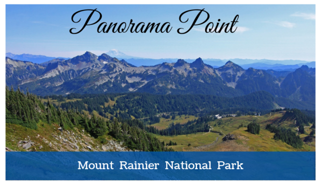
Not only are there views of Mount Rainier and the Nisqually glacier at the viewpoint; on clear days there are views of the rugged Tatoosh Peaks, Mount Adams, Mount Saint Helens and Mount Hood.
A big thanks to Ranger Kevin Bacher who also goes by the following geocaching name, K2D2 for his assistance with the cache and providing the following information about the historical restroom located at Panorama Point: "The comfort station at Panorama Point was originally constructed in 1928 by the National Park Service. It is an outstanding example of non-intrusive, NPS Rustic architecture, a style of construction that was developed in the late 1920s specifically for the National Park Service. After many years of use, the comfort station was abandoned. At some point in the mid-to-late 1980s, the building was rehabilitated into the structure that exists today, with mortar added in between the stones.
Please keep in mind that the meadows here are fragile. Hikers should stay on official trails at all times. Obtaining this virtual does not require any departure from the trail. The viewpoint and the trails leading to it are snow covered from about October through June. Winter access requires snowshoes or skis. The bathroom and sign will probably be buried by snow. (See winter option task) Avalanche danger can be high in this area in the winter, so hikers should check the weather forecast and check current conditions at the visitor center (In winter, at Paradise on weekends and holidays or at Longmire seven days a week).
What is the assignment to log this virtual cache as a find?
Summer Assignment.
1) At the posted coordinates take a picture of you or a personal item at the interpretive sign. If it is not available take a picture of you or a personal item at the base that supports the sign with the four bolts.
2) At WP2 message me what you are instructed to do on the outside of the historic bathroom door and why. (It has nothing to do with the roof.) After "finding" this cache, you probably will want to continue hiking to the next reference point for a knock-your-socks-off viewpoint of Mount Rainier!
Winter Assignment.
1) Post a picture of your cell phone or GPS clearly showing you have arrived at the posted coordinates.
This Virtual Cache is part of a limited release of Virtuals created between June 4, 2019 and June 4, 2020. Only 4,000 cache owners were given the opportunity to hide a Virtual Cache. Learn more about Virtual Rewards 2.0 on the Geocaching Blog.