Goyt Packhorse Bridge is a beautiful old packhorse bridge which today crosses the River Goyt well above Errwood Reservoir at a scenic spot. The bridge is believed to date back to 1762 when it was built on an ancient salt route. However, the bridge wasn't originally located here - it was originally built further down the valley in a community named after the bridge - Goyt's Bridge. Unfortunately that community was lost when Errwood Reservoir was constructed in 1965 and the bridge was the only thing that was saved - it was believed to have been moved and reconstructed here - looking at the old photos they did a pretty good job.
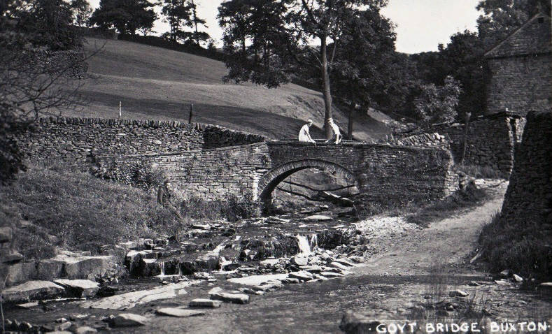
The packhorse bridge in it's original position in Goyt's Bridge
This EarthCache allows you to compare the bridge against the local stone visible closeby and decide if they built it from the immediate stone in the area. It also looks at how rocks age and whether you believe all the stone in the bridge is still original following the move and all these years. It also looks at shape, size and quality of different stones and how important they were in construction many years ago.
What are our local stones and what do they look like?
The Goyt valley was formed around 280 to 350 million years ago. Mud, gravel and sand were washed down to the Peak District area by a vast river from what is now the highlands of Scotland. These layers of mud and sand were laid down in the sometimes deep and sometimes shallow waters of the river estuary. Over millions of years the mud and sand were compressed to become layers of shale and gritstone rock and so it is shale you find in the nearby quarries with the gritstone being found higher on the hills above the valley.
Most of the rock that was quarried in the nearby area is what is known as 'Rough Rock'. Rough Rock is a widespread type of coarse sandstone which is a prominent landscape-forming feature here in the Peak District and Pennines of northern England. It is assigned by geologists to the Yeadonian sub-stage of the Namurian stage of the Carboniferous period. It is the most extensive of all of the sandstones of the Millstone Grit Group occurring throughout the Peak District, South and West Pennines and extending northwards into the central and northern Pennines. Because Rough Rock is formed from sedimentary rock formation processes, it varies in thickness with the largest bands being as thick as 30 metres which are visible in the nearby disused quarries.
The quality of Rough Rock varies throughout the Peak District, on the other side of the county the Rough Rock sandstone was used greatly in the building of Derby and of Kedleston Hall. I haven't been able to find out much about the stone use here, but I do know it was used for local roads and transported to London for unknown building uses. Some of the Rough Rock in this area has been identified by the Manchester Geological Society as coarse arkose sandstone - this means it contains at least 25% feldspar and also some quartz so may be able to spot a gleam in the rock a little like you see millstone grit and this could give the rock some pinkish/orange colouring.
Goytsclough Quarry (waypoint 2/3), taken from the hillside above the quarry, looking towards Derbyshire Bridge, this early 1900s photo shows local families loading stone onto horse-drawn wagons. The buildings in the distance belong to Goytsclough Paint Mill.
One way to identify Rough Rock is by texture - it will have visible sand grains of a coarse nature. It isn't yellow and sand coloured like the more common sandstones - Rough Rock can often have dark colours, similar to what you might associate with millstone grit rather than lighter colours you'd normally associate with sandstone but the Rough Rock is not as hard and coarse as millstone grit. Greys, often quite dark can be seen after weathering. However, the rock often exhibits the pink hue you often see in millstone grit so this shade of sand is a clue - especially seen in less weathered parts of the stone. The weathered grey colour can make it easier for people to mistake it for limestone which is also sedimentary but the coarse sandy texture should be visible if you look very closely at the rock. There could also be patches of a reddish colour. This colouring may be from siderite – an iron carbonate which can be seen in the local quarries.
To eliminate doubt, conveniently there is a disused Rough Rock quarry at the top of the path from the bridge - two waypoints have been provided. Therefore the best way to be sure would be to compare the stone on the bridge with that at the quarry and see what you think. Remember, the bridge wasn't built in this spot originally and so even if the stone was sourced in the valley it may have come from a different quarry elsewhere. The quarries around here were apparently initially used locally for roads, but later expansion resulted in deliveries to London for building.
A Brief History of Goyt's Bridge
According to historic records, the bridge was originally built further down the valley, at Goyt’s Bridge, in around 1762, on an ancient salt route. Teams of ponies would cross at this point in the valley, transporting salt from Cheshire into Derbyshire. The lead pony in a train would wear a bell attached to its harness. This bell warned other trains to wait at passing places, and sometimes advertising the approach of the pony train to potential customers.
Medieval packhorse routes and roman roads indicate the valley was a significant trade route, indeed Goytsclough Quarry is thought to be where the well known international haulage and removal company Pickfords started trading in the late 17th century, when Thomas Pickford purchased the quarry. Trains of packhorses were used to transport the stone from the quarry, and rather than returning empty the horses were used to return goods to the area. It was said that 50 horses were often required to pull the trains of stone - that would have required some skillful control.
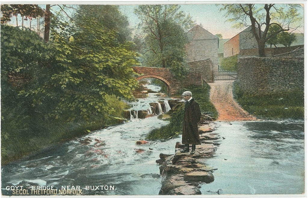
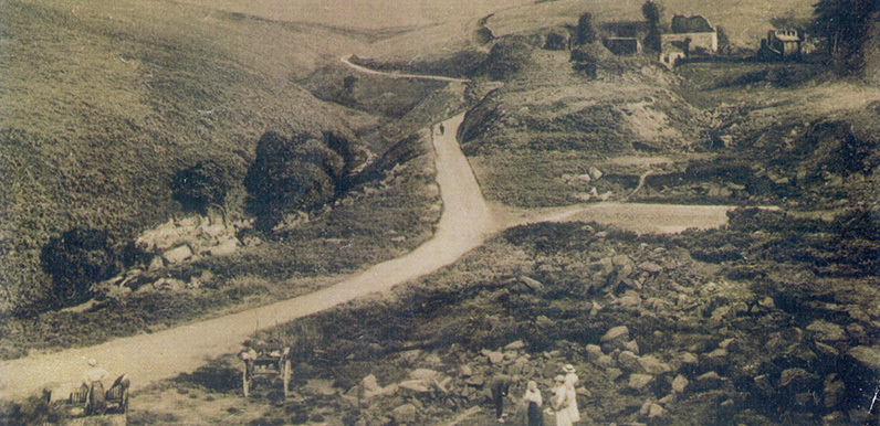
The track came from high on the moors at Derbyshire Bridge, through Goyt’s Bridge, and then on towards Macclesfield along the old Roman road. It would have been used by merchants transporting everything from salt and spices to household goods and building materials since medieval times – and probably long before. When Victorians first discovered the picturesque charms of the Goyt Valley, the packhorse bridge became a popular subject for both artists and then photographers. But whereas the rest of Goyt’s Bridge has vanished beneath the waters of Errwood reservoir, the small bridge has miraculously survived. Although not many people who pass it on the road to Derbyshire Bridge may realise it. Before the reservoirs were built the valley was home to a thriving community with many farms, a paint works, a railway, a Victorian mansion, coal mines, a quarry, a school and even a gunpowder factory.
So why am I telling you about the history of the area in an EarthCache? Because you should always think about the past when studying stone. The period of industrial activity here in the Goyt Valley all those years ago would have meant coal smoke in the valley which could have blackened the stone in local buildings including the bridge. Any new stones used when it was reconstructed in 1965 would not have been subjected to any pollution so bear this in mind when looking at the stone - it may or may not be relevant.
Questions to Answer (Logging Requirements)
This is an observational EarthCache. You only need to read the lesson above, and then view the bridge in front of you at GZ to formulate your answers. Please look from both sides and also visit at least one of the waypoints. No previous geological knowledge or additional research is required, I only ask that you make a good attempt at the answers and send them to me on e-mail or the messenger. Although I read all answers and usually reply to everyone, at busy times there may be a delay so please log immediately, there is no need to wait for a reply.
The stones used in the construction of the bridge have 3 distinct different areas which show different shapes/sizes/colours. This doesn't necessary mean they are different stones, there could be other reasons. There are the stones used to build the arch, then the main stone used in the construction of the bulk of the bridge, and finally there are the stones across the top of the bridge (coping stones). Many locals would like to believe the bridge was moved complete with all the original stones but this may not have been the case - see what you think when you examine the bridge as remember age and pollution could change the appearance of the same type of stone.
Question 1
a) Look at the stone used to built the bridge walls. Comment on the colour, quality, texture and the shape and size of the stones. Why do you think these stones were chosen for this particular purpose? Do you think all the stones used here date back to 1762 and why?
b) Look at the stone used to built the main arch that supports the bridge. Comment on the colour, quality, texture and the shape and size of the stones. Why do you think these stones were chosen for this particular purpose? Do you think all the stones used here date back to 1762 and why?
c) Look at the stone used on the top of the walls (coping stones). Comment on the colour, quality, texture and the shape and size of the stones. Why do you think these stones were chosen for this particular purpose? Do you think all the stones used here date back to 1762 and why?
Question 2
a) Walk up the path to where the large boulders are lying close to the path. These came from the quarry opposite. You may also want to have a look at the stone in the quarry. Waypoints are provided. This gives you examples of the local rough stone - do you think it is the same as any of the stone you've examined in the bridge, if so which stone(s)? If you think it is different, explain why you think so.
Optionally
Please feel free to include a photo of yourself at Goyt Packhorse Bridge. Try to avoid including any obvious spoilers in any photo or log.
Thank you for visiting the EarthCache. I hope you have enjoyed learning about the local stone and it's uses.

The Little Bridges series was started by Stanthews in 2009 to highlight small footbridges in remote parts of Wiltshire. Since then the series has been expanded by others all over the country and starting to spread fast. There is a stats listing run by Billiethecat, so you can see how many Little Bridges you have found, you can find it here:- https://littlebridgesseries.wordpress.com/ . If you would like to add to the series, please contact Stan on stanthews@aol.com and he will give you a number for your bridge, to qualify, the bridge must be a foot bridge too small for vehicles, please make sure your title exactly matches “Little Bridges # xxxx then the name” including spaces so it will get picked up and added to stats list.