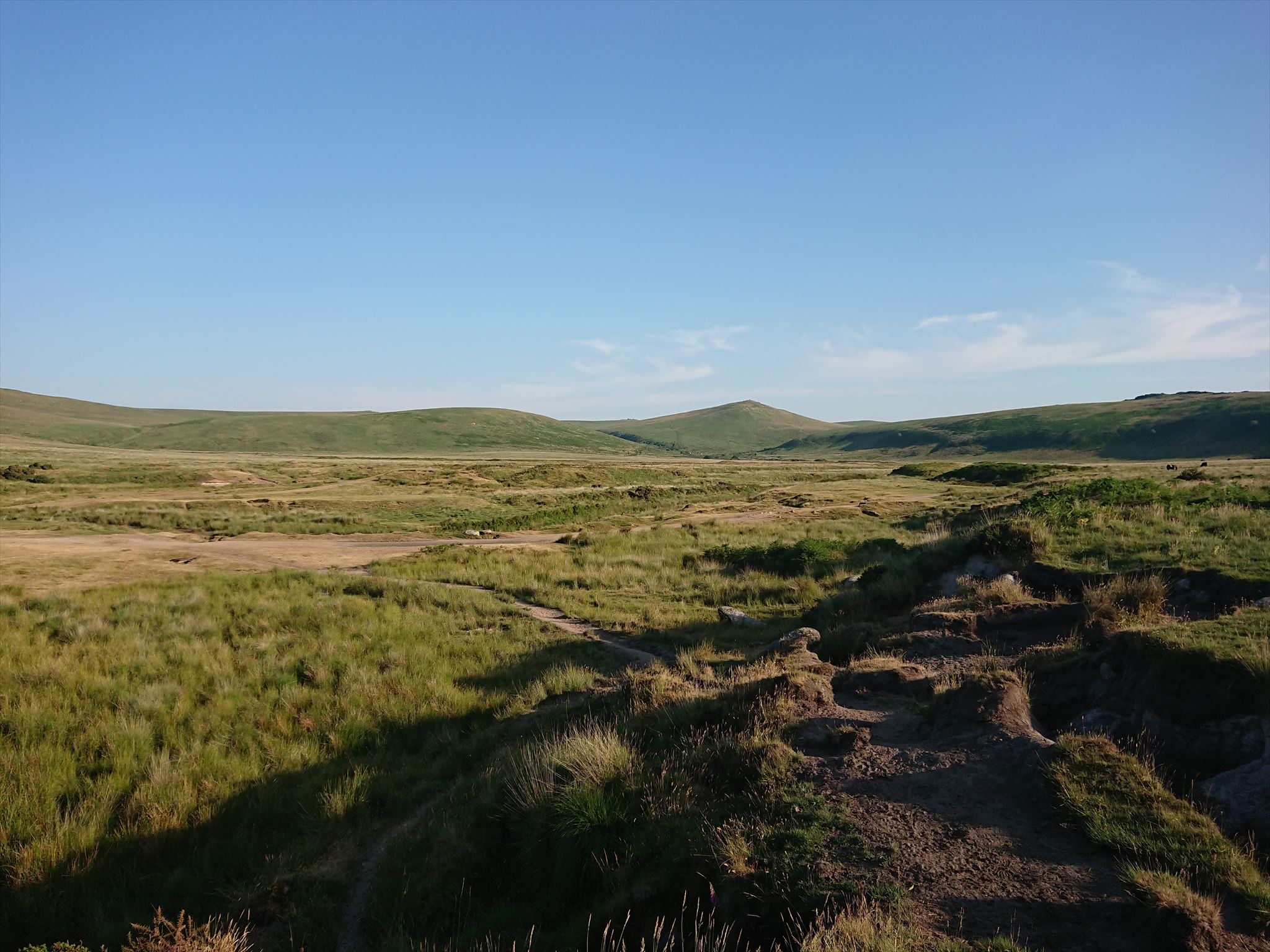
This EarthCache will take you from the Dartmoor village of Belstone, along the River Taw Valley, into what I have always referred to as "The Superbowl." When you arrive at GZ you will hopefully be able to see why. This beautiful and impressive location is one of my favourites on Dartmoor and is created by the surrounding ridges including Belstone Tor/Higher Tor, Oke Tor, Steeperton Tor, Metheral Hill and White Hill. Although there are many locations on Dartmoor that illustrate the Earth Science lesson of this EarthCache, the ford here across the River Taw is probably one of the best because unlike many of the valleys in Dartmoor, which are steep sided, this is a wider flat valley that is more conducive for the deposition of alluvial material.
Although this is a relatively short walk out onto Dartmoor, all eventualities should be planned for. So please go prepared for all weather conditions.
The geology of an area can largely be divided into two main parts, these are the bedrock and superficial deposits. The bedrock is defined as a term used for the main mass of rock whether exposed at the surface in outcrops, or concealed beneath superficial deposits/water. In the case of Dartmoor this bedrock varies, but the main upper outcrop of the Moor, including the location of this EarthCache, is granite. Superficial deposits are the youngest deposits in an area and overly the bedrock in areas where the bedrock is not exposed. Superficial deposits can vary from deposits from rivers, such as pebbles, sands and silts, to organic accumulation from the local flora (plant species).
The superficial deposits that are formed by riverine deposition are called alluvial deposits. These commonly form in areas where the river's velocity and depth lessen, which affects its ability to keep particles in suspension. Most commonly large alluvial deposits are found lower down a river's course, either where it enters flood plains or deltas. The reason that alluvial deposits tend to form further from a river's source is mainly a result of topography. The upper reaches of many streams/rivers, including most of those located on Dartmoor, flow within steep V shaped valleys and generally lose a relatively large amount of height for a given horizontal distance. If you look almost anywhere on Dartmoor you will see that the terrain is very dramatic and means that the velocity of the water is high, giving it a greater capacity to carry material along. The part of the River Taw that this EarthCache is located on is much more fitting of a lower section of a river. As the Taw enters the flat area of "The Superbowl" the speed of the water drops, this is further compounded by the formations of a number of meanders, such as the one the ford at the posted coordinates is situated on. This means that deposition of material here is high, and that can clearly be seen in the river bed and the exposed areas of erosion.
Alluvial deposits of rivers vary in their composition and this is mainly based on the geology of a river's course up til that point. This is because the deposits will consist of organic material, such as plant matter, soils, and eroded bedrock. In rivers that flow through soft geologies, such as mudstones or siltstones, the resulting eroded material will be very fine. In harder geologies, such as granite, the eroded material may well still be identifiable as rock, either in the form of pebbles or sands. Of course the composition and appearance of these pebbles and sands will vary depending on the exact type of rock that was eroded to form them. Alluvual deposits on the moorland part of Dartmoor are almost exclusively granite pebbles and sand, and this is important both geologically, but also historically. The granite pebble and sand deposits were so important to the early tin extraction, and trade, in the Southwest that there is even a word for it, Growan. This is a Cornish word and is a derivative of grou, meaning gravel, and a root shared with grouan, from Breton. Although not a true geological term, gravels is commonly used to describe the finer fraction of pebbles and the most coarse fraction of sand. The makeup of these deposits are the distinct pebbles within a finer matrix of sand, and both of these are eroded forms of granite. From here on these granite pebbles within a matrix of granite sand will be referred to as Growan.
The historic exploitation of tin was an important industry for Dartmoor, as well as the Southwest in general, and the alluvial deposits of moorland streams were important to this industry. Prior to the 1600s the majority of tin extraction was in 'stream workings'. This type of extraction relied heavily on the natural erosion process of the granite being broken down to form the Growan. This is because the alluvial deposits contains cassiterite, which is the main ore tin is extracted from. Cassiterite is found within granite, but by exploiting the eroded alluvial deposits, a source of cassiterite was more accessible to the tin streamers than mining it from the granite itself.
The way that alluvial deposits form occurs in different ways, based on their composition. For Growan found here, as well as across much of Dartmoor, this is the final process in the weathering of the granite bedrock forming the main upland area of Dartmoor National Park.
Where the granite is exposed such as on the tors, in the rivers or elsewhere, the granite tends to break down into boulders through a range of processes. The most common of these are chemical and physical weathering, in the form of freeze thaw. Once these boulders have been removed from the main outcrops of rock, they continue to be weathered, and are progressively broken down. The resulting material is Growan, that can be seen at this EarthCache, as well as in the beds of many of the streams around Dartmoor.
As mentioned above, alluvial deposits vary in their composition, both through grain size and material. Within the study of alluvial deposits, as with other sciences, the classification of size, such as pebbles, sands and silt, are strictly defined by their measurements. From these scientific definitions the names have been adopted by common language to describe material that is judged, or associated, with a particular name. An example of this would be calling the material making up a beach sand, even though the beach material may in fact be a mixture of sand and pebbles. The following are the scientific definitions based on particle size.
Boulders are any particles that are greater than 25.6 cm.
Cobbles are between 6.4 and 25.6 cm.
Pebbels are between 0.2 and 6.4 cm.
Sands are between 0.006 and 0.2 cm (or 0.06 and 2 mm).
Silts are between 0.0004 and 0.006 cm (or 0.004 and 0.06 mm or 4 and 60 μm).
To log this EarthCache go to the posted coordinates and waypoints and send me a message or email answering these following questions.
Go to the posted coordinates where you will find a section through some of the alluvial deposits
1) Describe the loose material on the floor and estimating its size, would you categorise it as mainly pebbles, sand, or silt?
2) Look at the eroded section of the bank and split the sequence into 'units' of similar material. How many 'units' can you see and describe their composition based on the definitions above.
3) What is the local name of the granite alluvial material?
Go to the points at which the path has eroded into the banks either side of the river
4) Using the eroded slopes estimate the height of alluvial material surrounding the River Taw at this point.