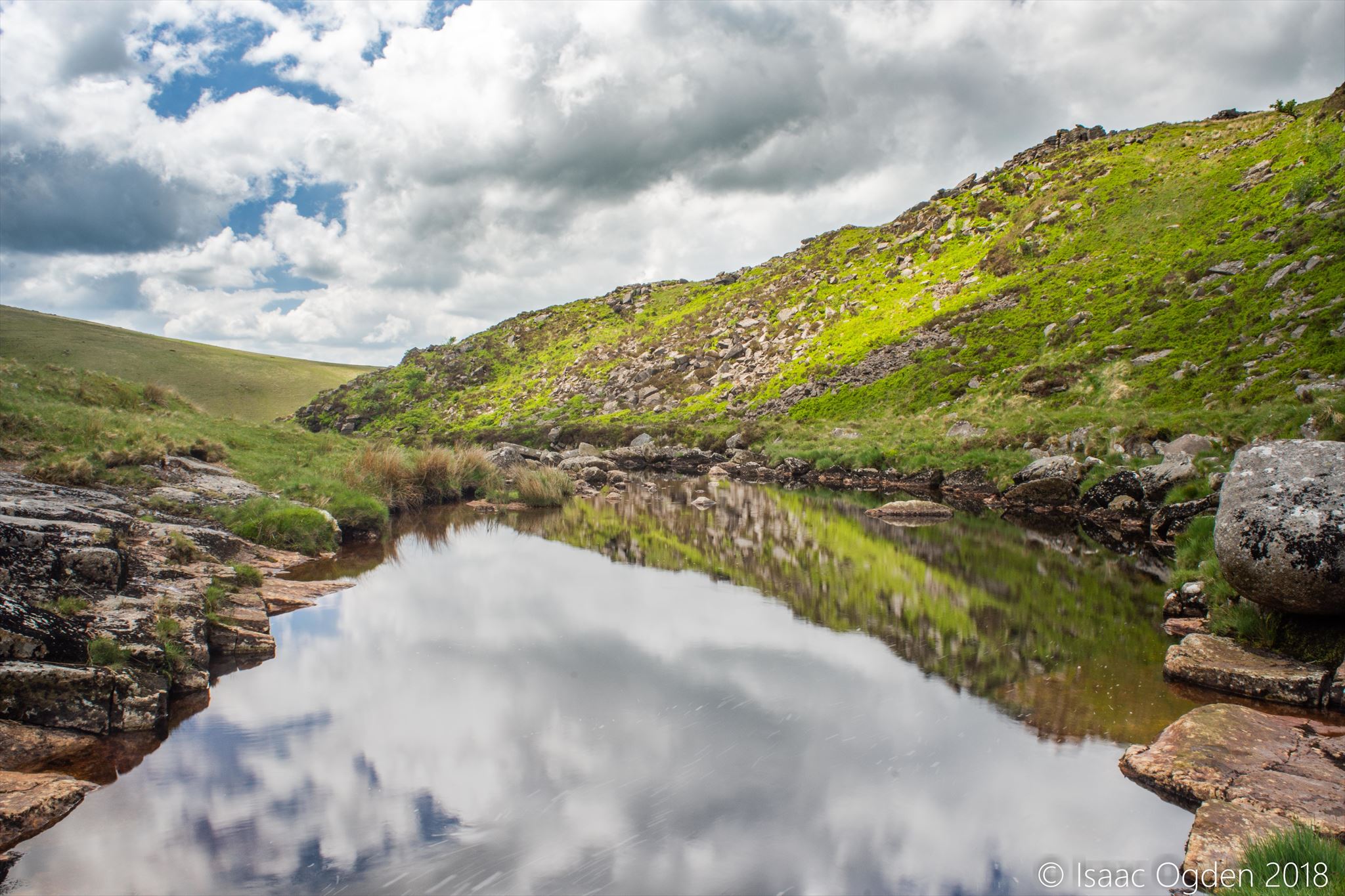
This earthcache will take you to a waterfall at Tavy Cleave which is often referred to as the Devil's Kitchen. To claim your smiley, you need to answer the below questions at GZ, and send your answers to me by any means of electronic communication.
Logging tasks:
1. Measure the approximate dimensions of the waterfall at the headline coordinates
2. Describe the texture of the rocks surrounding the waterfall. Is this the same as the granite that typically makes up Dartmoor?
3. Observe the waterfall you see at GZ. Can you see any evidence to suggest that it has moved positions over time?
4. Downstream from the waterfall, estimate the approximate dimensions of the large expanse of water. Is this shallower or deeper than most stretches of river here? Explain why.
Please email the answers to the questions to me through the Message Center or my profile. If I do not receive answers within a day or two of you logging a find then your log is at risk of being deleted.
There is evidence on the edge of the moor for ‘marine platforms’ or ancient shorelines, created when Dartmoor was an island during the Pleistocene era, around two million years ago. As the icy conditions thawed after the Pleistocene, the rivers were torrential and incised their valleys deeply to produce the steep-sided, boulder-filled gorges of today’s landscape, such as here at Tavy Cleave. Generally, the volume and discharge of rivers in upland regions tends to be low, and the river uses much of it's energy in overcoming friction. The erosion direction here is vertical, or straight down into the bed of the river. This has the effect of destabilising the slopes on either side of the river, creating a steep landscape.
One feature that is popular in Tavy Cleave is waterfalls.
Waterfalls are one of the most spectacular landforms found in the upper valley and are created by erosion processes. They occur where a band of hard rock (e.g. granite) overlies a softer rock (e.g. sandstone). Erosion processes such as Hydraulic Action (the force of the water) and Abrasion (where the river rubs stones that are being transported against the bed of a river thereby breaking it down) dominate.
The softer rock is eroded quicker than the harder rock and gradually washes away downstream, leaving an overhang of harder rock which will eventually collapse. The erosion of the softer rock creates a plunge pool where water is swilled around, potholing can occur here and any rocks and debris swept into the plunge pool by the river will be swirled around and rub against the bed and banks of the plunge pool (called corrasion), deepening it further.
Eventually, the hard rock overhang collapses because it is unsupported and the waterfall moves back upstream. This creates Gorges, which are steep sided deep river valleys. This process will repeat continually, with the location of the waterfall moving back upstream.
A diagram of this process can be seen here: 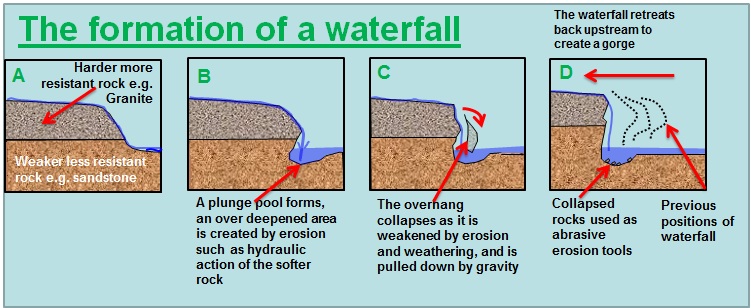
This cache has been placed in accordance with DNPA Geocaching Guidelines.
Hopefully if you're planning to go and find this one, you will know you are going to Dartmoor. Now the weather on Dartmoor is unpredictable, a bit like geocaching itself, and it could go from a bright sunny day to a hailstorm before you can say, 'Is it going to rain?'. With that in mind, please ensure you are adequately attired for your moorland march to this cache - I would advise taking a map and compass with you in case your normally trusty GPS fails and the fog comes down. That way nobody will need to phone me, the emergency services or anyone else for help!
Yes - this is a geologically interesting site, but it is also located within the Willsworthy Firing Range, where live firing occurs, hence the name. Before going out to find the cache please check the Firing Times which can be found online. Regardless, if you see the red flags, do not enter the range, you may meet an unhappy ending by being blown to smithereens. Do not pick up anything you find on the ground, it may explode and you could, again, meet an unhappy ending