Panorama de la Croix de la Liberation : vue sur un lac fossile
Depuis ce point de vue, ou a été érigé une croix en granit de 6mètres de haut, il est possible d'avoir une vue complète sur le bassin d'Autun jusqu'aux portes du Morvan.
Avant que la Bourgogne soit recouverte par la mer durant l'ère secondaire, il a été reconnu à la fin de l'ère primaire que sur toute la France se dressait un puissant système de montagne, et qui se prolongeait en Allemagne dans la Forêt Noire, le Harz (anciennement Hernycia silva, la foret hernycienne) qu'il lui a été donné, et celui du socle hernycien pour ce qu'il en reste.

Ancienne cité romaine, Autun a été jadis un lac de cette montagne hernycienne.
Les sédiments lacustres, grés, argiles, schistes bitumeux ont été, après avoir été déposé, ployés en creux sous la forme d'un pli.
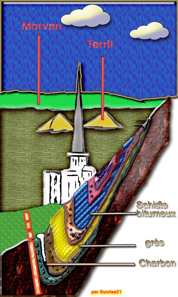
En effet, moins resistant que les gneiss et et autres roches environnantes, ils ont permis à cette cuvette de se dégager à travers les eaux courantes.

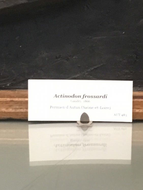
De nombreux fossiles, associés aux schistes, ont conduit en 1881 à choisir ce bassin comme type d'un étage du stratotype – aujourdhui « périmé » : l'Autunois.

Quelques notions complémentaires :
la ligne de faite détermine le partage des eaux des deux versants d’une chaîne de montagnes.
anticlinal : pli convexe dont le centre est occupé par les couches géologiques les plus anciennes
synclinal : un pli dont la concavité est tournée vers le haut
------
EN
Panorama of the Liberation Cross: view of a fossil lake
From this point of view, where a granite cross of 6 meters high has been erected, it is possible to have a complete view of the Autun basin as far as the Morvan gates.
Before Burgundy was covered by the sea during the secondary era, it was recognized at the end of the primary era that all over France stood a powerful mountain system, which extended in Germany in the Black Forest , the Harz (formerly Hernycia silva, the Hernycian forest) that it was given to him, and that of the Hernycian basement for what remains of it.
Ancient Roman city, Autun was once a lake of this Hernycian mountain.
Lacustrine sediments, sandstones, clays, and bituminous shales were, after being deposited, hollowed out in the form of a fold.
Indeed, less resistant than gneiss and other surrounding rocks, they allowed this bowl to emerge through running water.
Many fossils, associated with schists, led in 1881 to choose this basin as a type of one floor of the stratotype - today "out of date": the Autunois.
Some complementary notions :
the de facto line determines the division of water on the two sides of a mountain range.
anticlinal :convex fold whose center is occupied by the oldest geological layers
syncline : fold whose concavity is turned upwards
|
Sources :
http://videotheque.cnrs.fr/visio=4319
http://infoterre.brgm.fr/rapports/70-SGN-038-GEO.pdf
http://geolfrance.brgm.fr/sites/default/files/upload/documents/gf2-2-1999.pdf
http://www.geoforum.fr/topic/26687-fossiles-du-bassin-d-autun-saone-et-loire/
http://gallica.bnf.fr/ark:/12148/bpt6k6262246n
|
Rappel concernant les « Earthcaches »: Il n'y a pas de conteneur à rechercher ni de logbook à renseigner. Il suffit de se rendre sur les lieux et d'éxécuter les requêtes du geocacheur.
Loguez cette cache "Found it" et envoyez-moi vos propositions de réponses soit via mon profil, soit via la messagerie geocaching.com (Message Center), EN PRECISANT LE NOM ET CODE GC DE LA CACHE et je vous contacterai en cas de problème.
Il est aussi apprécié d'avoir des photos des géocacheurs sur les lieux de l''EarthCache. Sentez vous inspiré de poster des photos de vous lors de cette visite ( optionnelle mais sympathique)
---
Reminder concerning "Earthcaches": there is neither a container to look for nor a logbook to sign.
Log in this cache " Found it " and send me your answers proposals or via my profile or via geocaching.com messaging (Message Center ) , BY PROVIDING THE NAME AND GC CODE OF THE CACHE and I will contact you in case of problems .
We also enjoy seeing photographs of people visiting this EarthCache. Please feel free to log photos of your visit...(this is entirely optional but funny)
Grace à la lecture du descriptif et votre observation, répondez aux questions suivantes :
Thanks to the reading of the description and your observation, answer the following questions:
QUESTIONS
| Q1 Le pli est il un synclinal ou anticlinal ? |
Q1 Is the fold a synclinal or anticline? |
|
Q2A En comparant le bord nord et le bord Sud, peut on dire que cette cette cuvette est symetrique ?
Q2B Quel est l'origine de ce mouvement selon vous ?
|
Q2A Comparing the north edge and the south edge, can we say that this bowl is symmetrical?
Q2B What is the origin of this movement in your opinion?
|
| Q3 Comment pouvez vous decrire la ligne de faite jusqu'au Morvan, et en particulier jusqu'au Mont Beuvray ? |
Q3 How can you describe the line made to the Morvan, and in particular to Mont Beuvray? |
|
Q4A En direction du Nord-est, à quelle hauteur sont situés les reliefs ( par rapport au Nord Ouest ?
Q4 BA quel mouvement cela est du selon vous ?
|
Q4A Towards the Northeast compared to the North East, how high are the landforms?
Q4 BA what movement do you think it is?
|
JOYEUX & HAPPY EARTHCACHING !