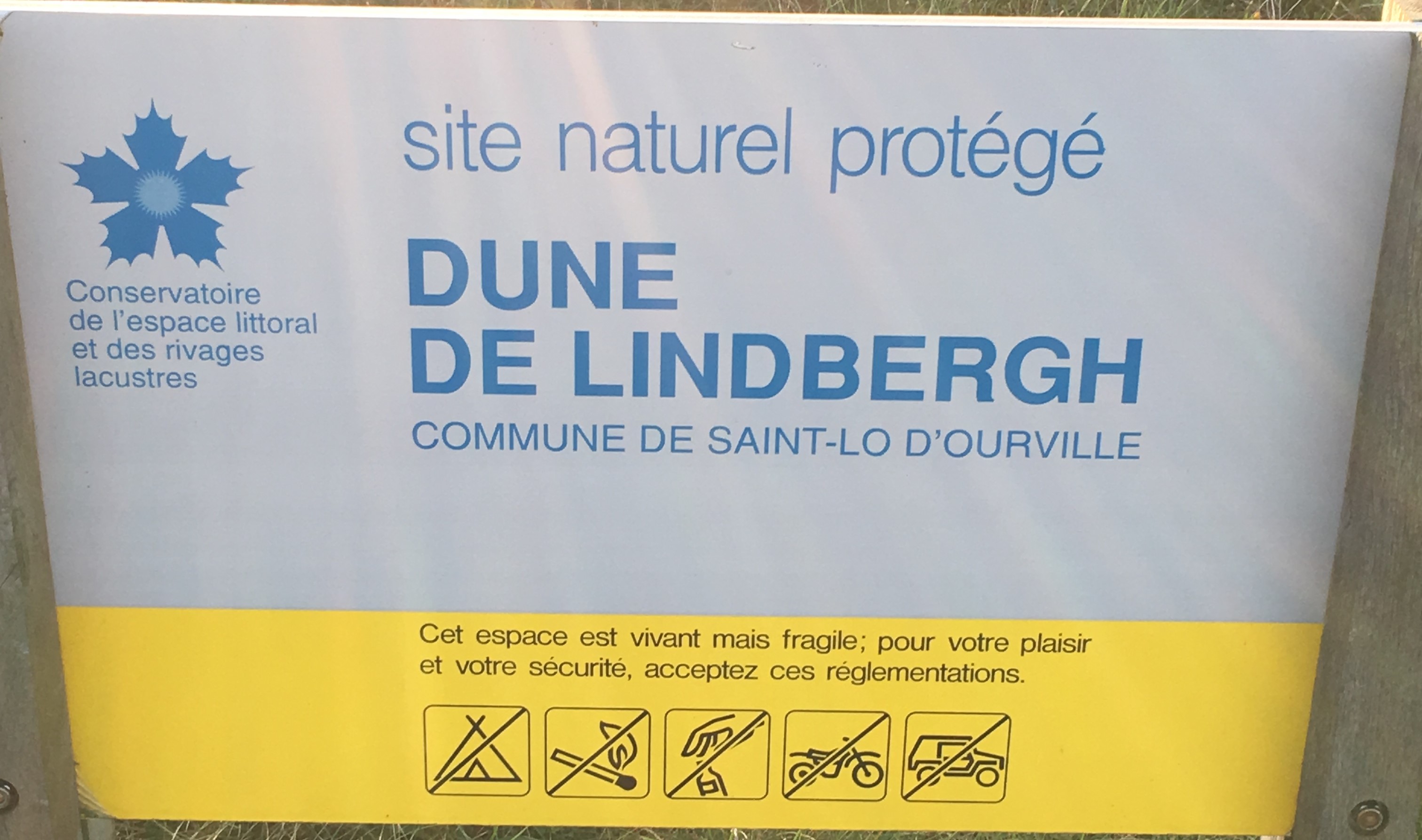
Description
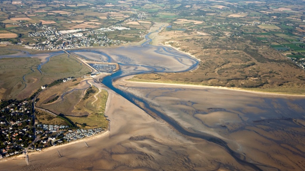
Le havre de Portbail est un petit estuaire de la Manche, ayant pour base l'embouchure de l'Olonde. La flèche sud constitue les dunes de Lindbergh. Elles font partie intégrantes du remarquable massif dunaire qui s’étire sur près de 100 Km, de la baie du Mont-Saint-Michel aux falaises du Cap de La Hague. Ce massif est entrecoupé de quelques promontoires rocheux et d’un chapelet de havres, conférant à ce littoral un profil intéressant en Europe.
Histoire
La dune de Lindbergh doit son nom à un aviateur américain célèbre, Charles Lindbergh, qui fut le premier à traverser l’Atlantique nord sans escale les 20 et 21 Mai 1927, entre New York et Paris. Le pilote du Spirit of Saint-Louis était alors considéré comme un héros, réussissant cette traversée.
Avant la date d’acquisition par le Conservatoire du littoral, en 1985, ce site a longtemps été le siège d’activités lui portant préjudice, tel que la pratique du camping-caravaning, des sports tout terrain, avec véhicules motorisés. A partir de 1984, la pose d’une barrière, d’une clôture en fil lisse le long de la route et de ganivelles sur les secteurs abîmés, a petit à petit mis fin à ces pratiques. Les ganivelles forment une petite palissade en bois de châtaigner disposée sur le littoral sableux, qui sert à piéger le sable pour reconstituer les dunes.
Aussi, d’importantes extractions de sable ont eu lieu entre 1979 et 1984 dans la partie sud du havre de Portbail. Environ 300 000 m3 de sédiments ont été prélevés durant cette période, notamment lors de la construction de la centrale nucléaire de Flamanville. Ce sont ces prélèvements qui sont à l’origine du bilan sédimentaire négatif. Ce bilan négatif explique l’absence d’accroissement de la surface du schorre (ou prés salés), en effet, l’élévation des fonds sédimentaires permettant son développement n’est pas suffisante.
Cependant, le bilan sédimentaire actuel est positif, (évalué à 30500 m3/an).
Faune et Flore
La formation du massif dunaire de Lindbergh date de la fin de la dernière période glaciaire, le Würm. La Manche ne forme alors pas une mer, mais elle est occupée par des fleuves qui sillonnent le plateau continental. Il y a 14000 ans, le réchauffement post-glaciaire (Holocène) entraîne la remontée du niveau des mers, appelée transgression flandrienne. Sous l’action de la houle et du vent, les dépôts de sable sont mobilisés et déposés en haut de plage, formant un cordon dunaire. Ce cordon se renforce par l’action de la végétation qui fixe le sable. Celui-ci s’accumule, et la dune grandit. La mise à jour d’estrans fossiles, suite à l’érosion intensive de la partie nord des dunes de Lindbergh, a permis de dater la forme actuelle du massif au XVIIIe siècle. La présence de dépressions humides (mares) en milieu dunaire, s’explique par l’action du vent, qui va évacuer les matériaux fins et va générer un affleurement de la nappe d’eau souterraine.
Questions :
- Sur combien de km s’étire le massif dunaire ?
- De quand date la formation du massif dunaire de Lindbergh ?
- Au waypoint N 49 19.066 W 001 42.354 Quelle est la nature du sol ? gravilloneux, sableux, terreux ? Pouvez vous voir la mer de ce point ?
Rappel : Sur une Earthcache, il n'y a pas de boites à trouver
Pour valider votre visite sur le site, Loguez cette cache "Found it" et envoyez-moi vos réponses, soit via mon profil soit via la messagerie geoocaching.com, je vous contacterai en cas de probleme. Les logs enegistrés sans réponses seront supprimés.

Description
The port of Portbail is a small estuary of the Channel, based on the mouth of the Olonde. The south arrow is the dunes of Lindbergh. They are an integral part of the remarkable dune massif that stretches for nearly 100 km, from the Bay of Mont-Saint-Michel to the cliffs of the Cap de La Hague. This massif is interspersed with some rocky promontories and a string of harbors, giving this coastline an interesting profile in Europe.
History
The Lindbergh Dune owes its name to a famous American aviator, Charles Lindbergh, who was the first to cross the North Atlantic non-stop on May 20 and 21, 1927, between New York and Paris. The pilot of the Spirit of Saint-Louis was then considered a hero, succeeding this crossing.
Prior to the date of acquisition by the Conservatoire du Littoral in 1985, this site has long been the site of activities prejudicial to it, such as the practice of camping-caravanning, all-terrain sports, with motorized vehicles. From 1984, the installation of a barrier, a fence in smooth wire along the road and ganivelles on the damaged sectors, gradually put an end to these practices. The ganivelles form a small palisade of chestnut wood arranged on the sandy coastline, which serves to trap the sand to reconstruct the dunes.
Also, extensive sand extractions occurred between 1979 and 1984 in the southern part of Portbail Harbor. Approximately 300,000 m3 of sediments were collected during this period, particularly during the construction of the Flamanville nuclear power plant. It is these samples that are at the origin of the negative sediment balance. This negative balance explains the lack of increase of the surface of the schorre (or salt meadows), in fact, the elevation of the sedimentary bottoms allowing its development is not sufficient.
However, the current sediment balance is positive, (estimated at 30500 m3 / year).
Fauna and Flora
The formation of the Lindbergh dune massif dates from the end of the last ice age, the Würm. The Channel does not form a sea, but it is occupied by rivers that crisscross the continental shelf. 14,000 years ago, the post-glacial warming (Holocene) caused the rise of the sea level, called Flandrian transgression. Under the action of the swell and the wind, the sand deposits are mobilized and deposited at the top of the beach, forming a dune cordon. This cord is reinforced by the action of the vegetation which fixes the sand. It accumulates, and the dune grows. The update of fossil foliage, following the intensive erosion of the northern part of the Lindbergh dunes, made it possible to date the current shape of the massif in the 18th century. The presence of wet depressions (ponds) in the dune environment, is explained by the action of the wind, which will evacuate the fine materials and will generate an outcrop of the groundwater table.
Questions :
1. How many kilometers is the dune massif stretching?
2. When did the formation of the Lindbergh dune massif begin?
3. Waypoint N 49 19.066 W 001 42.354 What is the nature of the soil? gravel, sandy, earthy? Can you see the sea from this point?
Reminder: On an Earthcache, there are no boxes to find
To validate your visit on the site, Log this cache "Found it" and send me your answers, either via my profile or via the email geoocaching.com, I will contact you in case of problems. Logs logged without answers will be deleted.