You are standing above the head of the Pagosa Springs flood plain. A flood plain is a generally flat area of land next to a river or stream. It stretches from the banks of the river to the outer edges of the valley. A flood plain consists of two parts. The first is the main channel of the river itself, called the floodway. Floodways can sometimes be seasonal, meaning the channel is dry for part of the year. Beyond the floodway is the flood fringe. The flood fringe extends from the outer banks of the floodway to the bluff lines of a river valley. Bluff lines, also called valley walls, mark the area where the valley floor begins to rise into bluffs. Floodplains can be thousands of kilometers wide or as narrow as a meter. Some faster moving rivers have no floodplain at all.
There are two major processes involved in the natural development of flood plains: erosion and aggradation. The erosion of a flood plain describes the process in which earth is worn away by the movement of a floodway. Aggradation (or alluviation) of a flood plain describes the process in which earthen material increases as the floodway deposits sediment. A meandering stream can contribute to a flood plain's aggradation as well as its erosion.
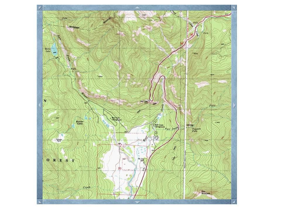
A floodplain's size is mathematically calculated by geologists and hydrologists using the Exner Equation, which analyzes the change in bed elevation, grain packing density, and sediment flux over time. The Pagosa Springs floodplain you see before you contains two separate floodways: the Wolf Creek Floodway draining from the North East and the Himes Creek Floodway draining from the Northwest. This floodplain was originally formed as glaciers during the last ice age receded, carving the U shaped valley you see before you. As the glaciers melted streams and rivers formed and the floodways were created. The distinctive shape of the Valley is easily seen on the topographical map below:
The floor of the valley is at 7,792' above sea level, which indicates that the floodways below you have a long way to travel before they meet up with the Pacific Ocean in the west. As you consider the long journey they have ahead of them, take a moment to answer the following questions to gain credit for visiting this Earthcache.
1. What two floodways make up the valley below you? Can you visibly see either from your current location? If not, how do you know they are there?
2. How high above the valley floor are you currently located. What does this tell you about the height of the glacier that formed this floodplain?
3. Estimate the width of the floodplain. Does this floodplain area consist more of floodway or flood fringe.
4. (Optional) Take a photo of yourself in front of the scenic view!
Thank you for visiting my earthcache! Please take the time to visit some of my other Earthcache locations as you travel around the US and the world!
Source: National Geographic