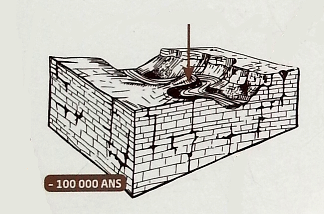
La création du méandre
Le "Cirque de Navacelles" désigne un méandre abandonné et court-circuité par le cours actuel de la rivière au niveau du hameau de Navacelles. L'abandon du méandre ne s'est pas fait suivant le procédé classique de sapements opposés de rives concaves, à la base du pédoncule.
The "Cirque de Navacelles" designates a meander abandoned and short-circuited by the current course of the river at the hamlet of Navacelles. The abandonment of the meander was not done according to the classical method of opposing sappings of concave banks at the base of the peduncle.
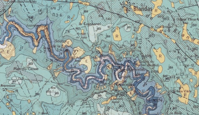
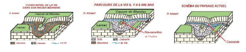
Des travertins calcaires à débris végétaux, remplissent le méandre et se suivent le long de la Vis jusqu'à Madières. Ils ont exhaussé son niveau, lui permettant alors un tracé plus direct. Quand la rivière a repris son creusement, elle a gardé cet emplacement et a recoupé les travertins.
Limestone travertines with plant debris fill the meander and follow along the Vis to Madières. They raised his level, allowing him a more direct route. When the river resumed its digging, it retained this site and intersected the travertines.

L'abandon du méandre est donc contemporain de la formation des travertins, soit environ de - 6000 ans à l'Holocène.
The abandonment of the meander is thus contemporaneous with the formation of travertines, that is, about 6000 years ago in the Holocene.

Géologie du cirque de Navacelles / Geology of the circus of Navacelles
Les points de vue, de la Baume Auriol et de la rive opposée, permettent une vision générale sur le canyon de la Vis entaillé dans les calcaires du Malm du Causse du Larzac, la paléosurface fondamentale (altitude 720 m) et les incisions mioplioquaternaires. Des affleurements du Jurassique supérieur subhorizontaux depuis l’Oxfordien jusqu’au Kimméridgien en aggradation verticale sont visibles le long de la route D130 descendant au cirque.
Outcrops of the Upper Jurassic subhorizontal from the Oxfordian to the Kimmeridgian in vertical aggradation are visible along the D130 road descending to the circus. The viewpoints of the Auriol balm and the opposite shore allow a general view of the canyon of the Vis scored in the limestones of Malm du Causse du Larzac, the fundamental paleosurface (altitude 720 m) and the mioplioquaternary incisions.
Les bancs massifs du Kimméridgien supérieur forment une corniche au sommet. La partie moyenne est formée de calcaires en petits bancs et la base, de calcaires marneux et de marnes de l'Oxfordien moyen. Enfin de la dolomie bathonienne affleure dans le fond du cirque.
The massive banks of the upper Kimmeridgian form a cornice at the summit. The middle part consists of limestones in small banks and the base of marly limestones and marls of the middle Oxfordian. The bathonian dolomite appears in the background of the circus.
Pour valider la découverte de cette earthcache
Q1 - En vous aidant des éléments indiqués sur le schéma ci-dessus quelles sont les 2 types de roches que les gorges de la Vis entaillent ? With the help of the elements indicated on the diagram above, what are the 2 types of rocks that the Vis gorges cut into?
Rendez-vous au WP 2 - N 43°53.683 / E 003°30.700
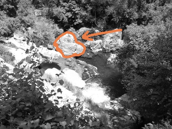
Q2 - Au waypoint n°2 - Postez-vous en hauteur et observez. Quelle est la couleur de la grosse roche en bas ? (cf photo ci-dessus) D’après les informations indiquées sur cette page pouvez-vous indiquer qu’elle est cette roche ? Stand up and watch. What is the color of the big rock below? (See photo) According to the information on this page can you indicate that it is this rock ?
Q3 - Pensez à faire une photo de vous avec la cascade en arrière plan et ajoutez là dans votre log ! Consider taking a photo of yourself with the waterfall in the background and add it to your log !
Loguez cette cache « Found it » et envoyez-moi vos propositions de réponses soit via mon profil, soit via la messagerie geocaching.com. Je vous contacterai en cas de problème.
Log this cache "Found it" and send me your suggestions for answers either via my profile or via the geocaching.com messenger. I will contact you in case of problem.