La Pierre Bécherelle EarthCache
-
Difficulty:
-

-
Terrain:
-
Size:  (other)
Please note Use of geocaching.com services is subject to the terms and conditions
in our disclaimer.
La Pierre Bécherelle
|
Présentation :
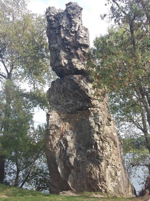
FR :Le site est en bord de la Loire, entre les villages de Savennières et Bouchemaine , il est proche du hameau d’Épiré. Le monolithe de 15 mètres de hauteur est un élément spectaculaire de la formation " Pierre Bécherelle".
Historique
Il sert pendant longtemps comme point de repère pour les mariniers et comme borne de limite entre les fiefs seigneuriaux.Jusqu'en 1565 c'était un lieu de péage sur les bateaux de marchandises au profit des seigneurs de Serrant.
En 1850 la formation à été emputé, la masse de schiste du coteau est séparée en deux lors de la construction de la voie de chemin de fer Angers / Nantes.
Aujourd'hui c'est un lieu d'entrainement pour les alpinistes.
EN: The site is on the banks of the Loire, between the villages of Savonnières and Bouchemaine, it is close to the hamlet of Épiré. The 15 meter high monolith is a spectacular element of the "Pierre Bécherelle" formation.
History
It served for a long time as a landmark for the mariners and as a boundary marker between the seigniorial fiefs. Until 1565 it was a toll-booth on merchant ships for the benefit of the lords of Serrant.
In 1850 the formation was impounded, the mass of shale of the hill is separated in two during the construction of the railway line Angers / Nantes.
Today it is a training place for mountaineers.
|
|
Géologie:
Fr :
La Pierre Bécherelle est composée d’alternance schisto-gréseuse appartenant à la Formation de Fégréac.
Les roches se sont formées au Paléozoique (Ordovicien supérieur à Dévonien inférieur)de - 458,4 Ma à – 393,3 Ma
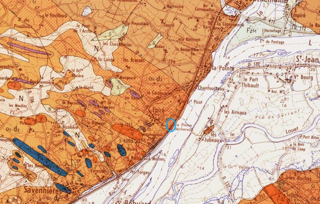
Carte BRGM: O5-d2(G) : Ordovicien supérieur à Dévonien inférieur : intercalations (ou zones) gréseuses
Le schisto-gréseux est constitué de schiste et de grès
schiste : Un schiste est une roche d' aspect feuilleté. Il peut s'agir d'une roche sédimentaire argileuse, ou bien d'une roche métamorphique.
Le grès : Le grès est une roche sédimentaire détritique, issue de l’agrégation et la cimentation de grains de sable. Il peut s'agir d'une roche cohérente et dure.
EN:
The Bécherelle Stone is composed of schisto-sandstone alternation belonging to the Formation of Fégréac.
The rocks were formed to the Upper Ordovician to the Lower Devonian,
BRGM map: O5-d2 (G): Upper Ordovician to Lower Devonian: sandstone intercalations (or zones)
schisto-gréseux: consisting of schist and sandstone shale
A schist is a rock of laminated appearance. It may be a clayey sedimentary rock, or a metamorphic rock.
sandstone: Sandstone is a detritic sedimentary rock, resulting from aggregation and cementation of sand grains. It can be a coherent and hard rock.
|
|
Validation
Fr:Pour valider la earth cache vous devez répondre à la question
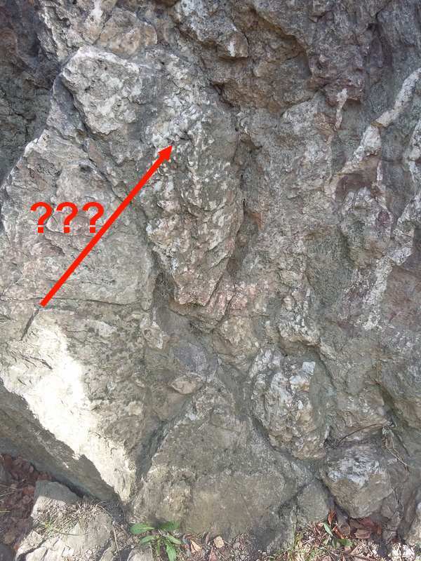
Question 1: En regardant de prêt ce monolithe on observe des veines blanches ; au point désigné par la flèche, que voit-on ? (Sur la photo et sur angle Sud Ouest du monolithe)
Question 1: Looking at this piton, we observe white veins; at the point designated by the arrow, what do we see?
|
|
Les « Earthcaches »: Il n'y a pas de conteneur à rechercher sur place. Il suffit de se rendre sur les lieux pour répondre aux questions ."Loguez cette cache "Found it" et envoyez-moi vos propositions de réponses soit via mon profil, soit via la messagerie geocaching.com (Message Center), et je vous contacterai en cas de problème."
|
Additional Hints
(No hints available.)