Coal Post # 82 - Wraysbury Traditional Geocache
Coal Post # 82 - Wraysbury
-
Difficulty:
-

-
Terrain:
-
Size:  (micro)
Please note Use of geocaching.com services is subject to the terms and conditions
in our disclaimer.
Coal posts are marker posts, now numbering about 210 but originally about 280 in number, erected mainly in the 1860s and forming an irregular loop between 12 and 18 miles around London to mark the points where taxes on coal were due to the Corporation of London.
There are five different forms of coal duty boundary markers in all, this one being type 4.
1. Granite obelisks, about 1.2 metres high, erected beside canals and navigable rivers.
2. Cast-iron posts about 1.2 metres high. These form the majority of posts and are found beside roads and also beside tracks and footpaths, sometimes in open countryside.
3. Cast-iron boxes or plates, about 230mm square, built into parapets of road bridges.
4. Stone or cast-iron obelisks, about 4.5 metres high, found beside railways. Originally erected on previous boundaries and reused on the 1861 boundary.
5. Cast-iron obelisks, about 1.75 metres high, erected on railways after 1865.
This post was originally placed at N 51° 27.254' W 000° 32.186'. The N side railway E of stream and 600 yards SE of Wraysbury Station. See GC2BT1W. At this location it was the most westerly post in the ring. It was moved to its current location in 1979
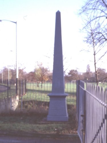
Coal Post 82 at unveiling at new location in 1979.
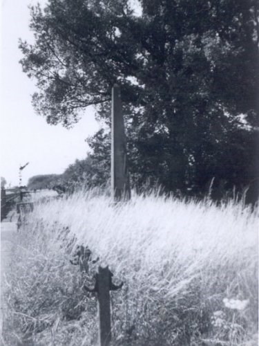
Coal Post 82 at original location in 1961.
You are looking for a magnetic micro, so please bring your own pen
Happy Hunting
Additional Hints
(Decrypt)
Pbeare, Oruvaq, Gbc ohg orybj ubevmbagny