Cache354_EC60PM_OsTerramotosesuasConsequencias
TERRAMOTOS
E SUAS CONSEQUÊNCIAS
EC61PM

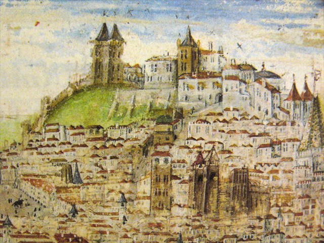
PORTUGUÊS

EARTHCACHE

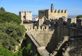
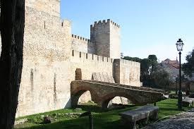
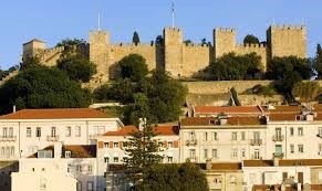
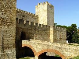
CASTELO
DE S. JORGE
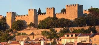
“O Castelo
de
São Jorge é
um dos monumentos mais emblemáticos de Lisboa, cujo nome
deriva
do santo dos
cavaleiros e cruzadas. Está no topo de uma das
colinas da
cidade, com uma
das melhores vistas para o Tejo e Lisboa.
Quando
Lisboa se
chamava Olisipo e as legiões Romanas
conquistaram a
Hispânia, já a
colina era um ponto estratégico militar. Mais tarde vieram
os
Suevos e
Visigodos, até que no século VIII os
muçulmanos
ocuparam a cidade, passando
esta a chamar-se Al-Ushbuna (ou Lissabona). No seu
período
islâmico, a
muralha foi estrategicamente aumentada e fortificada (ganhando o nome
de “Cerca
Moura”).
Durante a
Reconquista
Cristã
na Península, a cidade passou para
as mãos dos
Almorávidas, também
muçulmanos. Foi apenas em 1147 que D. Afonso
Henriques, primeiro Rei de
Portugal, astutamente conseguindo o auxílio de muitos
Cruzados a
caminho do
Médio Oriente, iniciou o famoso Cerco de Lisboa,
operação que durou três meses.

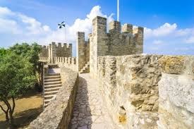
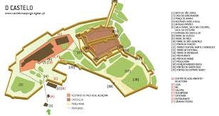
O castelo
conta com
aproximadamente
6.000 metros quadrados, onde se encontram pátios, guaritas,
fossos, torres, e a
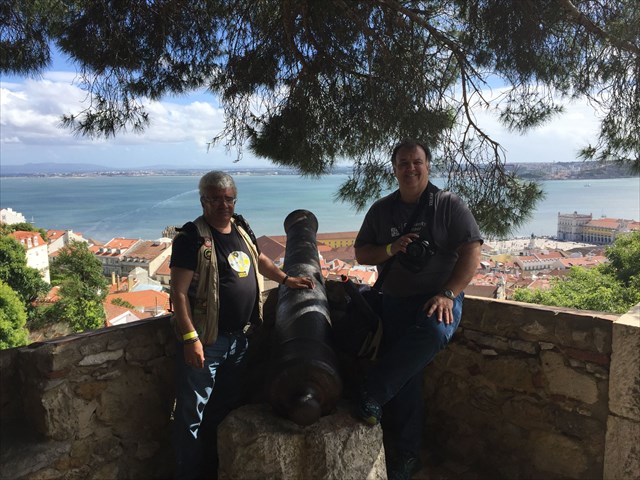
fabulosa vista para a cidade, onde estão os
canhões de
ferro.
Além
do miradouro,
da Camera Obscura
e da exposição permanente, encontrará
ainda alguma
“restauração”, no
espaço
onde antigamente se prendiam os leões trazidos de
África.
O Castelo
de S. Jorge
é certamente um
espaço a visitar em Lisboa (não é
todos os dias
que se visita um castelo
medieval no centro urbano de uma capital e com uma
vista
destas)”.
TERRAMOTO
DE LISBOA
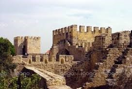
O Sismo
de 1755,
também
conhecido por Terramoto de 1755, ocorreu no dia 1 de
novembro de 1755, resultando na
destruição
quase completa da cidade
de Lisboa, especialmente na zona da Baixa, e
atingindo ainda
grande
parte do litoral do Algarve e Setúbal.
O sismo foi seguido
de um maremoto - que se crê tenha atingido
a altura de
20 metros - e
de múltiplos incêndios, tendo feito
certamente mais
de 10 mil mortos (há
quem aponte muitos mais). Foi um dos sismos mais mortíferos
da história,
marcando o que alguns historiadores chamam a
pré-história
da Europa Moderna. Os
sismólogos estimam que o sismo de 1755
atingiu magnitudes entre 8,7 a
9 na escala de Richter.
O
terramoto de Lisboa teve
um enorme
impacto político e socioeconómico
na sociedade portuguesa do século
XVIII,
dando origem aos
primeiros estudos científicos do efeito de
um sismo
numa área
alargada, marcando assim o nascimento
da sismologia moderna.
O
acontecimento foi largamente discutido
pelos filósofos iluministas,
como Voltaire, inspirando desenvolvimentos significativos no
domínio
da teodiceia e da filosofia do sublime.
O
terramoto fez-se sentir
na manhã de
1 de novembro de 1755 às 9:30 ou 9:40 da
manhã, dia que coincide com
o feriado do Dia de Todos-os-Santos. A data contribuiu para um
alto número
de fatalidades, visto que ruas e igrejas estavam cheias de
fiéis.
O epicentro não
é conhecido
com precisão, havendo diversos sismólogos que
propõem locais distanciados de
centenas de quilómetros. No entanto, todos convergem para
um epicentro no mar, entre 150 a 500
quilómetros a
sudoeste de
Lisboa. Devido a um forte sismo, ocorrido
em 1969 no Banco
de Gorringe, este local tem sido apontado como tendo forte
probabilidade de aí
se ter situado o epicentro em 1755. A magnitude pode ter atingido 9 na
escala
Richter.
Relatos
da época
afirmam que os
abalos foram sentidos, consoante o local, durante entre seis minutos a
duas
horas e meia, causando fissuras enormes de que ainda hoje há
vestígios em
Lisboa. O padre Manuel Portal é a mais
rica e completa
fonte sobre os
efeitos do terramoto, tendo descrito, detalhadamente e na primeira
pessoa, o
decurso do terramoto e a vida lisboeta nos meses que se seguiram. A
intensidade
do terramoto em Lisboa e no cabo de São
Vicente estima-se entre X-XI
na escala de Mercalli. Com os
vários desmoronamentos os
sobreviventes procuraram refúgio na zona
portuária e assistiram ao
recuo das águas, revelando o fundo do mar cheio de
destroços de navios e cargas
perdidas. Poucas dezenas de minutos depois, um tsunami, que
atualmente se
supõe ter atingido pelo menos seis metros de
altura, havendo relatos de
ondas com mais de 10 metros, fez submergir o porto e o centro da
cidade, tendo
as águas penetrado cerca de 250 m. Nas
áreas que
não foram afetadas
pelo tsunami, o fogo logo alastrou-se, e
os incêndios duraram
pelo menos cinco dias. Todos tinham fugido e não havia quem
o
apagasse.
Acerca do
nível de
destruição do
terramoto, sem menção ao tsunami, e focando os
incêndios, no Novo atlas
para uso da mocidade portuguesa (1782), o tradutor corrige em
nota
o autor
francês dizendo:
O Autor,
mal informado do
que
aconteceu a esta capital no referido Terramoto, asseverou que ela
ficara
inteiramente arrasada, quando é certo que em mais de duas
partes
ficou em pé, e
que somente o incêndio, que lhe sobreveio, abrasou, e
consumiu os
edifícios,
tesouros, móveis, riquezas, preciosidades, alfaias, etc.
ficando
unicamente as
paredes. Porém, de tudo o mais raro, que se perdeu, foi a
grande
Livraria de
Sua Majestade - rara pelos manuscritos e originais da Antiguidade que
conservava - perda sem dúvida lamentável para os
sábios.
CONSEQUÊNCIAS
DE UM TERRAMOTO
"Os
terramotos estão entre os mais comuns, os mais
destrutivos e os mais terríveis dos desastres naturais. Estima-se
que, possivelmente, até um milhão de sismos de
diferentes
graus de intensidade
ocorrem todos os anos. A
grande maioria deles passa praticamente despercebida, exceto para os
sismólogos. Mas
em cada ano acontecem alguns terramotos violentos que deixam para
trás: morte,
incêndios, edifícios derrubados e tsunamis.
Ocasionalmente,
a topografia de regiões inteiras é
substancialmente alterada.
Os
terramotos podem destruir assentamentos e matar muitas pessoas. As
réplicas podem
causar ainda mais danos numa área.
É
possível classificar os impactos de um terramoto, levando em
consideração os
seguintes fatores:
•
impactos
imediatos (de curto prazo)
•
impactos de longo prazo
•
impactos sociais (o impacto sobre as pessoas)
•
impactos económicos (o impacto sobre a riqueza de uma
área)
•
impactos ambientais (o impacto na paisagem)
Os efeitos
são frequentemente
classificados como impactos primários e
secundários. Os
efeitos primários ocorrem como resultado direto do tremor do
solo, por exemplo,
o desmoronamento dos edifícios. Efeitos
secundários ocorrem como resultado dos efeitos
primários,
por exemplo, tsunamis
ou incêndios devido à ruptura da rede de
gás.
A
paisagem construída pode ser
destruída. Os
incêndios podem se espalhar devido a explosões de
tubulação de gás. Os
incêndios podem,
também,
danificar áreas de florestas. Deslizamentos
podem ocorrer. Os
tsunamis
podem causar
inundações em áreas costeiras. Marcos
importantes
naturais e humanos podem ser perdidos".
O
TSUNAMI

Lisboa
não foi a
única cidade
portuguesa afetada pela catástrofe. Todo o sul de
Portugal,
sobretudo
o Algarve, foi atingido e a destruição
foi
generalizada. Além da
destruição causada pelo sismo,
o tsunami que se
seguiu destruiu no
Algarve fortalezas costeiras e habitações,
registando-se
ondas com até 30
metros de altura. As ondas de choque do sismo foram sentidas
por
toda
a Europa e norte da África. As
cidades marroquinas de Fez e Meknès sofreram
danos e perdas de vida
consideráveis. Os maremotos originados
pela movimentação
tectónica varreram
locais desde do norte de África
(como Safim e Agadir) até ao
norte da Europa,
nomeadamente até
à Finlândia (através
de seichas) e através
do Atlântico, afetando
os Açores e
a Madeira e locais tão
longínquos
como Antígua, Martinica e Barbados. Diversos
locais em
torno do golfo de Cádis foram
inundados: o
nível das águas subiu
repentinamente em Gibraltar e as ondas chegaram
até Sevilha através
do rio
Guadalquivir, Cádis, Huelva e Ceuta.

DIACLASES

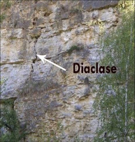
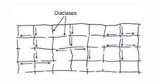
As
diaclases
ocorrem em todos os tipos de rochas e não são
mais do que
fraturas ao longo das
quais não existiu movimento considerável.
Normalmente, a
maior movimentação corresponde
ao afastamento dos compartimentos na direção
perpendicular ao plano de fratura.
As
diaclases
caracterizam-se pela sua extensão, forma da
superfície de
fratura (plana,
curvilínea ou irregular), atitude,
frequência
(número de diaclases
subparalelas) ou espaçamento (distância entre duas
diaclases subparalelas
consecutivas), aspeto da superfície de fratura (lisa,
rugosa,
granular) e
enchimento (se as diaclases se encontram ou não preenchidas
e
quais os
materiais que as preenchem)
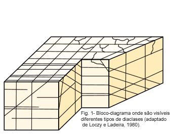
As
diaclases que
possuem superfícies planas chamam-se diaclases
sistemáticas. Estas
diaclases têm uma orientação
subparalela e um
espaçamento regular. As diaclases
que, numa mesma área, possuem uma
orientação
semelhante formam uma família
de diaclases. As várias famílias de diaclases
existentes
numa determinada zona
formam um sistema de diaclases.
As
diaclases que
possuem superfícies curvas ou irregulares designam-se
de diaclases
não-sistemáticas.
Origem
das diaclases
As
interpretações
propostas para explicar a origem das diaclases são diversas.
No
entanto, têm em
comum o facto de se formarem por rutura das rochas, como resultado de
um campo
de tensões aplicado a estes materiais.
Uma parte das diaclases
resulta da atuação de tensões
orogénicas sobre
as rochas.

HORÁRIO
E PREÇOS
Preço:
Bilhete
normal - 15 €.
Grátis
para crianças com menos de 10 anos, residentes do Concelho
de
Lisboa
(necessário Cartão de Cidadão e
digitação do PIN da morada), e outros…
Horário: Última
entrada 30 minutos antes da hora de
encerramento. De 1 novembro a 28 de fevereiro, 09:00 - 18:00 (fecha nos
dias
24, 25 e 31 de dezembro, e 1 de Janeiro). De 1 de Março a 31
de
outubro, 09:00
- 21:00 (fecha no 1º de Maio). Camera Obscura (sujeito
às
condições
meteorológicas), 10:00 - 17:00.
Telefone: (+351)
218 800 620
PARA
REALIZAR E REGISTAR ESTA EARTHCACHE:
PERGUNTAS:

Para
“encontrar/registar” esta cache deverá:
provar que
esteve no local e responder
às seguintes questões, enviando um email/mensagem
de
Geocaching, com as
respostas, em português ou em inglês, para o nosso
perfil.
Só
depois, de enviar as respostas, e
conforme as “guidelines” para as Earthcaches,
deverá
efectuar o seu registo!
Serão
removidos todos os registos
que não obedeçam a estes requisitos.
1.
Indica
alguns dos
efeitos possíveis e imediatos de um terramoto.
2.
Explica,
por palavras
tuas, o que é uma diáclase.
3.
No
local do GZ existe
uma diáclase (repara nos “agrafes”
…)!
a)
Qual
é (em
centímetros) a espessura máxima
observável desta
diáclase?
b)
Esta
diáclase é,
maioritariamente, vertical ou horizontal?

4) TAREFA
OBRIGATÓRIA: Deverá
tirar uma foto
sua (ou
com um papel/placa onde conste o seu nick-name
e a data da visita)e
que comprove a sua presença no local desta EC. Na foto onde
você deve aparecer ou, em alternativa, um papel ou placa com
o seu nick-name e data da visita.




EARTHQUAKES
ANDTHEIR
CONSEQUENCES
EC60PM

ENGLISH

EARTHCACHE
SAO
JORGE'S CASTLE
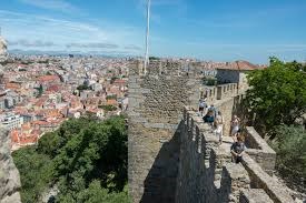
"The
Castle of São Jorge is one of the most emblematic monuments
of
Lisbon, whose
name derives from the saint of the knights and crusaders. It is at the
top of
one of the hills of the city, with one of the best views of the Tagus
and
Lisbon.
When
Lisbon was called Olisipo and the Roman legions conquered Hispania,
already the
hill was a military strategic point. Later came the Suevi and
Visigoths, until
in the 8th century the Muslims occupied the city, which was called
Al-Ushbuna
(or Lissabona). In its Islamic period, the wall was strategically
enlarged and
fortified (gaining the name of "Cerca Moura").
During
the Christian Reconquest on the Peninsula, the city passed into the
hands of
the Almoravids, also Muslims. It was only in 1147 that D. Afonso
Henriques, the
first King of Portugal, astutely getting the help of many Crusaders on
their
way to the Middle East, began the famous Siege of Lisbon, a three-month
operation.
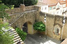
The
castle has approximately 6,000 square meters, where you will find
courtyards,
guaritas, moats, towers, and the fabulous view of the city, where the
iron
cannons are.
In
addition to the viewpoint, the Camera Obscura and the permanent
exhibition, you
will also find some "restoration", in the space where the lions
brought from Africa used to be.
The
Castle of S. Jorge is certainly a space to visit in Lisbon (it is not
every day
that you visit a medieval castle in the urban center of a capital and
with a
view of these).
LISBON
EARTHQUAKE
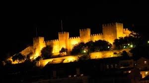
The
1755 earthquake, also known as the 1755 earthquake, occurred on
November 1,
1755, resulting in almost complete destruction of the city of Lisbon,
especially in the Baixa area, and still affecting much of the Algarve
and
Setúbal coast. The earthquake was followed by a tsunami -
believed to have
reached a height of 20 meters - and multiple fires, making more than
10,000
people dead (there are some who point many more). It was one of the
most deadly
earthquakes in history, marking what some historians call the
prehistory of
Modern Europe. Seismologists estimate that the 1755 earthquake hit
magnitudes
between 8.7 and 9 on the Richter scale.
The
Lisbon earthquake had a huge political and socioeconomic impact on
Portuguese
society in the 18th century, giving rise to the first scientific
studies of the
effect of an earthquake in an enlarged area, thus marking the birth of
modern
seismology. The event was widely discussed by the Enlightenment
philosophers,
such as Voltaire, inspiring significant developments in the field of
theodicy
and the philosophy of the sublime.
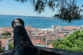
The
earthquake struck on the morning of November 1, 1755 at 9:30 or 9:40 in
the
morning, which coincides with the All Saints' Day holiday. The date
contributed
to a high number of fatalities, since streets and churches were full of
believers.
The
epicenter is not accurately known, with seismologists offering
locations
hundreds of kilometers apart. However, all converge to an epicenter at
sea,
between 150 and 500 kilometers southwest of Lisbon. Due to a strong
earthquake
in 1969 at the Gorringe Bank, this site has been pointed out as having
a strong
probability that the epicenter was situated there in 1755. The
magnitude may have
reached 9 on
the Richter scale.
Reports
of the time say that the shocks were felt, depending on the location,
for
between six minutes and two and a half hours, causing enormous cracks
that
still remains in Lisbon today. Father Manuel Portal is the richest and
most
complete source on the effects of the earthquake, having described in
detail
and in the first person the course of the earthquake and the life of
Lisbon in
the months that followed. The intensity of the earthquake in Lisbon and
Cape St
Vincent is estimated between X-XI on the Mercalli scale. With the
various
collapses the survivors sought refuge in the port area and watched the
waters
receding, revealing the seabed full of wrecks and lost cargoes. A few
tens of
minutes later, a tsunami, which is presumed to have reached at least
six meters
in height, with reports of waves with more than 10 meters, has
submerged the
port and the center of the city, having the waters penetrated about 250
m . In
areas that were not affected by the tsunami, the fire soon spread, and
the fires
lasted for at least five days. All had
fled and no one
had erased him.
On
the level of destruction of the earthquake, without mentioning the
tsunami, and
focusing on the fires, in the New atlas for the use of the Portuguese
youth
(1782), the translator corrects in a note the French author saying:
The
Author, misinformed of what happened to this capital in the said
Earthquake,
asserted that it had been utterly devastated, when it is certain that
in more
than two parts it stood, and that only the fire which overtook it,
burned, and
consumed the Buildings, treasures, furniture, riches, precious things,
implements, etc. Leaving only the walls. But of all the rarer things
that were
lost, it was His Majesty's great Bookstore-rare for the manuscripts and
manuscripts
of the Antiquity which it had preserved-an unfortunate loss for the
wise.
EFFECTS OF AN EARTHQUAKE
“Earthquakes
are among the most common, the most destructive, and the most
terrifying of
natural disasters. It is estimated that possibly as many as a million
temblors
of varying degrees of intensity occur every year. The great majority of
them
pass virtually unnoticed except by seismologists. But each year brings
its
share of violent quakes that leave behind death, fires, toppled
buildings, and
tidal waves. Occasionally the topography of entire regions is
substantially
altered.
Earthquakes can destroy
settlements and kill
many people.
Aftershocks can cause even more damage to an area. It is possible to
classify
the impacts of an earthquake, by taking the following factors into
account:
- short-term
(immediate) impacts
- long-term
impacts
- social impacts (the impact on people)
- economic impacts (the impact on the
wealth of an area)
- environmental impacts (the impact on the
landscape)
Effects
are often classified as primary and secondary impacts. Primary effects
occur as
a direct result of the ground shaking, eg buildings
collapsing.
Secondary effects occur as a result of the primary
effects,
eg tsunamis
or
fires
due to ruptured gas mains.
The
built landscape may be destroyed. Fires can spread due to gas pipe
explosions.
Fires can damage areas of woodland. Landslides may occur. Tsunamis
may cause
flooding in
coastal areas. Important natural and human landmarks may be
lost”.
THE
TSUNAMI
Lisbon
was not the only Portuguese city affected by the catastrophe. All of
southern
Portugal, especially the Algarve, was hit and destruction was
widespread. In
addition to the destruction caused by the earthquake, the tsunami that
followed
destroyed coastal fortresses and dwellings in the Algarve, registering
waves up
to 30 meters high. The shock waves of the earthquake were felt
throughout
Europe and North Africa. The Moroccan cities of Fez and
Meknès
suffered
considerable damage and loss of life. The tsunamis originated from the
tectonic
movement swept locations from North Africa (such as Safim and Agadir)
to
northern Europe, namely to Finland (through seiches) and across the
Atlantic,
affecting the Azores and Madeira and places as far afield as Antigua,
Martinique and Barbados. Several places around the Gulf of Cadiz were
flooded:
the water level suddenly rose in Gibraltar and the waves reached
Seville
through the Guadalquivir, Cadiz, Huelva and Ceuta.

DIACLASES

Diaclases occur in all types of rocks
and are no more
than fractures along which there was no considerable movement.
Normally, the
greater movement corresponds to the spacing of the compartments in the
direction perpendicular to the plane of fracture.
The diaclases are characterized by their
extension,
fracture surface shape (flat, curvilinear or irregular), attitude,
frequency
(number of subparallel diaclases) or spacing (distance between two
consecutive
subparallel diaclases), fracture surface appearance (smooth, Rough,
granular)
and filler (whether or not the fillers are filled and what materials
fill them)
Diaclases that have flat surfaces are
called
systematic diaclases. These diaclases have a subparallel orientation
and a
regular spacing. The diaclases which, in the same area, have a similar
orientation form a family of diaclases. The various families of
diaclases in a
given zone form a system of diaclases.
Diaclases which have curved or irregular
surfaces are
called non-systematic diaclases.

Origin
of diáclases
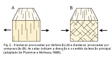
The interpretations proposed to explain
the origin of the
diaclases are diverse. However, they have in common the fact that they
form by
rupture of the rocks, as a result of a field of stress applied to these
materials.
A part of the diaclases
results from the action
of orogenic stresses on the rocks.
SCHEDULE AND PRICES
Price:
Normal
ticket -
€
15. Free for
children under 10 years of
age, residents
of the Municipality of Lisbon (Citizen's Card required and the PIN of
the
address) and other ...
Hours: Last check in 30 minutes before
closing time. From
1 November to 28 February, 09:00 - 18:00 (closes on 24, 25 and 31
December, and
1 January). From March 1st to October 31st, from 9:00 a.m. to 9:00 p.m.
(closes
on May 1st). Camera Obscura (subject to weather conditions), 10:00 a.m.
- 5:00
p.m.
Phone:
(+351) 218 800 620
TO PERFORM AND LOG THIS EarthCache:
QUESTIONS:

To
"find / register" this cache must: prove that visited the site and
answer the following questions by sending an email / message
Geocaching, with
answers (in Portuguese or in English, only) to our profile.
Only later,
sending the answers, and as the "guidelines" for EarthCaches should
make your registration! They will be removed from all records that do
not meet
these requirements.
1.
Indicates
some of the possible and immediate effects of an earthquake.
2. Explain, in your words, what a diaclase is.
3. At the site of the GZ there is a diaclase (notice the "staples"
...)!
a) What is (in
centimeters) the
maximum observable thickness of
this
diaclase?
b) Is this diaclase mostly vertical or horizontal?

4) MANDATORY
TASK: You
must take a picture of yourself
(or with a paper/plate with your nick-name and the date of the visit)
and that proves your presence at the location of this EC. In the photo
where you should appear or, alternatively, a paper or plate with your
nickname and date of visit.
ATTENTION:
