About Village Sign Caches
|
 ⠀ ⠀ |
This cache belongs to the Village Sign Series, a series of caches based on ornate signs that depict the heritage, history and culture of the villages that put them up (generally on the village green!).
The signs can be made of different materials from fibreglass to wood, from forged steel to stone. They can depict anything from local industry to historical events. The tradition probably started in Norfolk or Suffolk and has now spread across most of the country so we thought we would base a series on them!
|
More information, bookmarks and statistics can be found at the Village Signs Website
If anybody would like to expand the Village Sign Series, please do.
I would ask that you request a number for your cache first at www.villagesignseries.co.uk
so we can keep track of the Village Sign numbers and names to avoid duplication.
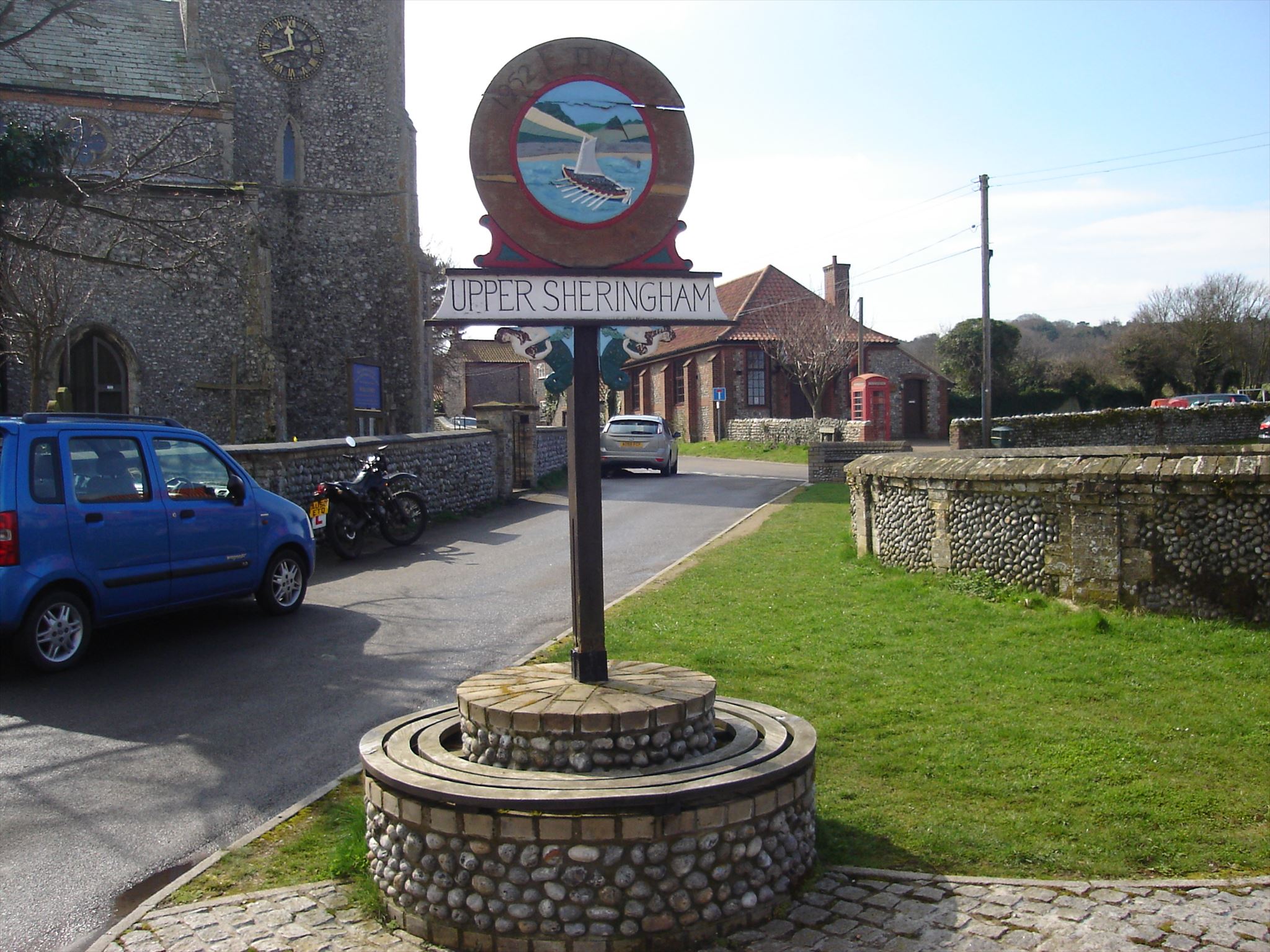
Upper Sheringham is a village and a civil parish in the English county of Norfolk. The village is 26.8 miles (43.1 km) north-north-west of Norwich, 6 miles (9.7 km) west of Cromer and 132 miles (212 km) north-north-east of London. The village is 1.2 miles (1.9 km) from the town of Sheringham. The nearest railway station is at Sheringham for the Bittern Line which runs between Sheringham, Cromer and Norwich. The nearest airport is Norwich International Airport. Nearby road connections are the A149 King's Lynn to Great Yarmouth road to the north of the village and the A148 King's Lynn to Cromer road just to the south. The parish of Upper Sheringham in the 2001 census, a population of 214, reducing slightly to 209 at the 2011 Census. For the purposes of local government, the parish falls within the district of North Norfolk.
The name Sheringham is of Scandinavian origin and has the meaning The Ham of Scira’s people. It is thought that Scira may have been a Viking warlord who was given the land as a reward for his performance in battle. The village is located a little south west on higher ground above the town of Sheringham. The village is bound to the west by the National Trust property of Sheringham Hall and its estate. To the south is the hill line known as the Cromer Ridge. The village is known locally as "Upper Town" as compared to the town of Sheringham (town) itself.
For more information visit the church micro cache.
The cache is NOT at the published coordinates and nor is the village sign (as the icon on the map would clash with Karen's pink wellies ... err I mean church micro.
Visit the waypoint which is the village sign and answer a question to find the coordinates of the cache.
The cache is a short walk from the village sign so please do not go climbing all over it!
The nearby reservoir was dedicated in ABAC
Cache is at N 52° 56.AB(C/2) E 001° AA.A(B+1)(B-1)
This cache is a camo 30ml tube