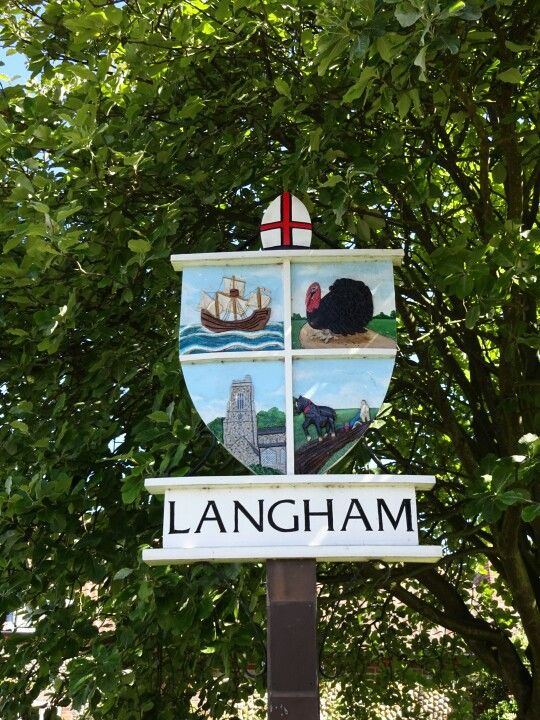
The village sign was made by H C Carter in 1979. The symbols represent a ship for Captain Marryat, a turkey for the Bernard Matthews farm on the old airfield, the church with its tower, ploughing for arable farming and bishop's mitre for Bishop's Langham.
Langham has an entry in the Domesday Book of 1085. In the great book Langham is recorded by the name ‘’Lagaam’’, and “Lang(a)ham” . The main tenant being Bishop William. The survey also notes that there are 2 churches and this is reflected by the double dedication of the remaining 14th century church of St Andrew and St Mary. The church lies at the centre of the modern village by the junction of the main roads through the village. About 60% of Langham lies within the Norfolk Coast Area of Outstanding Natural Beauty.
The parish was the location of RAF Langham airfield during the Second World War and the remains of the runway and airfield buildings still exist along the road to Cockthorpe. The most intriguing of the remaining buildings is a strange hemisphere - the Langham Dome Trainer. This is the youngest Ancient Monument in Norfolk and has its own website.
A brief history of RAF Langham has been published, and has been revised recently and is available on the village website.
If anybody would like to expand this series please do. I would just ask that you let Smokeypugs know first so they can keep track of the Village Sign numbers and names to avoid duplication.