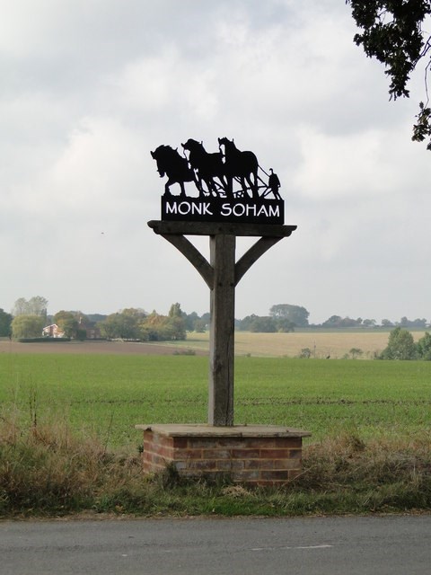
Village Signs is a series of caches based on the ornate signs that depict the heritage, history and culture of the villages that put them up.
Monk Soham directly means "monks" meadow by a "lake". The monks belonged to the abbey at Bury, and were given the land in the late 10th century by Alfed, Bishop of East Anglia. The lake no longer exists, however, it is believed to have reclined north of the back road which now runs from Earl Soham towards Ashfield-cum-Thorpe.
In the Doomsday Book of 1086, "Soham" was described as a village which consisted of both Monk and Earl Soham. Monk Soham was considered to be in the Bishop's Hundred along with Hoxne, while Earl Soham was considered to be in a different hundred for judicial purposes. This suggests that both villages have since been separated, as on twenty-first century maps they have distinguished boundaries. The Doomsday book also states Monk Soham had fifteen acres of meadow and woodland for thirty pigs and eighty-one goats in the 11th century; this suggests that the rural town was focused on farming and agriculture and carried on this sector of work for many centuries, and in 1868 the parish was recorded as "wholly agricultural".
 If anybody would like to expand the series please contact Smokeypugs here