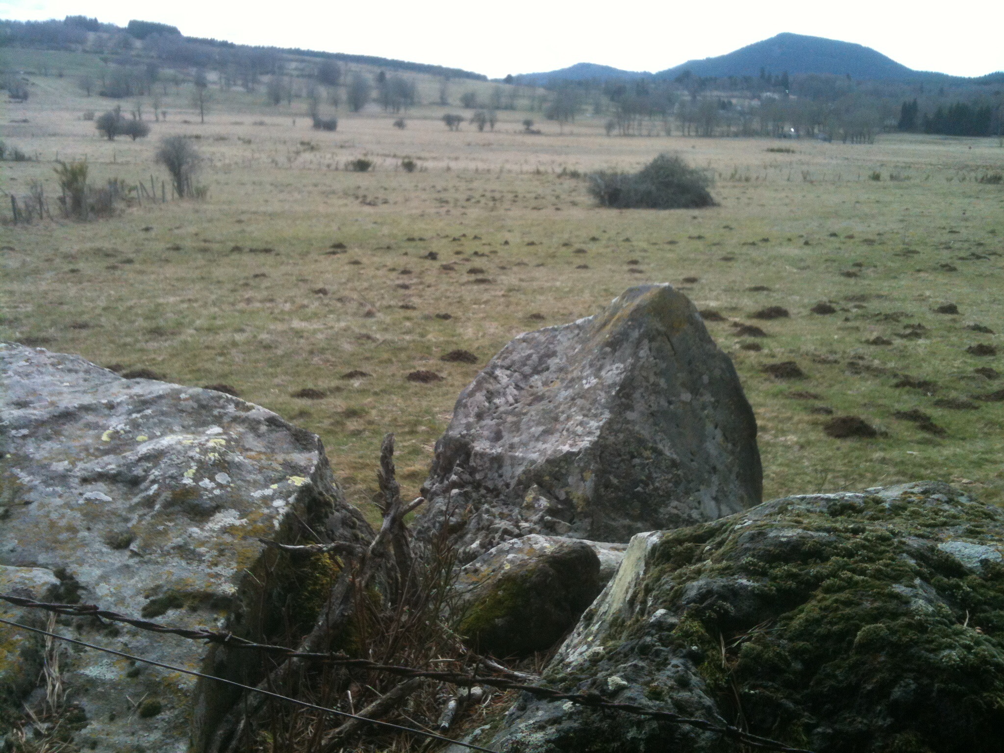
Cette earth cache va vous faire découvrir une anomalie magnétique très présente à proximité du village de Lachamp.
Ces anomalies magnétiques sont liées à la géologie locale et au volcanisme de la chaîne des Puys. Ce phénomène est d’ailleurs communément appelé le Lachamp. M Norbert Bonhomme a réalisé en 1970 une thèse sur le magnétisme rémanent des laves du Massif Central.
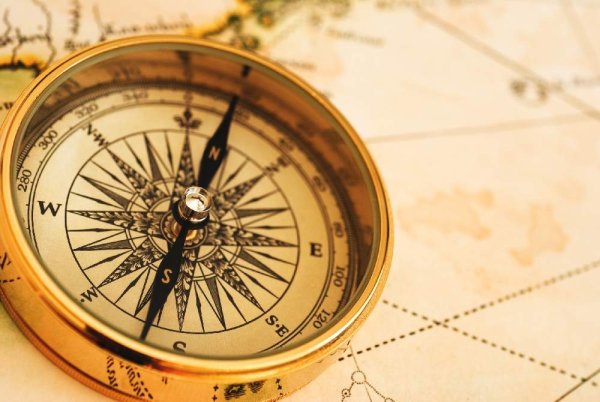
Pour observer ces anomalies vous devrez avoir avec vous une boussole classique ou bien utiliser le mode boussole de votre GPS ou une application de votre smartphone.
En approchant des roches situées aux coordonnées transmises, vous allez vous apercevoir un changement brutal de l’orientation de votre aiguille. La boussole perd le nord.
Mais il existe plusieurs Nords :
- le Nord géographique,
- le Nord magnétique
La déclinaison magnétique est, en un point donné sur la surface de la Terre, l'angle formé entre la direction du pôle Nord géographique et le Nord magnétique (il s'agit donc d'un angle sur le plan horizontal du point d'observation). Cet angle est compté positivement vers l'est et négativement vers l'ouest. La direction du Nord magnétique est celle de la composante horizontale de l'inclinaison magnétique.
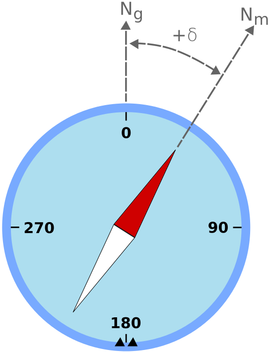
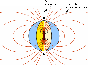
L'axe de rotation de la Terre définit les pôles géographiques, l'axe du champ magnétique terrestre les pôles magnétiques. Ces deux axes ne coïncident pas et le pôle Nord magnétique est ainsi distinct du pôle Nord géographique. Ceci explique que la déclinaison magnétique varie d'un point à un autre sur la surface de la Terre.
Elle varie également dans le temps car l'axe du champ magnétique terrestre (vu localement comme un champ dipolaire) se modifie au cours du temps au gré des mouvements de convection de la matière qui, dans le noyau externe liquide de la Terre, génèrent ce champ.
Comment expliquer ce phénomène ?
- Les laves contiennent une proportion non négligeable d’oxyde de fer et notamment de magnétite Fe3O4. Cet oxyde de fer ayant la propriété connue d’attirer les particules de fer.
- Les laves en fusion en se refroidissant se magnétisent suivant le champ magnétique terrestre au moment de l’éruption c'est-à-dire que le flux magnétique des oxydes de fer contenus dans la roche s’oriente suivant le champ magnétique terrestre de l’époque.
- Le champ magnétique terrestre évolue constamment. La déclinaison magnétique en est un exemple et que les pôles magnétiques se sont inversés à quelques reprises tout au long de l’histoire de notre planète
- Le flux magnétique de la roche est don orienté suivant le champ magnétique contemporain à l’éruption. Ce champ magnétique était alors différent de celui dont nous connaissons à ce jour.
Pour valider cette earth cache vous devrez répondre aux questions suivantes :
- Quel élément chimique est responsable de la « magnétisation » des rochers de Lachamp ?
- Au niveau du rocher aux coordonnées N 45°45.042’ E 002°58.558, quelle est la déclinaison magnétique observée en plaçant votre boussole sur le rocher ?
- Au niveau du rocher aux coordonnées N 45°45.104’ E 002°58.627, quelle est la déclinaison magnétique observée en plaçant votre boussole sur le rocher ?
Loguez cette cache "Found it" et envoyez-moi vos propositions de réponses soit via mon profil, soit via la messagerie geocaching.com (Message Center), et je vous contacterai en cas de problème.
Sources :
-wikipedia
-article de Mme Suzanne Gely, professeur agregée de Sciences Physiques (Bulletin Municipal n°33 de la commune de St Genes Champanelle)
The paleomagnetism indicates the past ground magnetic field, and by extension the scientific discipline of study of its properties. We sometimes indicate the study of the magnetic field of historic period by the name of archéomagnétisme.
This earth hides is going to make you discover a very present magnetic anomaly near the village of Lachamp.
These magnetic anomalies are bound to the local geology and to the volcanism of the chain of Volcanic hills. This phenomenon is moreover collectively a conscript le Lachamp. M Norbert Bonhomme realized in 1970 a theory on the residual magnetism of the lavas of Massif Central.
To observe these anomalies you will have to have with you a classic compass either use the mode compass of your GPS or an application of your smartphone.
By approaching rocks situated in the passed on(transmitted) coordinates, you go to notice a rough change of the orientation of your needle. The compass is fuddled.
But there are several North:
- The True north,
- The magnetic North
The magnetic declension is, in a point given onto the surface of the Earth, the angle formed between the direction of the geographical North Pole and the magnetic North (it is thus about an angle on the horizontal plan of the point of observation). This angle is counted positively eastward and negatively westward. The direction of the magnetic North is the one of the horizontal component of the magnetic slope.
The axis of rotation of the Earth defines the geographical poles, the axis of the ground magnetic field the magnetic poles. These two axes do not coincide and the magnetic North Pole is so different from the geographical North Pole. This explains that the magnetic declension varies from a point to an other one on the surface of the Earth.
It also varies in the time because the axis of the ground magnetic field (seen locally a field dipolaire) modifies in time according to the movements of convection of the material which, in the liquid external pit of the Earth, generate this field.
How to explain this phenomenon?
- Lavas contain a not insignificant proportion of oxide of iron in particular magnetite Fe3O4. This iron oxide having the known property to attract iron particles.
- Molten lavas by cooling magnetize according to the ground magnetic field at the time of the eruption that is the magnetic flow of iron oxides contained in the rock turns according to the ground magnetic field of time.
- The ground magnetic field evolves constantly. The magnetic declension
To validate this earth hides you will have to answer the following questions:
1. What chemical element is responsible for the "magnetizing" of the rocks of Lachamp?
2. At the level of the rock in coordinates N 45°45.042 ' E 002°58.558, what is the magnetic observed declension by placing your compass on the rock?
3. At the level of the rock in coordinates N 45°45.042 ' E 002°58.558, what is the magnetic observed declension by placing your compass on the rock?
Log this hiding place " Found it " and send me your proposals of answers either via my profile, or via the geocaching.com messaging (Center message), and I shall contact you in case of problem.

Journal La Montagne Octobre 2017 : Les boussoles perdent le nord
http://www.lamontagne.fr/saint-genes-champanelle/insolite/science/2017/10/27/a-laschamps-puy-de-dome-les-boussoles-perdent-le-nord_12597460.html