Join the group for the 1st annual Nasty hike. We are calling this the "1st Annual Nasty Hike" for two reasons. First, since Norm (strek2), the original owner of the event, can't make the trip this year we have to make sure we get him out here next year. Second, once you do the Nasty you can't help but want to do it again!
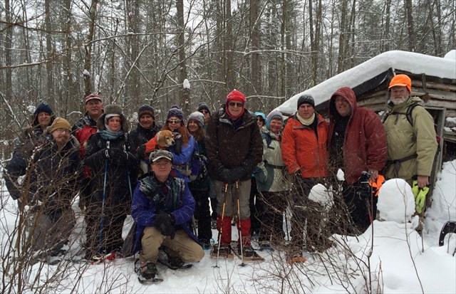
Group photo of most of the hikers who made the trek to the Camp Nasty event.
Event Itinerary
- The event will formally start at noon at Camp Nasty and run for an hour.
- For those that want to hike together from the Rte 107 parking lot (N 42° 58.740 W 071° 07.370), we will start the hike at 11AM and head straight to Camp Nasty. This is the best place to park with plenty of parking across from The Fremont Public Library. There are other locations to park and meet up at the final location but they do not offer enough parking for all.
- There will be a trackable table set-up.
- There will be a raffle at 12:30PM. Raffle donations are appreciated.
- Feel free to pack a lunch and/or bring snacks to share.
The event involves a winter hike of 3+ miles round trip with time spent outdoors at Camp Nasty. For your comfort and safety, please plan according (see suggested gear and clothing lists below). Dogs are welcome but should be leashed due to the snowmobile traffic on the rail trail.
Suggested gear to pack
- Snowshoes
- Boots
- Snowshoe poles (or trekking poles with snow baskets)
- Gaiters
- Pack
- Water (at least a liter)
- Ice cleats
- Food/snacks
- First aid kit
- GPS
Suggested clothing
- Wicking base layers (wool or synthetic)
- Insulating mid layer: fleece jacket or vest
- Waterproof/breathable jacket (or soft shell)
- Insulating jacket (down or poly-fill; worn at stops)
- Waterproof/breathable pants or bibs (or soft shell)
- Fleece pants
- Insulating hat, cap, balaclava or headband
- Neck or face gaiter (bandana or similar)
- Socks (synthetic or wool) plus spares
- Liner socks
- Gloves, mittens and/or overmittens
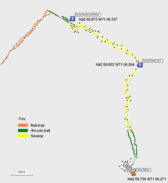
Hiking waypoints
Here is a map, from one of my previous hikes to Camp Nasty, which includes tracks and waypoints for the bushwhack part of the hike: