Une chapelle troglodyte... EarthCache
Une chapelle troglodyte...
-
Difficulty:
-

-
Terrain:
-

Size:  (other)
Please note Use of geocaching.com services is subject to the terms and conditions
in our disclaimer.
Notre Dame de Lorette...
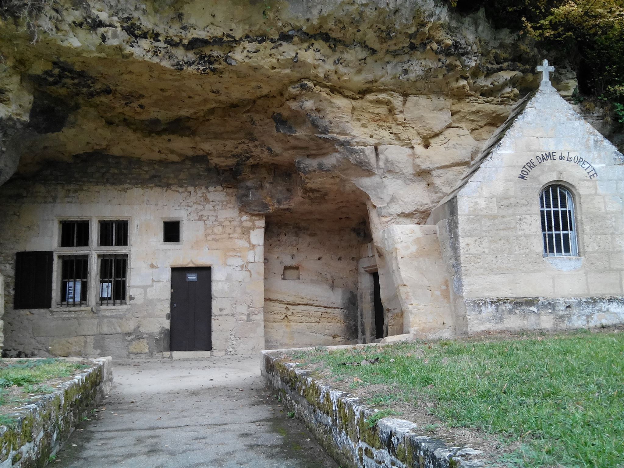 Dans la Vallée de Courtineau se trouve la chapelle "Notre-Dame-de-Lorette" creusée dans le coteau. Cet oratoire daterait du XVème siècle.
Jeanne d’Arc s’y serait abritée de la pluie alors qu’elle se rendait à Chinon le 6 mars 1429.
Le département de l’Indre-et-Loire situé dans le quart Centre-Ouest de la France est connu pour ses habitations troglodytiques le long de la vallée de la Loire, il renferme aussi un potentiel en grandes carrières souterraines à entrées latérales sur versant.
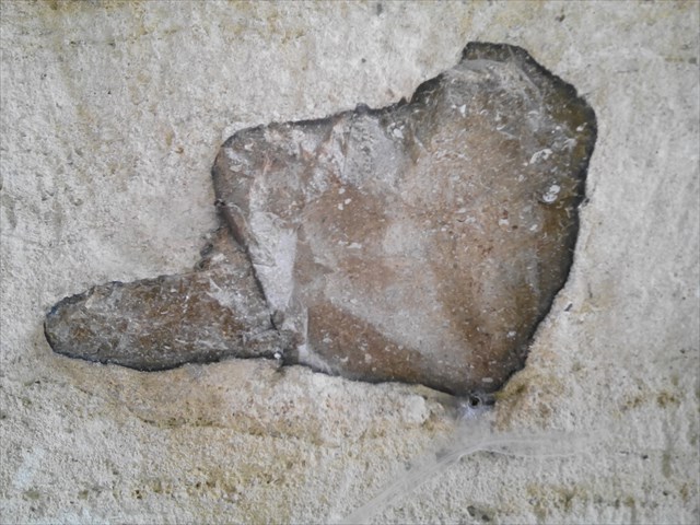
Ces cavités souterraines diverses proviennent de la géologie de la région. En effet, le substratum très calcaire, localement appelé ( falun ) a été très exploité et aménagé. Egalement, la craie du Turonien ou tuffeau a fait l’objet de nombreuses excavations..
On estime que le réseau de caves, carrières, et galeries couvre une superficie supérieure à 3000 hectares de la globalité des 6126 km carrés du département.(on en dénombrerait 12 à 13000 !!!)
Dans la région, on rencontre deux sortes de cavités:
1) Cavités souterraines d'origine anthropique: exploitation des matières premières minérales (pour la construction, l’industrie ou l’agriculture) .
2) Cavités souterraines d'origine naturelle: Cavités de dissolution par circulation d’eau.
Dans la vallée de Courtineau, le plateau est en grande partie recouvert par les argiles à silex du Sénonien ou par les perrons de Touraine. Le nord du finage est souvent recouvert par des limons plaqués. En de nombreux endroits l'érosion a laissé apparaître le calcaire jaune du Turonien supérieur. <
L'or jaune de Touraine... 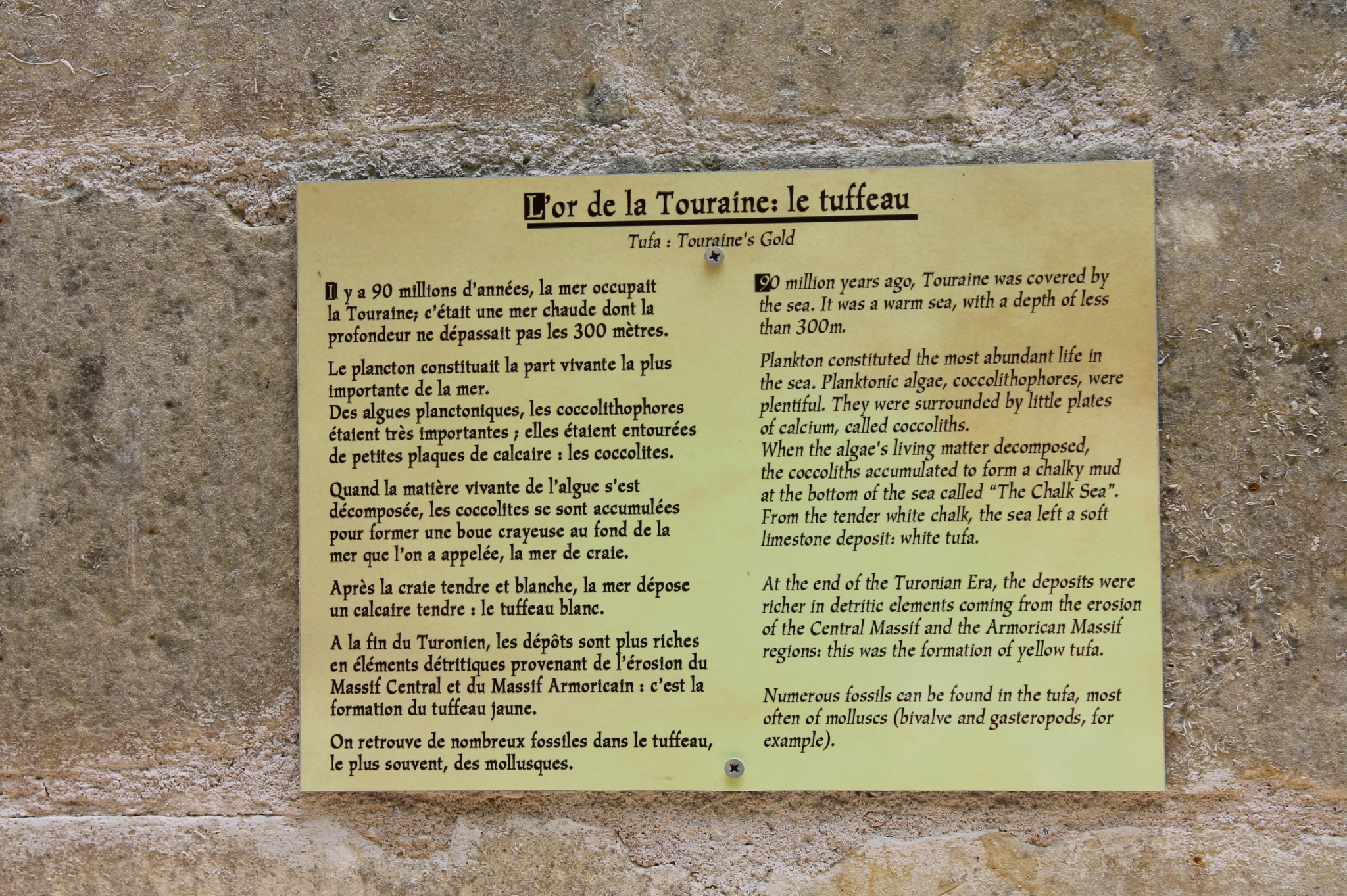 Intéressons-nous ici à la falaise ou est adossée la chapelle car c'est un formidable observatoire de la roche et de ses composants...
ICI PAS DE RESEAU:
Alors pour vous aider dans vos recherches, je vous indique ou chercher en vous donnant les indices suivants:
Intéressons-nous ici à la falaise ou est adossée la chapelle car c'est un formidable observatoire de la roche et de ses composants...
ICI PAS DE RESEAU:
Alors pour vous aider dans vos recherches, je vous indique ou chercher en vous donnant les indices suivants:
1) A droite de l'oratoire en faisant face à la falaise !!!
2) A droite de l'entrée de la chapelle !!!
3) A gauche en entrant dans la grotte !!!
4) Dans la grotte en haut et à droite sous l'arche !!!
5) Au dessus de vous à l'entrée de la grotte !!!
RAPPEL: PAS DE BOITE A TROUVER SUR PLACE...
POUR VALIDER LE FOUND-IT: REPONDEZ AUX QUESTIONS SUIVANTES:
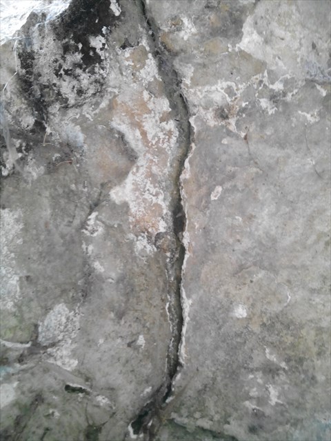
1) LA FALAISE... Quel type de falaise est devant vous, et que remarquez-vous ?
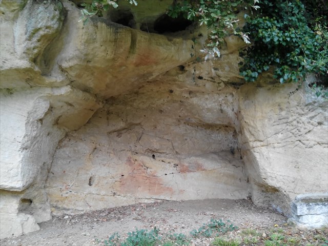
2) LA ROCHE... Déterminer le type de roche et sa longueur à la base (à + ou- 1cm) ?
 3) LA FISSURE... Nom géologique de ce type de faille et sa longueur (à + ou- 10cm) ?
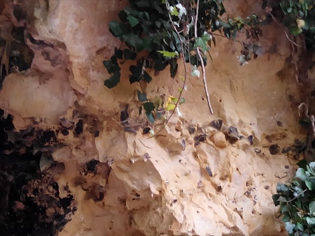
 4) LE FILON... Nom géologique de cette formation et déterminer sa longueur (à + ou- 10cm) ?
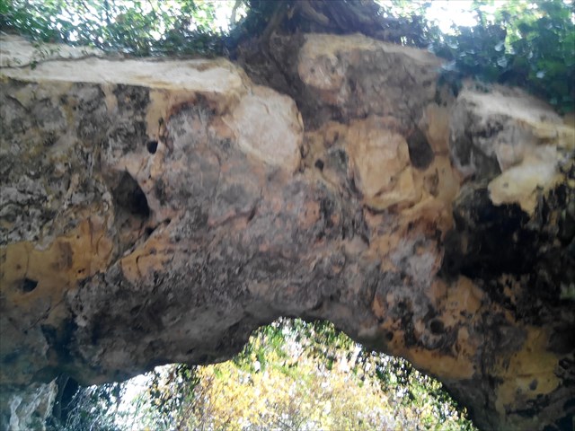
 5) L'ARCHE... Estimer sa largeur (à + ou- 10cm) ?
 Loguez cette cache "Found it" et envoyez-moi vos propositions de réponses soit via mon profil, soit via la messagerie geocaching.com (Message Center), et je vous contacterai en cas de problème.
 Our Lady of Loreto ...
In the Courtineau Valley is the chapel "Notre-Dame-de-Lorette" dug into the hillside. This chapel dates from the fifteenth century.
Joan of Arc it would be sheltered from the rain on her way to Chinon March 6, 1429.
The department of Indre-et-Loire located in the Central West quarter of France is known for its cave dwellings along of the Loire valley, it also contains a potential large underground quarries side entrances on slope.
These diverse underground cavities come from the geology of the area. Indeed, the very bedrock limestone, locally called (gong) was very operated and fitted. Also, the Turonian chalk or limestone has been the subject of numerous excavations ..
It is estimated that the network of caves, quarries, galleries and covers an area greater than 3,000 hectares of the whole of 6126 km square of the department. (We would count 12-13000 !!!)
In the region, we find two types of cavities:
1) underground cavities anthropogenic. Exploitation of mineral raw materials (for construction, industry and agriculture)
2) underground cavities of natural origin: Cavities dissolution by circulating water.
In the Courtineau Valley, the plateau is mostly covered by flint clays Senonian or stoops of Touraine. Northern finage is often covered by silt plated. In many places erosion has left appear yellow limestone of the Upper Turonian. <
The Yellow Gold Touraine ...
Let us here at the cliff or is backed by the chapel because it is a wonderful observatory of the rock and its components ...
HERE NO NETWORK:
So to help you in your research, I tell you or look giving you the following indices:
1) To the right of the oratory facing the cliff !!!
2) the right of the entrance to the chapel !!!
3) To the left on entering the cave !!!
4) In the upper right cave under the arch !!!
5) Above you at the entrance of the cave !!!
TO CONFIRM THE CACHE, ANSWER THE FOLLOWING QUESTIONS:
1) THE CLIFF ... What kind of cliff in front of you, and do you notice?
2) LA ROCHE ... Determine the type of rock and its length to the basis (+ or 1cm)?
3) THE CRACK ... geological name of this type of fault and its length (10cm to + or-)?
4) THE BONANZA ... geological name of this training and determine its length (10cm to + or-)?
5) ARCH ... Estimate width (10cm to + or-)?
phones Sign the cache "Found it" and send me your answers proposals either via my profile or via email geocaching.com ( Message Center), and I will contact you in case of problems.
BELLE BALADE, JE VOUS ATTENDS/BEAUTIFUL WALKING, YOU WAIT 
Additional Hints
(Decrypt)
A'bhoyvrm cnf yrf cubgbf cbhe ibhf ercéere rg yr zèger vaqvfcrafnoyr cbhe yrf zrfherf...
*************************
Erzrzore gur cvpgherf gb svaq lbhe zrgre naq rffragvny sbe zrnfherzragf ...