Un exemplaire spectaculaire d'éboulis péri-glaciaire.
L'éboulis de la Rocaille est situé en rive gauche du Ciniq et à moins de 2Km du village de Malbo.
Cet éboulis s'est formé au pied d'une corniche vive de basalte appartenant à la bordure ouest de l'une des planèzes du sud du massif volcanique du Cantal, la planèze de Malbo.
Géographiquement cette planèze est limitée par les vallées du Brezons à l'Est et du Ciniq à l'Ouest. Ces deux vallées, qui descendent plein Sud en direction de la Truyère, ont été sculptées durant les périodes froides du Quaternaire par de puissants glaciers de type alpin. Ces glaciers se raccordaient alors en amont à des cirques d'alimentation situés sur le flanc sud du Plomb du Cantal.
Pour valider la cache :
Loguez cette cache "Found it" et envoyez-moi vos propositions de réponses
soit via mon profil, soit via la messagerie geocaching.com (Message Center),
et je vous contacterai en cas de problème.
Merci de ne pas publier les réponses dans vos logs.
1. La répétition de quel mécanisme a eu pour conséquence de désolidariser les prismes de basalte et conduit à leur détachement, puis à leur chute au pied de la falaise ?
2. Quel est le nom des gros blocs rocheux transportés par les lobes glacières et abandonnés, après leur fonte, à la surface de la planèze ?
3. Quelle est la largeur de l'éboulis à son sommet au niveau du sentier ?
4. A quelle altitude se situe le sommet de l'éboulis au niveau du panneau d'informations ?
5. Une photo du site (optionnel).
|

A spectacular example of peri-glacial scree.
The scree of La Rocaille is located on the left bank of the Ciniq and less than 2Km from the village of Malbo.
This scree formed at the foot of a lively basalt ledge belonging to the western edge of one of the planches of the south of the volcanic massif of Cantal, the planeze of Malbo.
Geographically this planze is limited by the valleys of Brezons in the East and Ciniq in the West. These two valleys, which flow south due to the Truyère, were carved during the cold Quaternary periods by powerful alpine-type glaciers. These glaciers then connected upstream to feeding circuses located on the southern flank of Plomb du Cantal.
To validate the cache :
Log in this "Found it" cache and send me your responses
either via my profile or via messaging geocaching.com (Message Center),
and I will contact you in case of problem.
Thank you for not publishing the answers in your logs.
1. The repetition of what mechanism had the consequence of dissociating the prisms of basalt and leading to their detachment, and then to their fall at the foot of the cliff ?
2. What is the name of the large rock blocks transported by the ice lobes and abandoned, after their melting, on the surface of the planze ?
3. What is the width of the scree at its top at the trail ?
4. At what elevation is the top of the scree at the information panel ?
5. A photo of the site (optional).
|
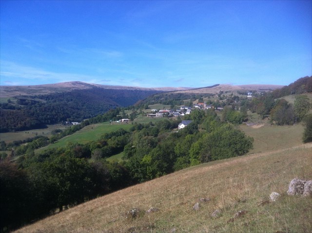
Vue sur Malbo