The cache: This cache is located along the Foothills Trail just west of the city of South Prairie. In high school, I lived on the ridge to the NW of the cache. In the summer we would hike down a trail (unless we had gas money, then we would drive) to swim in South Prairie Creek.
Do not park on the corner of South Prairie Carbon River Rd and SW 1st Street. This is private property that the owner uses to access his land on the north side of the trail.
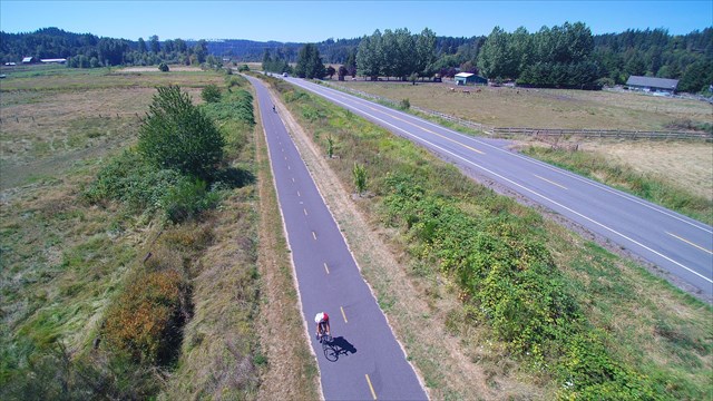
The Foothills Trail is a rails-to-trails project. The 25-mile trail sits atop a historic railroad bed and snakes through the river valley southeast of Tacoma. One of the most scenic sections, which has unobstructed views of Mount Rainier, begins in Orting and follows the Carbon River upstream through farmland and forest.
The rail history began in 1864, when Congress gave the Northern Pacific Railroad Company sufficient land to construct a railroad between Ellensburg and Tacoma. Around 1874, the Northern Pacific began construction of the railroad line from Tacoma to Wilkeson to take advantage of the newly discovered coal resources in the Cascade foothills. In 1883, Northern Pacific was forced to complete its line from the Midwest to Tacoma or forfeit millions of acres of land grants. This rail section east of South Prairie through Enumclaw and the Stampede Pass tunnel was completed in July 1887, finally connecting Tacoma and Ellensburg.
The Burlington Northern Railroad Company succeeded the Northern Pacific Railroad Company in managing the railroad line. Burlington Northern abandoned the rail bed in 1982, and by late 1986, the balance of the railroad line had been removed for salvage.
Pierce County saw the opportunity to create a trail on the former rail line and worked with the salvage company to preserve the remaining trestles along the line. In October 1990, the Pierce County Council passed Ordinance #90-6, establishing the Foothills Trail as a public linear park. Thus began the journey of constructing what is now the Foothills National Recreation Trail.
Source: Pierce County, Foothills Trail
2016 was the 100th anniversary of the National Park Service, and to celebrate, Visit Rainier and WSGA hosted the Visit Rainier Centennial GeoTour - 100 caches placed in and around Mount Rainier National Park. The geocaches highlighted the rich history, scenic wonders, quaint communities, and hidden gems of the Rainier region. Participants received geocoin and pathtag prizes for finding all the caches.

