Glacial activity on Mount Rainier is continually providing water and sediment to the surrounding lowlands. High on the northeastern slope of Rainier, the Emmons Glacier provides a steady flow of water that becomes the White River.
If you've ever viewed the White River, then you probably know how it got its name - the waters are usually milky white, much more so than other rivers, especially in the upper reaches. The color comes from tiny rock particles the size and color of plaster dust. These particles are called glacial flour, and are created as the Emmons Glacier grinds up rocks and expels the debris in its meltwater.
The White River flows east for a few miles before wrapping north around the mountain and then flowing west, paralleling Hwy 410 for a stretch. Other tributary rivers flow into it, including the West Fork White River from the Winthrop Glacier, and eventually, it dumps into the Puyallup River near Puyallup, which then continues to Puget Sound through Tacoma.
The White River has been a food source for the Muckleshoot Indian Tribe for millennia. The river and its tributaries support five fish runs, including trout and sockeye, coho, and chinook salmon.
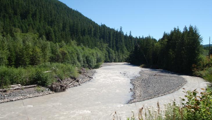
About the cache: This cache is located along Highway 410 near a huge pullout with great views of the river.
2016 was the 100th anniversary of the National Park Service, and to celebrate, Visit Rainier and WSGA hosted the Visit Rainier Centennial GeoTour - 100 caches placed in and around Mount Rainier National Park. The geocaches highlighted the rich history, scenic wonders, quaint communities, and hidden gems of the Rainier region. Participants received geocoin and pathtag prizes for finding all the caches.

