Bullion Canyon Miners Park Traditional Geocache
Bullion Canyon Miners Park
-
Difficulty:
-

-
Terrain:
-
Size:  (regular)
Please note Use of geocaching.com services is subject to the terms and conditions
in our disclaimer.
 Ranked next to the Uintah and La Sal Mountains, the obscure Tushars are Utah’s third highest range. ATV enthusiasts in Piute and Beaver Counties have been well aware of this alpine paradise for years and it’s just a matter of time until other outdoor enthusiasts discover all this range has to offer.
Bullion Canyon, on the east side of the range, showcases many of the things that make the Tushars a unique adventure destination: dizzyingly high peaks, odd-colored volcanic rocks (varying from purple to red to yellow), and a chance to view majestic mountain goats. Setting Bullion Canyon apart however, are the abundant well-preserved relics attesting to the storied mining history of the Tushars.
In 1865, the first prospectors to dip their pans into the frigid moss-lined Pine Creek in Bullion Canyon had little trouble finding stream-worn nuggets of gold. As they continued to prospect up canyon, in search of the gold’s source, they noticed a circular stone-ground depression atop of a large boulder next to the creek – clear evidence that these adventurous miners were not the first to discover the riches of Bullion Canyon. Part of a Spanish arrastra, gold-rich ore was placed in the depression and large stones would be drug over the top, grinding the ore into a fine powder. This crude milling process was the first step in separating the precious metal from the rock. This arrastra, which was weather-worn and full of lichens in 1865, is a testament to a Spanish presence in present-day Utah long before the arrival of American explorers and settlers.
The Ohio Mining District was organized in 1868 and its largest mining camp, Bullion City, reached a peak population of 1651 in 1880. The population declined sharply as the richest veins were mined out, but the town was continuously occupied until the Bully Boy Mill closed for good in 1938. This longevity, by western standards, has resulted in a number of well-preserved dwellings, infrastructure, and tools that help one get an authentic feel for what life was like for miners in this bygone era.
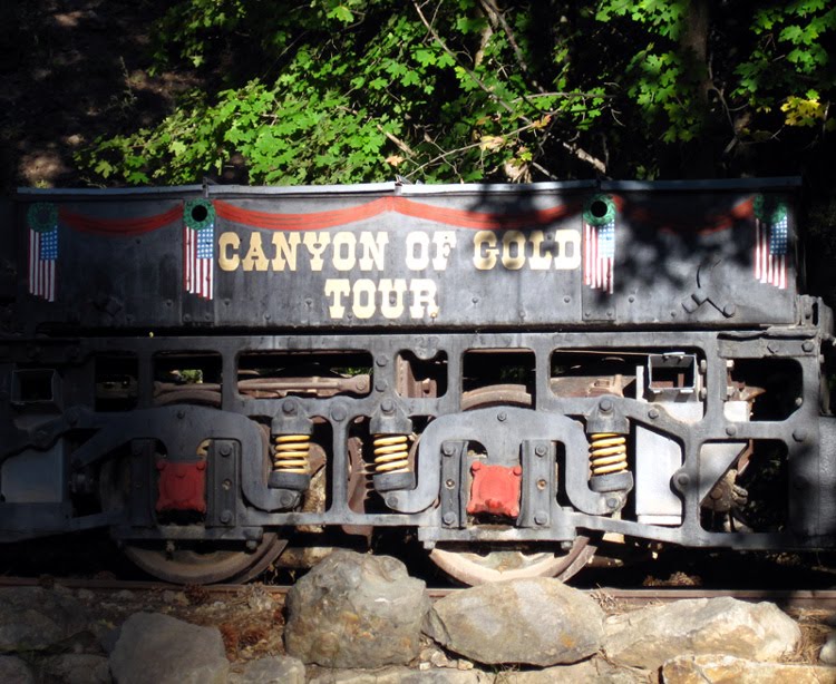
Accessed from Marysvale, Bullion Canyon is most often explored by ATV or automobile, but the canyon road’s gentle grade and smooth gravel surface is equally enjoyable on a mountain bike. Near the canyon’s mouth, stop at a restored ore car on the north side of the road and pick up a pamphlet that describes the various stops on the self-guided “Canyon of Gold Tour.” Numbered signposts along the canyon mark the locations of an abandoned toll road, the Dalton Mill, the Spanish arrastra, and other historic sites.
Additional Hints
(Decrypt)
Ohfu jnpxvat erdhverq