Pando Grove:
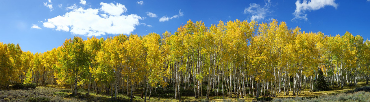
Pando Grove, as seen above in the early fall.
The Fishlake Area is home to several unique items; arguably the most impressive is Pando (Latin for "I spread"), an enormous grove of quaking aspens that takes the “forest as a single organism” metaphor and literalizes it: the grove really is a single organism. Each of the approximately 47,000 trees in the grove is genetically identical and all the trees share a single root system. While many trees spread through flowering and sexual reproduction, quaking aspens usually reproduce asexually, by sprouting new trees from the expansive lateral root of the parent.
 The individual trees aren’t individuals, but stems of a massive single clone, and this clone is truly massive. Spanning some 107 acres and weighing 6,615 tons, Pando was once thought to be the world’s largest organism (now usurped by thousand-acre fungal mats in Oregon), and is almost certainly the most massive. In terms of other superlatives, the more optimistic estimates of Pando’s age have it as over one million years old, which would easily make it one of the world’s oldest living organisms. Most however agree that is is likely about 80,000 years old, which still makes it one of the oldest living organisms in existence.
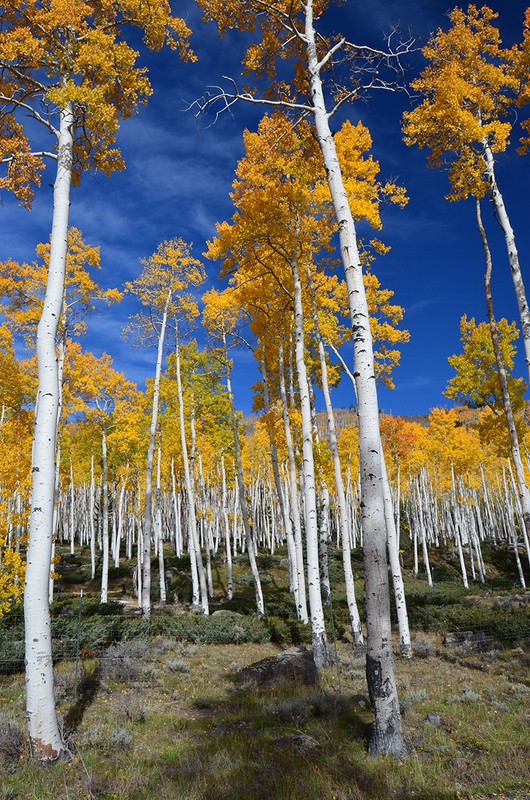
Left: another picture of the Pando Grove
Unfortunately, the future of the giant appears grim. According to numerous scientists and studies, the Trembling Giant is in danger. While the mature stems of Pando routinely die from the eternal problems of pests and drought, the regenerative roots of the organism that are responsible for Pando’s resilience are under attack as well.
Multiple sources report a marked absence of juvenile and young stems to replace the older trunks, blaming overgrazing by deer and elk. Without new growth, to replace the old, the Trembling Giant is vulnerable to a catastrophic, sudden withering and shrinking. As ecologist Paul Rogers confessed (one of the scientists heavily invested in understanding Pando), “It’s slipping away very quickly.” The National Forest Service is attempting to help Pando recover; to see a video on their efforts, click here. And here is a recent news article that discusses Pando & its outlook: Pando's Future
Fish Lake:
While Pando may be of interest to many, it is not the only thing of note. Many people have come to the Fish Lake area over hundreds and even thousands of years, in large part because of the nearby lake, for which the surrounding National Forest is named. The lake's geologic formation also has an interesting history; to learn more about that, check out Fishlake Earthcache.
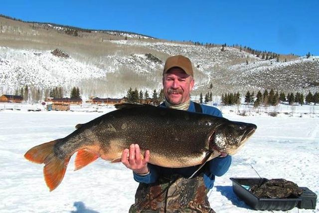
Above: As this photo shows, there are some real lunkers in Fish Lake
Fish Lake itself is one of the largest natural alpine lakes in Utah, which at its deepest is 175 ft. Being such a large and deep lake, it supports some very large fish, including Mackinaw Trout that often reach 25 lbs in weight, and as such is a popular fishing destination.
Additionally, the nearby Fish Lake Lodge and the Bowery Haven Resort are popular destinations with locals and tourists alike, both known for their cozy cabin accomodations, food, fishing supplies, etc. Fish Lake Lodge even has a cell phone booster that comes in handy because you likely won't get a cell signal anywhere else nearby. See the waypoints for their locations.
 Old Spanish Trail: Fish Lake Cut-off
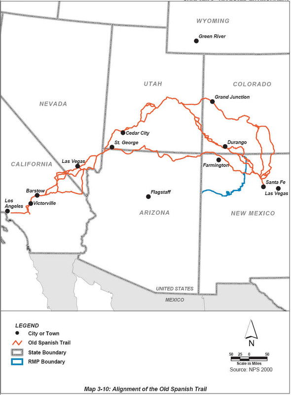
If that wasn't enough excitement for you, be sure to check out the Old Spanish Trail information stand that is found nearby the Doctor Creek camping area. Between 1829 and 1848, traders from New Mexico stitched together a series of trails left by Native Americans and Spanish priests. The route, from Sante Fe to Los Angeles, was later named by John Charles Fremont as the “Great Spanish Trail”, today known as the Old Spanish Trail. It stretched 1,200 miles through what are now the states of New Mexico, Colorado, Utah, Nevada and California. It entered nearly waterless lands scorched by unceasing heat and then climbed rocky, rugged mountains, like you see here. This area was known as the Fish Lake Cut-off, because during the summer months it provided a shorter, better route with access to water, grass, good fishing, etc.
Left: Map of the Old Spanish Trail, with numerous different routes, as we best understand it today.
According to Fishlake National Forest Archeologist Bob Leonard, the Old Spanish Trail has been described as the “longest, crookedest, toughest pack trail in North America.” The mule was the hands-down choice for the beast of burden and as riding animal. Simply put, mules are stronger, tougher and more intelligent than horses. Their hooves are incredibly dense and they never needed to be shoed. Kit Carson, famous American scout, soldier and Indian agent, never rode anything but a mule.
 So what did the pack mules carry? Typically, they carried woolen goods from New Mexico to California where they were traded for Spanish mules and horses. One to two blankets would get you a horse while three to five blankets were demanded for a good mule. On the return trip, caravans could employ 200 to 300 men who drove thousands of animals back to New Mexico. One such caravan or “caballado” had over 4,000 animals when it left California.
The BLM recently explored the Utah sections of the Old Spanish Trail; to learn more about their adventure, see: OST Adventure. Perhaps it will pique your interest as well!
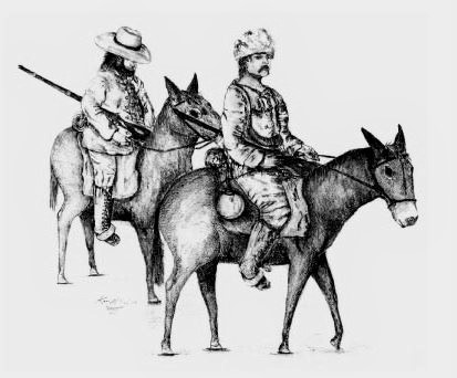
Right: Traders as they would have appeared traveling the Old Spanish Trail.
Summary:
As you can see, there is much to see and learn as you explore this area. While you are here looking for the GeoTour cache, we hope you enjoy your time here and make the most of it!
Source: Cache description and information was adapted from http://www.fs.usda.gov/ and http://www.atlasobscura.com/ by josephaw; we'd also like to thank madambutterfly1822 for the beautiful painting, stamp, and logbook she created for this particular cache, and Disintagrator for his maintenence of the cache location as needed.
Cache Description:
The posted coordinates are not where the actual letterbox cache is located. However, it is a good place to begin, and you may park there. Very close by, towards the lake you will see an information board that is entitled: "The Fish Lake Cut-off on the Old Spanish Trail." Near there is where your journey will begin.
To find the actual cache, you must answer each step's question correctly, and you eventually you will be led to the actual cache in three simple steps.
Here are the coordinates for the final cache (where you'll actually find it):
N 38° 31.7A2 '
W 111° 44.B5C '
Each letter represents a missing coordinate / number (which will range from 0-9). Figure out the answer to that step's question, and you’ll have your missing number! Note: taking a photo of the info board to help you answer the questions as you go would be helpful; or you can run back and forth; your choice!
Step A: "The Fish Lake Cut-off on the Old Spanish Trail."
There is a picture on this information board, and it depicts at least one type of animal.
- If it depicts just a wolf, take the Doctor Creek Trail path, and replace "A" with 4
- If it depicts a just trout, take the Lakeshore Trail path, and replace "A" with 5
- If it depicts both a trout and some mules, take the Lakeshore Trail path, and replace "A" with 6
- If it depicts both a wolf and some mules, take the Doctor Creek Trail path, and replace "A" with 7
Step B: Down the Path & 100 ft Away
After traveling down your chosen path for about 100 ft, you will see the path end in a T, with a sign showing the trail now going both to the left and right. Now, you may proceed several different ways. To know the correct way to go, answer the following question:
The info board may have mentioned that Fish Lake had another, native name. What what that name?
- If you are sure the answer was "Wasatch Lake", then take the path to the left, and travel another 100 feet in that direction. Replace "B" with 4
- If you think the name was "Wahsatch Lake", then take the path to the right, and travel another 100 feet in that direction. Replace "B" with 5.
- If you are positive that the only name mentioned was "Fish Lake", turn around, and continue back the way you came for 50 feet. Replace "B" with 6
Step C: The Spanish Trail Travelers
To the west of the parking area, there are several metal cut-out figures representing a caballado (caravan); how many individual figures are represented?
- Take the number of figures (FYI, a man on a mule counts as one figure, not two) and replace "C" with that number.
You should now know where the cache is, and it shouldn't be too far away from where you are. Good luck & happy hunting!
Sum check: A+B+C should equal 17 if you did it correctly