Toponaut: Hemlock
Inside this cache, you you will find a clue needed to search for Toponaut: Hemlock 2, Confluence & Gullies.
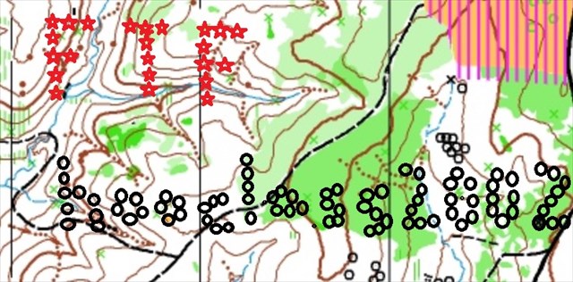
This series needs to be done in sequence, both geographically, in order of difficulty, and to retrieve clues to continue. Detailed instructions will be included for the first cache, and then decrementally so as the series progresses. All together the series will lead to about a 2 mile round trip hike (or possibly more of course!), most of it off-trail.
Quick background: I went on an orienteering course with caching pal Englaand. Once. At night. We had a ball running for miles through the woods (orienteering is timed) following the map and finding waypoints. The map and legend are borrowed from orienteering, but there the similarity ends; there is no "real" compass use. And this park is closed at night. However, feel free to run!
You will need:
- A color printout of the topo map and the legend (both are found in the Gallery).
- A compass (your GPS compass will suffice if you trust it).
- The knowledge of how to project a waypoint using your GPS device.
- If you are unsure of how to proceed, there is a primer below.
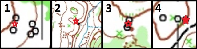
Navigate to the red star. Project 437 feet bearing 272 degrees to locate the cache.

Primer (intended directions with map reading tips along the way)
- Park at the posted coordinates for the cache (blue P on target map above). The target map is a magnified portion of the large topo map just for this cache; you will need the full-sized map for the entire series.
- Proceed back up the road (heavy black line) you drove in on to the northeast.
- Look for the old trail off to the west (dashed black line). It is a large trail, 6' wide, but it is unmarked.
- Go west on the trail downhill (brown contour lines denote elevation; contour interval is 5 meters).
- At an intersection (where the main path veers southwest), continue due west on a less well-defined trail that ends at the creek.
- Note: the areas on the map that are light green denote "slow run" which means light vegetation and deadfall. Darker green means a tougher bushwhack. No green means open woods.
- Follow the "trail" west all the way to the creek, then head south along the creek.
- Note: somewhere along here the creek goes from "intermittent" (dashed blue line) to permanent (solid blue line).
- Continuing south, keep your eye out for any of the piles of rocks to the west (open black circles). Go check them out!
- Note: the small black dots are "stony ground". You should be able to discern between these and the piles.
- You're almost on your own! Use your compass and newly-learned map reading skills to navigate to the target.
- You'll be going uphill, but if you go over the hill you've gone too far (note target is just before a ridge, denoted by a "peninsula" in the contour lines).
- If you come upon the group of three rock piles...well, you're getting closer, but you're not quite there yet.
- Once you find the two rock piles near the top of the ridge, stand in the middle between them and perform your projection from there.
- There is a photo of the northern rock pile as seen from between them in the Gallery for confirmation.
- Just to be clear: there is nothing hidden at the red star location. That is just where you do your projection from.
- Note: if you get lost, return to a known point and try again. Another tip is to use your compass to determine the direction of a creek or other feature to help determine where you are. For example, both the creek and the target rock piles generally trend north-south.
- As you use your GPS to navigate to the cache, pay attention to where you are on the map! This will be helpful/crucial in continuing to the next cache in the series.
Some other notes:
- I have set the "not winter friendly" attribute solely due to difficulties with finding the piles of rocks in the snow.
- As you navigate, it might be prudent to come up with a point that is "too far". For example in the first cache, going over the ridge in search of the piles of rocks.
- Within the cache you will find a distance and bearing needed for the next cache in the series. Record this but don't take it with you.
- Have fun exploring! However this is ungroomed territory so be mindful of snakes, ticks, and other scary creatures.
Links to caches:
 No night caching

Best Series 2016