The cache is NOT at the posted co ordinates.
Stage 1: Use your OL28 1:25000 map
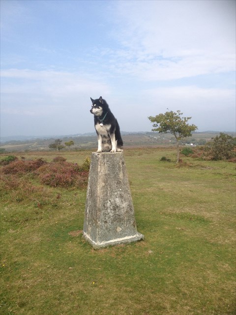
At the Roborough Down trig point, you head toward the busy main road. 300m to the north, a minor road bears off roughly north east. You follow it for 3.5km until you reach a crossroads; you take the east road for 1.7km until it joins another road. At this point, the ground to the north east gains height, so you follow the line of an old boundary work until you reach the peak. You can see a trig point so you head to it. Which OS grid square are you now in? Grid = ABCD
Stage 2: Visit the trig point and obtain the four digit number from the base plate. Trig No = EFGH
The cache can be found at:
N 50 (B-A) (E+F) . (D+E) (D-C) (E+H)
W 004 (F-E-G) D . E (D-F) C
