Cache Across Maryland 2016
The Maryland Geocaching Society and the National Park Service welcome you to the 2016 edition of Cache Across Maryland! In commemoration of the 100th Anniversary of the National Park Service, the MGS and the NPS have joined together in presenting CAM 2016 in ten National Park locations throughout the state of Maryland. From the mountains of Western Maryland to the Atlantic Ocean, Cache Across Maryland 2016 will demonstrate that Maryland truly is “America in Miniature”.
This is one of ten geocaches placed in National Parks for Cache Across Maryland 2016. Each geocache contains a code which you will use to determine the location of the CAM 2016 Picnic to be held on May 14th. The code can be found under the lid of the cache container and on the inside front cover of the logbook. Don't forget to record this code! Any geocacher who has completed all ten CAM geocaches and attends the CAM Picnic on May 14th will receive a Certificate of Completion and a Cache Across Maryland 2016 Geocoin. We hope you enjoy a very special CAM 2016!

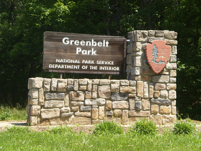
Greenbelt Park
Greenbelt Park is located in Greenbelt, MD just inside the Capital Beltway only 13 miles from the White House in Washington DC, and is the closest campground to the nation’s capital. The park contains over five miles of hiking and equestrian trails, several campsites and three picnic areas.
The land that became the National Park was assigned to the National Park Service from a larger tract of land that surrounded the newly formed city of Greenbelt. The other piece of land became the Beltsville Agricultural Research Center. Greenbelt Park received its National Park designation in 1950. This is around the same time the NPS acquired the land that would end up forming the Baltimore Washington Parkway, which cuts through Greenbelt Park.
The Geocache
This geocache is not located at the listed coordinates. This cache is a four-stage puzzle which will take you through the southern portion of Greenbelt Park along the Perimeter Trail. Along the way you will gather some basic information from man-made items placed along the trail, and this will lead you to the final. Once you start your journey, you will stop at 3 different areas before reaching the final container, which is a little over half a mile from the parking coordinates. Please take careful note of the Parking waypoint. This cache is in the southern end of the park, and the parking lot is accessed from Good Luck Road. This lot cannot be accessed from the Greenbelt Road entrance at the north end of the park.
Stop 1
- Just behind the starting coordinates is a man-made bench at the junction of the Perimeter Trail and hard top road.
- A = How many long boards make up the seat of the bench?
Stop 2
- As you start your journey down the trail, you will encounter a curving boardwalk over some soggy low ground. The park has replaced a portion of the boardwalk with an elevated portion to cross a little stream that flows through the lowland. This si the first portion you will encounter and it sits about 2-3" taller than the remaining boards.
- BC = How many full boards make up the elevated section of boardwalk that crossed the little stream minus 7? (checksum=9) (NOTE: puzzle was changed on 7/1/17 to account for new boards added to elevated section)
Stop 3
- As you continue your journey down the trail, you will spot a marker along the left hand of the trail with a 2 digit number on it.
- DE = What is the two-digit number on the sign?
Final
- R = B+D+E
- S = C–B
- T = A+E
- L = C+B–A
- N = A+D–E
The geocache is located at N38° 5R.STL, W076° 5N.TTL
The checksum of RSTLN is 29.
The geocache is a clear lock-n-lock container.
Greenbelt Park is open from dawn to dusk every day of the year and does not charge a fee to use their hiking and walking trails.
The Maryland Geocaching Society extends its thanks to the National Park Service for participating in Cache Across Maryland 2016 and for allowing us to partake in its centennial celebrations. Geocaches may only be placed on National Park Property at the direction of National Park Service staff.