Cache Across Maryland 2016
The Maryland Geocaching Society and the National Park Service welcome you to the 2016 edition of Cache Across Maryland! In commemoration of the 100th Anniversary of the National Park Service, the MGS and the NPS have joined together in presenting CAM 2016 in ten National Park locations throughout the state of Maryland. From the mountains of Western Maryland to the Atlantic Ocean, Cache Across Maryland 2016 will demonstrate that Maryland truly is “America in Miniature”.
This is one of ten geocaches placed in National Parks for Cache Across Maryland 2016. Each geocache contains a code which you will use to determine the location of the CAM 2016 Picnic to be held on May 14th. The code can be found under the lid of the cache container and on the inside front cover of the logbook. Don't forget to record this code! Any geocacher who has completed all ten CAM geocaches and attends the CAM Picnic on May 14th will receive a Certificate of Completion and a Cache Across Maryland 2016 Geocoin. We hope you enjoy a very special CAM 2016!

Monocacy National Battlefield

Monocacy National Battlefield comprises 1647 acres of farmland, forest and riparian areas on the outskirts of Frederick, Maryland. The landscape in the park is virtually untouched since the Battle of Monocacy which was fought on July 9, 1864. This was the last time that Confederate forces fought the Union forces in the North. Despite the South being considered the victors of this battle, the outmanned Union forces held off the Confederate troops long enough at Monocacy so the Union can send troops to Washington DC, which was unguarded at the time.
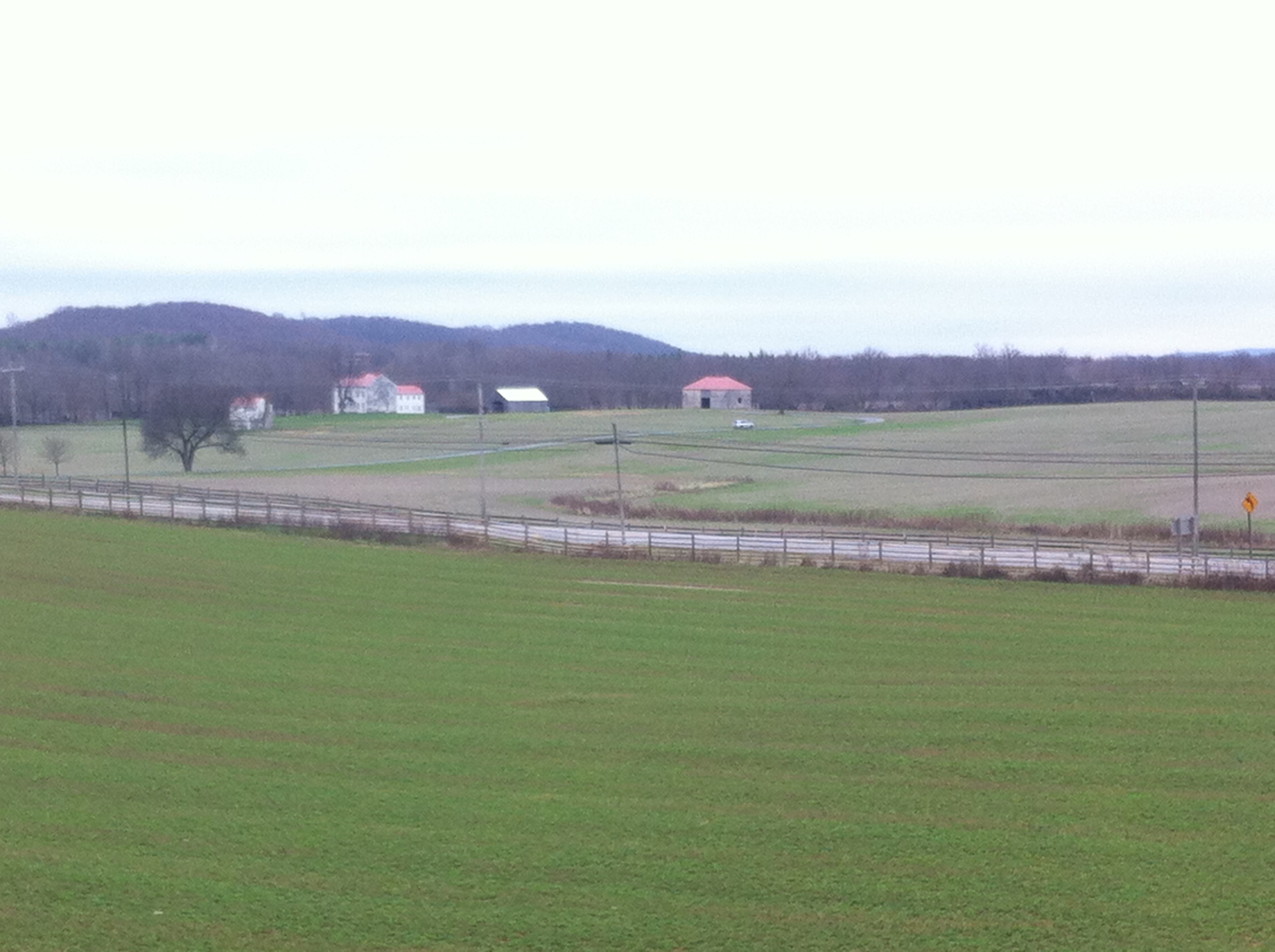
There is a guided tour of the battlefield which takes you to all the important sites in the area. These sites include:
- 1) Best Farm – This is where the Confederate were holed up with their sharpshooter picking up Union soldiers until the Union artillery was able to set the barn on fire.
- 2) New Jersey Memorial – The State of New Jersey was the first state to place a memorial on the grounds of Monocacy Battlefield.
- 3) Worthington Farm – Where the Confederates initiated three advances to the Union troops stationed at Thomas Farm. Because of high causalities in this part of the battle, the farm became used as a field hospital.
- 4) Thomas Farm – The heaviest fighting of this battle occurred here as this farm was caught in between Confederate and Union forces.
- 5) Gambrill Mill – Used as a field hospital by Union forces during the battle until their retreat.
The Geocache
This geocache is a three stage mutli-cache. At the given coordinates, you will find an information sign just outside the Visitor's Center. Use this sign to gather information which will help you figure out the coordinates to Stage 2.
Stage 1
- A = # of letters in first name of Private, whose quote is on the top left corner of the sign.
- B = The date given in the first sentence in the lower left hand corner of the sign.
- C = In the Map Legend, # of soldiers that make up a Union brigade.
- D = 1st digit of the # of men commanded by Lieutenant Davis minus one.
- E = 2nd digit of the number of men in General Ramseur's division.
- F = In the upper right, there is a photo of Georgetown Pike; The 4th digit of the year.
The coordinates for Stage 2 are N39° 21.ABC, W77° 24.DEF
The checksum of ABCDEF is 24.
At Stage 2, look for an information sign which shows a child peering through the gaps of boarded windows. Use this sign to gather information to figure out the final coordinates. There is a parking area 100 feet from the sign. Please use this parking area and do not drive your vehicle up to the sign.
Unauthorized vehicles are not permitted on the road leading to the cache. Please walk to the cache from Stage 2. Do not drive to the cache.
Stage 2
- G = # of words in the title of this information sign.
- H = There is a photo in the lower left corner of Glen Worthington and his cousin; The second digit of the year of photo.
- J = Age of child when battle occurred minus 2.
- K = Last digit of the year of death of person mentioned on bottom left hand corner of sign.
- L = Last digit of year Glen Worthington graduated from Law School.
- M = Last digit of year in which he published the first complete account of the Battle of Monocacy.
The geocache is located at N39° 21.GHJ, W77° 24.KLM
The checksum of GHJKLM is 29.
The geocache is a clear lock-n-lock container.
The Monocacy National Battlefield Visitor Center is open daily from 8am–5pm except on New Year’s Day, Thanksgiving Day, and Christmas Day. The park’s driving tour and hiking trails are open daily from 7am until 20 minutes past sunset. There are no fees to enter Monocacy National Battlefield.
The Maryland Geocaching Society extends its thanks to the National Park Service for participating in Cache Across Maryland 2016 and for allowing us to partake in its centennial celebrations. Geocaches may only be placed on National Park Property at the direction of National Park Service staff.