 < /centre>
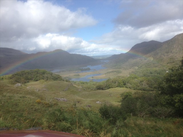
This is a busy beauty spot for tourists to stop and admire the view. But what is it that you are looking at? It is a good place to See the scale of the last glaciation of the area. To your left you can see the black valley beneath the peaks of the MacGullycuddy reeks. To your right, towards Killarney is the flat valley floor containing the Upper lake studded with rocky islands.
Glacial Valley
A valley is a low area between hills, often with a river running through it. In geology a valley is a depression that is longer than it is wide. Most valleys are either U-shaped or V-shaped. Valleys generally start out as V-shaped valleys, where water runs off the surrounding hills and forms a river at the bottom. When a valley becomes glaciated, full of ice, the weight and force of the ice pushes everything in its path out of the way and the valley becomes U-shaped with a much more rounded bottom.
Killarney's last ice age
This began over 2 million years ago and only ended 10,000 BC. A 490 metre deep wall of ice slowly pushed its way through the Killarney Valley, leaving the mountains above it with their jagged appearance and gouging out the wide valley you see before you, scouring it clean and leaving many basins some of which are now filled with lakes. When a glacier moves through a valley it tends to leave a 'nap' similar to a wave, the upstream side of the upraided rock outcrops tend to be smooth and streamlined, whereas the downstream sides are rough and in many cases, almost vertical, like the breaking crest of a wave. The ice sheet flowing down the valley produced a smooth surface on the left hand ends of the hillocks, whereas the rougher right hand ends were shaped by the ice plucking lumps of rock free as it flowed over the rock surface. This type of formation gives us a good indication of the direction of the flow.
To log this Earthcache
Please contact me via my profile with the answers to the following questions. Please send me the answers BEFORE you log the find. If you feel you have the right answers please go ahead and log the cache, if there is a problem I will contact you.
1. The valley runs roughly North-South. In which direction do you think the glacier moved, give your reasons.
2. Why are the upper peeks of the mountains more jagged in appearance than the lower parts.
3. In which year did Queen Victoria and her entourage visit this area, the answer is on the notice board near where you are standing.
4. How many viewing telescopes are there here.
5. Photos of you and your visit here are welcome, but please no spoilers of the answers to the last two questions