Brandbergmassiv /White Lady
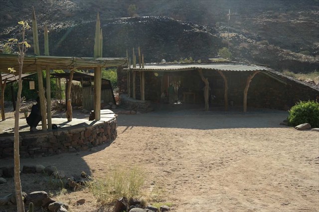
Mountain Guides Office
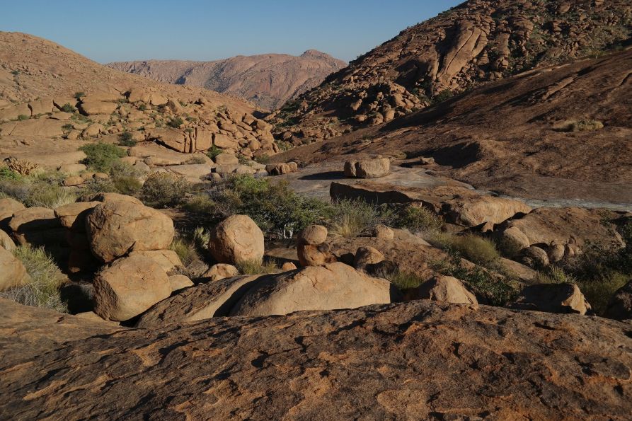
Granit formations at the Brandberg in 1.800 m
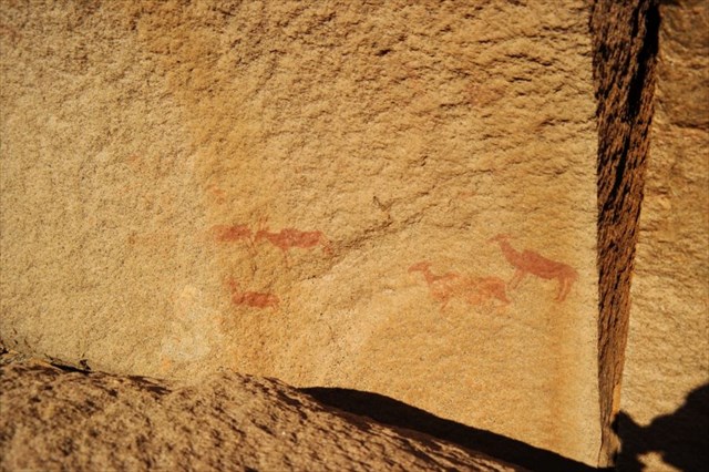
Rock painting at Brandberg
English Version


Brandberg massif - White Lady-
The Brandberg massif is located about 50 km west of the small town Uis in the Namib Desert.
In order to reach the coordinates listed above coming from Uis, follow the unpavedmain road C35 and then the gravel road D2359 which diverges from it westwards. You will find the coordinates at the end of D2359. This is where the Daureb mountain guide office of the NHC (National Heritage Council of Namibia) for the Brandberg massif and the rock paintings with the famous "White lady" is located.
Submontane, the almost circular massif has a diameter of up to 30 km. It covers an area of about 650 sqm. The peak known as the Königstein at 2574 m is Namibia's highest point.
The first preconditions for the formation of the Brandberg massif have been created approximately 130 Million years ago. As harbinger of the Gondwana splitting masses of granitic magma came up from the depths of the earth into the Damara-Metamorphites, Karoo-Sediments and Vulcanite. This heat bubble consisting of granite-pluton cooled off approx. 2 km under the earth's surface and was only exposed to what we today call the Brandberg during the following millions of years by constant erosion. A so called Inselberg developed which rises up to 2000 m above level land. For a process like this a combination of various environmental conditions is needed. First of all physical and chemical alteration leading to the disaggregation of the weathering mantle. Heavy rainfall leading to the erosion of weathering material (Denudation) and wind blowing away the finely granulated material after drying off (Deflation). This way, the granit, being resistant to alteration, in relative terms rose up in comparison to its surrounding area.
When the granitic magma came up contact metamorphism occurred everywhere it came into contact with the Karoo-Sediments. Clastic rock developed, the so called magmatic breccia. The pyrophillit that emerged from this is still being used as material for decoration articles.
The famous rock paintings and the "White Lady" can be reached via the parking lot in the Tsisab gorge.
Rock paintings are to be found in the whole massif.
It is possible to climb mount Königstein via the Ga-aseb gorge with a mountain guide; however, the ascent has to be well-prepared.
Before you may log the cache, please do answer the following questions:
- 1. How is the surface structure of the red granite formed to this day? Very smooth or very rough?
- 2. How large is the difference in height between the level of the coordinates and the top of Koenigstein today?
- 3. What the two main causes of this local geological phenomenon?
- 4. How do you call the alteration by wind?
- 5. What is the last word at point 13 on the notice board or Admission Rules and Regulations to Brandberg found on the back of the Withe Lady's visit ticket?
After sending your answers to cache allowed to sign. If necessary, I will contact you.
If you like, do post a photo of you in front of the bureau. Please send your answers to my E-Mailadress in this account.
Sources: Namibias faszinierende Geologie, Autorin: Nicole Grünert, Klaus Hess Verlag
German Version

Das Brandberg-Massiv befindet sich etwa 50 km östlich der kleinen Stadt Uis in der Namibwüste.
+
Den Listingkoordinaten erreicht man von Uis über die unbefestigte Hauptverbindungsstraße C35 und die in westliche Richtung abzweigende Schotterstraße D2359, am Ende dieser Straße. Dort befindet sich das Daureb Bergführer Büro des NHC (National Heritage Council of Namibia) für das Brandbergmassiv und den Besuch der Felsmalereien mit der berühmten "White Lady".
+
Am Fuße hat das nahezu kreisfömige Massiv einen Durchmesser von bis zu 30 km. Es bedeckt eine Fläche von ca. 650 qkm. Der Königstein ist mit 2.574 m der höchste Punkt des Massivs und gleichzeitig die höchste Erhebung Namibias.
Die ersten Voraussetzungen für die Entstehung des Brandbergs wurden vor etwa 130 Mio Jahren geschaffen. Als Vorboten der Godwana-Aufspaltung drangen gewaltige Massen granitischen Magmas aus den Tiefen der Erde in die auflagernden Damara-Metamorphite, Karoo-Sedimente und Vulkanite ein. Diese Wärmeblase aus Granit-Pluton erstarrte ca. 2 km unter der damaligen Erdoberfläche und wurde erst in den folgenden Jahrmillionen durch immerwährende Abtragung zu dem frei gelegt, was wir heute den Brandberg nennen.
+
Es entstand ein sogenannter Inselberg der sich bis zu 2.000 m über die Ebene erhebt. Für einen solchen Prozess ist die Kombination mehrerer Umweltbedingungen erforderlich. Zum einen die physikalische und chemische Verwitterung, die zu einer Auflockerung der oberflächlichen Verwitterungsdecke führte. Heftige Niederschläge führten zu einem Abtrag des Verwitterungsmaterials (Denudation) und der Wind verwehte nach dem Abtrocknen das feine Material (Deflation). Der verwitterungsresistentere Granit wuchs auf diese Weise relativ zur Umgebung in die Höhe.
Als die gewaltigen Mengen granitischen Magmas aufstiegen, kam es an deren Kontakt mit den Karoo-Sedimenten zur Kontaktmetamorphose. Es entstand ein Trümmergestein, eine sogenannte magmatische Brekzie. Das so entstandene Pyrophillit wird noch heute zu Dekorationsgegenständen verarbeitet.
+
Die berühmten Felsmalereien und die "White Lady" erreicht man vom Parkplatz in der Tsisab-Schlucht.
Im gesamten Massiv sind Felsmalereien zu finden.
Die Besteigung des Königsteins über die Ga-aseb Schlucht ist mit Bergführer möglich, muss aber gut vorbereitet sein.
Hinweis: Die Einstufung D3 ist der entlegenen Lage und der teils schwierigen Straßenverhältnisse geschuldet.
Bevor du den Cache loggen darfst, beantworte bitte folgende Fragen:
- Wie ist die Oberflächenstruktur des roten Granits beschaffen? Sehr glatt oder sehr rauh?
- Wie groß ist der Höhenunterschied zwischen dem Niveau an den Koordinaten und der Spitze des Königstein heute?
- Was die beiden wichtigsten Ursachen für dieses lokale geologische Phänomen?
- Wie nennt man den Abtragungsprozess durch Wind?
- Wie heißt das letzte Wort bei Punkt 13 auf der Infotafel oder den Admission Rules and Regulations to Brandberg, zu finden auf der Rückseite der Eintrittskarte für den Besuch der Withe Lady?
Nach Versendung deiner Antworten darfst den Cache loggen. Im Bedarfsfal werde ich mich melden.
Wenn du möchtest füge ein Foto von dir vor dem Büro bei. Sende deine Antworten an meine E-Mailadresse in diesem Account.
Quellenhinweis: Namibias faszinierende Geologie, Autorin: Nicole Grünert, Klaus Hess Verlag