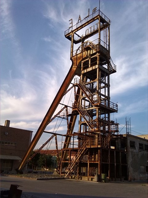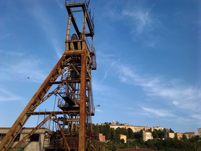
LABIN – ŠOHT (TORANJ RUDARSKOG LIFTA ) – LOST PLACE
Na ovom se mjestu nalaze ostaci rudarskog lifta koji je služio za spuštanje rudara i tereta u podzemni rudnik kamenog ugljena koji se je u Labinu i okolici kopao od 1785 do 1999. godine, a u samom gradu Labinu do 1978. godine. Rudnici doživljavaju najveći napredak u razdoblju od 1936. – 1942. godine dok su bili po Talijanskom upravom. Oko okna je tih godina izgrađeno rudarsko naselje pod nazivom Pozzo Littorio d Arsia, kasnije nazvano Podlabin. Najveća je proizvodnja zabilježena 1942. odine, kad je iskopano 1.158.000 tona ugljena , koji je tih, ratnih godina bio jedan od glavnih industrijskih energenata. Nakon 2. svjetskog rata rudnici nastavljaju sa radom pod upravom tadašnje Jugoslavije. Molim vas da se ne penjete stepenicama, nije najsigurnije niti potrebno za doći do geocachea.
LABIN - TOWER MINING LIFT
This is where the remains of the mining elevator that per serving for lowering miners and cargo in an underground coal mine that was in and around Labin dug from 1785 to 1999 , in the town of Labin to 1978 . Mines experienced the greatest progress in the period from 1936th to 1942nd year when they were by the Italian government. Around windows per these years built a mining settlement called Littorio Pozzo d Arsia , later called Podlabin ( Labin down town ) . The maximum per production recorded in 1942 Odin, when ever excavated 1,158,000 tons of coal per Which of these , the war years was one of the major industrial energy After the 2nd World War mines continues to work under the direction of former Yugoslavia . Please do not climb the stairs, not the safest nor necessary to reach the geocache .
LABIN - MINING LIFT
Dies ist, wo die Reste der Bergbauaufzug, dass pro Portion zur Senkung Bergleute und Fracht in einem unterirdischen Kohlebergwerk , die in war und um Labin gegraben 1785-1999 , in der Stadt Labin bis 1978 . Mines erlebt den größten Fortschritt in der Zeit von 1936. bis 1942. Jahr , als sie von der italienischen Regierung . Um Fenster je diesen Jahren baute eine Bergbausiedlung genannt Littorio Pozzo d Arsia , später Podlabin . Die maximale Produktion pro 1942 Odin aufgezeichnet , wann immer 1.158.000 Tonnen Kohle pro Welche dieser ausgegraben , war die Kriegsjahre eine der wichtigsten industriellen Energie . Nach dem 2. Weltkrieg Minen weiterhin unter der Leitung des ehemaligen Jugoslawien zu arbeiten. Bitte nicht die Treppe , nicht der sicherste noch notwendig klettern , um den Geocache zu erreichen.