General Description:
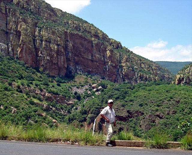
This is the only Tufa waterfall that can be viewed from a road in South Africa. Please enjoy it. To view this Tufa Waterfall you will need to find a parking spot. The waypoint given on the listing is for the Tufa Waterfall. There is parking lot at the Strijdom Tunnel where you can stop to browse through curios, arts and crafts, and take a photograph of the view of the Olifants River below as it cuts its way towards the Kruger National Park. As usual in RSA please be aware of people around you. Also all credits for this EC is contributed to team FishEagle for his initial research and listing. This EC is also wheel chair friendly. From a vehicle with a binoculars you will be able to observe what you need to do.
Please do not attempt to approach the waterfall - the terrain is dangerous, and probably impassable unless you are an experienced rock climber. Also please note that there is no physical cache to find. You have to visit the area and you need to study the waterfall and the listing in order to answer the questions given below.
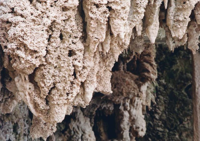
Tufa Waterfalls are unique. Most waterfalls cause the erosion of rocks, while a Tufa waterfall creates rock through sedimentary deposits of limestone over millions of years. Please do not confuse the gelogical term tuff with tufa. Tuff is a porous volcanic rock also loosely called 'tufa'.
A Tufa Waterfall is created when water running over dolomite rock absorbs calcium, and becomes supersaturated with calcite. Supersaturation typically occurs at a waterfall, when the water is highly aerated, has an accelerated flow velocity, and an enlargement of the air/water interface area. This accelerates the release of carbon dioxide, which promotes calcite precipitation. It is believed that algae and mosses, which grow abundantly on the porous tufa deposits, assist with the removal of carbon dioxide, and also create the necessary substrate to trap the calcite precipitation.
The photo above was taken by Team Louise_Gerhard shortly after heavy rains. You will see that the river flows beneath the hard crust of the large dome shaped Tufa deposit which fills the valley, and emerges from a small cave-like hole. There are also several other holes where the river has previously flowed. All the tufa making up the massive dome was deposited over several million years by this river.
Other Tufa waterfalls.
-
There is another nearby Tufa Waterfall at the inflow of the Blydepoort Dam, which can be viewed either from the guided Kadishi-Tufa hiking trail which starts from Aventura Blydepoort (top), or from guided boat trips on the Blydepoort Dam near Aventura Swadini (bottom).
-
Also please refer to EC Tugela Bushveld - Tufa Waterfalls for even more information.
To log this cache you need to:
- Estimate the approximate width and height of the Tufa dome.
- Name the primary difference between tufa waterfalls and normal waterfalls.
- And send us your answers by email. Please do not quote your answers in your log.
Please upload a photo of yourself with the Tufa dome in the background, taken from the viewpoint. This is voluntary and not a requirement to log.
Notes:


| I have earned GSA's highest level: |
 |