Mount Nebo Scenic Byway
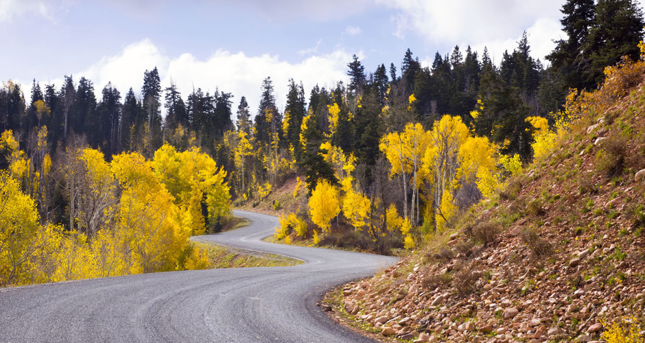
View of the fall foliage, north end nearby Payson Lakes Campground (utah.com)
The Nebo Loop is a 35-mile paved road paralleling the Mt. Nebo Wilderness Area on the Uinta National Forest. The road runs through vegetation communities ranging from oak and juniper to aspen and spruce-fir. Middle and upper elevation wildflowers are common and diverse in summer, especially on side roads and paths joining the main paved road. Several campgrounds and many trailheads and scenic view pullouts are found along the byway.
 Viewing Information
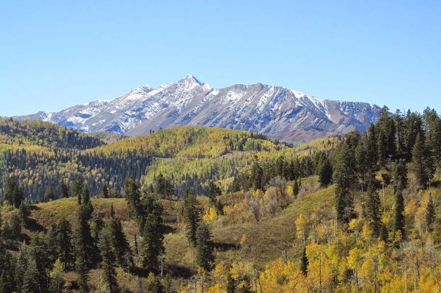
The Nebo Loop Byway is a photographer's dream with many overlooks and wildlife viewing opportunities. The brilliant fall foliage of the Uinta National Forest is hard to match anywhere in the nation.Visitors will be able to enjoy spectacular views of the immense nearly 12,000 ft tall peak of Mount Nebo (meaning "Sentinel of God") and the diverse vegetation all along the scenic byway. Several pullouts with scenic overlooks, informational signs and trails are located along the byway.
Right: Mt Nebo in the early fall (source: Joseph Wright)
 Things to See
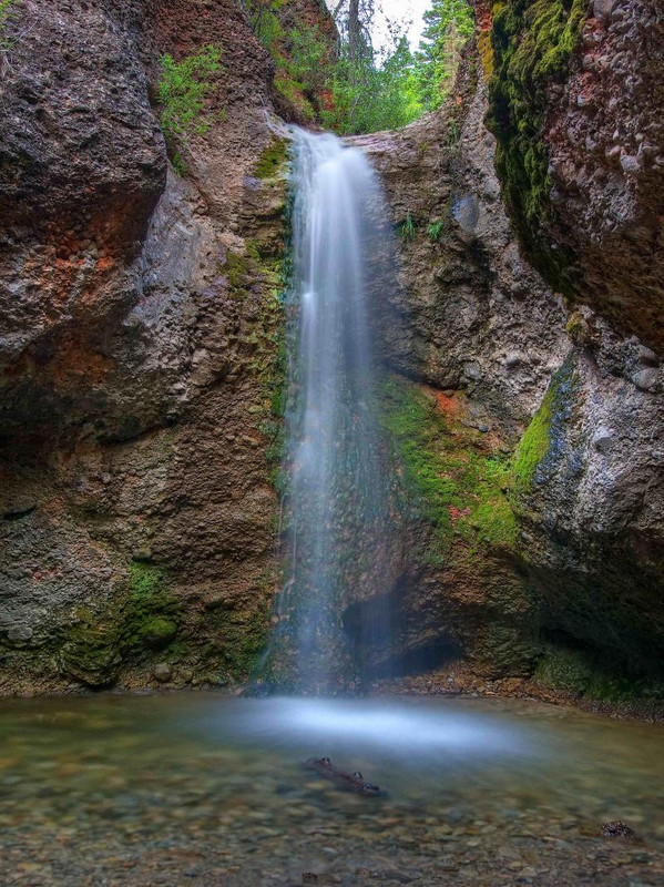
There are many different trails, popular with pedestrians, mountian bikers and equestrians that can be accessed from the Loop Road. Many are indicated by signs and parking areas, such as the popular Grotto Trailhead, Bennie's Creek Trailhead, Blackhawk Trailhead, and the Mt. Loafer Trailhead, just to name a few. There are several trails that will lead you to Mount Nebo itself. There are also many different campgrounds along the way, from Cottonwood Canyon and Bear Canyon on the south end, to the Payson Lakes and Maple Dell areas on the north.
Right: the Grotto Falls are a very popular family-friendly hike destination! (bogley.com)
A very popular stop accesses Devil’s Kitchen, with its red rock cliffs and spires. The byway is nationally known for its wonderful views of bright fall foliage. Best viewing time varies year to year, usually starting mid to late September. A wide range of wildflowers can be seen along the byway from June through late September.
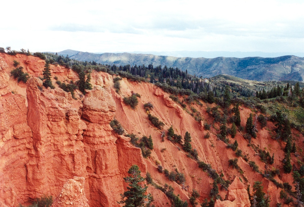
The Devil's Kitchen, often called a "mini Bryce Canyon" (source: A. E. Crane)
Safety First
The byway is a smaller two lane road in mountainous terrain. Don’t be distracted by the scenery while driving. Stay on your side of the road except while crossing into a pullout. Watch for opposing traffic, cattle and large wildlife on the road. In colder weather, watch for icy conditions in shaded or snowmelt areas.
 Directions
To access the south end – from Interstate 15 at Nephi, take Exit 225 to travel east on State Route 132. Five miles from the Interstate, look for a left turn (north) onto Forest Road 015, which is the scenic byway. Travel north on the byway, following the signs at junctions. The byway ends just outside Payson, from which you can access I-15 again. See this map for more info / details: Nebo Loop Map.
To access the byway from the north – from Interstate 15 take Exit 248 in Payson, heading east on 800 South. Turn right onto 600 East, which becomes the Nebo Loop Road (FR 015) into the mountains.
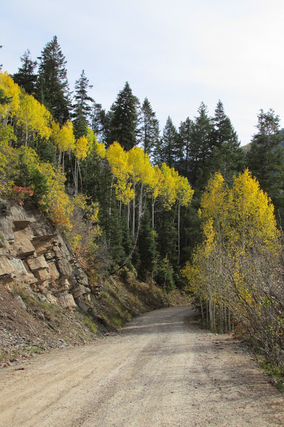
Left: There are other roads worth exploring nearby. This dirt road connects the Nebo Loop with Santaquin, UT (source: Joseph Wright)
Ownership and Management: USDA Forest Service, Uinta National Forest, Spanish Fork Ranger District; Utah and Juab Counties.
Closest Town: The north end is about one mile south of Payson, Utah. The south end is about five miles east of Nephi, Utah.
Source: info adapted from US Forest Service, utah.com and others as noted by josephaw