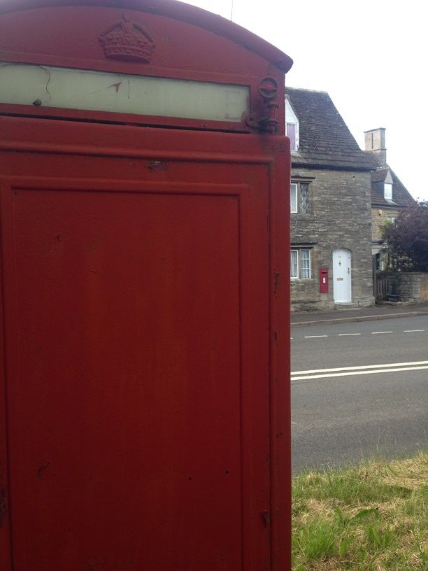
Fine Pair #312 - Upper Benefield Traditional Geocache
Fine Pair #312 - Upper Benefield
-
Difficulty:
-

-
Terrain:
-
Size:  (micro)
Please note Use of geocaching.com services is subject to the terms and conditions
in our disclaimer.
35mm pot
BENEFIELD Benefield (xi cent.); Banefield, Benifeld (xii cent.); Beningfelde, Benefilde, Berifelde, Benetfeld, Benifeud, Beningfeud (xiii cent.); Benyngfielde alias Benefielde alias Beddingfielde (xvi cent.). This parish, to which the hamlets of Biggin and Churchfield, formerly in Oundle, were transferred in 1894, contains 5,664 acres of clay land on a subsoil of Oxford clay in the north and cornbrash in the south. Nearly the whole of this area is permanent grass, less than a fifth is arable land, growing barley and wheat, and some 356 acres are woodland and plantations. The land rises about 100 ft. from east to west, where it reaches 300 ft. above the ordnance datum. The principal road is the highway from Kettering to Oundle, which enters Benefield from Great Weldon on the west and leads eastwards into Upper Benefield, formerly called Uppthorpe, Overthorpe or Upperthorpe. Here there is a good deal of woodland, called in 1800 the Spring, Cockendale, and Blackthorns Woods; here also are the reservoir, some farms and Benefield and Springwood Lodges. The village lies some distance southwards, in Lower Benefield, or Netherthorp, as it was called in the 17th century and later. The church of St. Mary stands on rising ground and adjoining it on the west is the moated site of the castle of the Lisurs. The date of the erection of the castle is unknown, but it may well have been one of the numerous forts thrown up during the anarchy of Stephen's reign (1138–44). It was in existence in 1208, when John seized it for the debts of Hugh de Lisurs. On 15 May 1264, the day following the Battle of Lewes, Henry III, while a prisoner with Simon de Montfort, issued a mandate to the knights and others in Benefield Castle, stating that peace having been made between the king and his barons, they were not to go out of the castle nor do any ill in those parts. It was probably in the following year that, the castle being held for Edward the king's son, the men of the castle plundered the manor of Biggin and crossed the river to Oundle, where and at Ashton they took a number of cattle. The men of Oundle, however, made a counter-attack and recovered many of their beasts. Not long after this date the castle was probably dismantled. In 1298 it is described as an old castle, and in 1315 the site of the castle only is referred to. It continued a ruin and is so described in 1378. Leland about 1535 mentions the site as 'the diche and mines of an old castelle.' Part of the wall was still standing in Bridges' time (1724), when the inclosure was said to be square, covering about an acre of land. On the north of it was the manor house, which apparently superseded the castle and is mentioned in 1445. A furlong to the west of the village are nine Swallow Holes where the land floods occasionally flow and disappear. Banhaw Wood (the Banho or Danho in the 14th century) was said to be within the metes of Rockingham Forest, and Humphrey de Bassingbourne obtained licence to inclose 100 acres of its waste. In 1820 the wood covered nearly 312 acres on the south of the parish. Eastward of this wood are the hamlets of Churchfield and Biggin Hall with a large part of its grounds, the rest of which are still in Oundle. An Act of 1820 for the inclosure of certain waste and commonable lands in this parish preserves many place names, such as Northaws, Cobs Hurn, David's Leys, Rimington, Cockmore and Nuthalls Closes. Other place names which occur are Ouldwalles and Pottereswaye, a lane near Banhaw Wood, and Fezauntes landes. In 1921 the inhabitants of Benefield numbered 410. The modern parish of Beanfield Lawns in the Hundred of Corby, which was for some purposes considered part of Benefield, though extra parochial in 1831, lies about three miles distant from it. It was perhaps part of the King's fee in the 11th and 12th centuries. Henry II granted the Abbey of Pipewell its pasturage and herbage, which the Abbot exchanged in 1356 for the advowson of the church of Geddington. Many references to leases or grants of the custody of the launds of Benefield and to the capital messuage here are found in public records. If you wish to add to the Fine Pair series, please contact matt2dk for a number, to avoid duplication.
Additional Hints
(Decrypt)
Tebhaq yriry