Greenwater is nestled in the wilderness on WA Hwy. 410 on the way to the western edge of Mount Rainier National Park, and part of the Mount Baker-Snoqualmie National Forest. This area is served largely by Forest Service Roads (FS Rd), with many uses such as hiking, mountain biking, camping, back-roading and off-roading in 4X4 vehicles - all a popular pastime in the area.
The Naches Trail is up FS Rd 70, and was used by some of the first settlers while making their way to the Pacific Northwest. In 1853, current residents encouraged more settlers to take the Naches branch of the Oregon Trail to the Washington Territory. They promised improved passage trails to the area, but it was soon learned that they never followed through on their promise. The biggest problem was a sheer cliff drop-off that made the continued passage almost impassable. But these hardy pioneers improvised and found a way to make the descent. One man offered one or more of his cattle to be sacrificed for forming a rope by which to let down provisions, the dis-assembled wagons, their remaining livestock, as well as the pioneers themselves. The rope was formed and they made the traverse with little loss of provisions and only one wagon. After one more final group of settlers attempted the trip on the Naches Trail, it was then abandoned due to the extreme hardship of the route. One of the final group of settlers to cross was the Meeker family, a well-known family name in South King County. Read more about one family's journey in Nothing in Life is Free, written by Della Gould Emmons.
Today, the trail is used extensively by four wheel vehicles which have altered parts of the original trail, as they found the circuitous route the wagons were forced to travel with little of today's modern conveniences and know-how could be improved and straightened out for their use. The trail is broken into two individually numbered FS Rds, and are available at various time of the year for use. However, some parts of the trial still show the ruts of the wagons from the original trail, and marks on the cliff where wagons, etc., were lowered are evidence of its original use. To celebrate the centennial of the first crossing, a group of jeepsters hacked and gouged a route over the pass in 1953, and since then the trail has been heavily used by motorbikes and off-road vehicles. A proposed road through the pass was added to the state highway system in 1943, and is still in the state statutes as State Route 168, but has never been built. The Naches Trail is being considered for designation as a National Historic Trail under the National Trails System Act. For more information and to learn about historic sites along the way, see the website http://www.piercecountyhistory.org.
Please note that phone service is marginal at best, so please do not rely on phone service to find this cache.
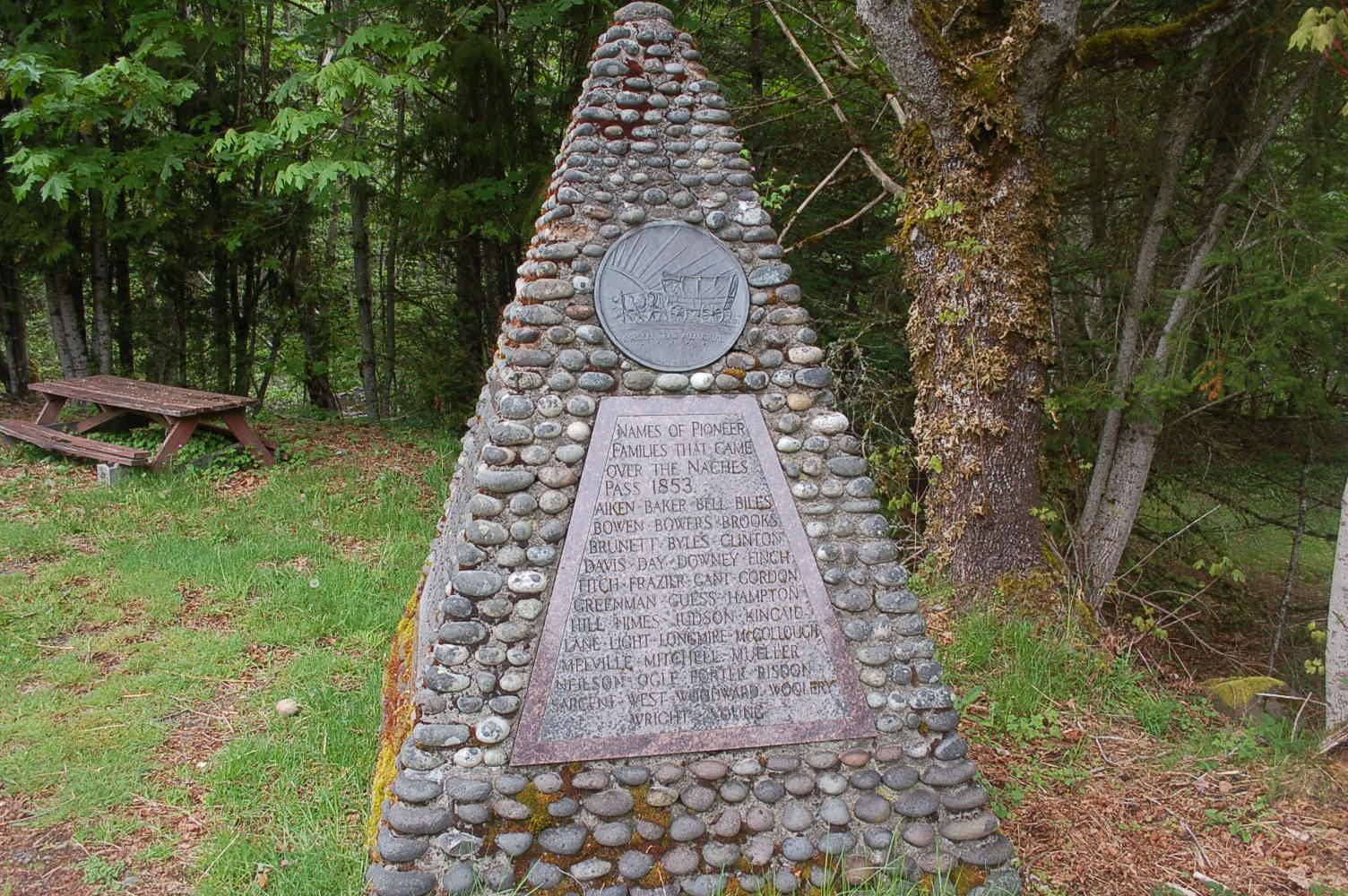
A historic marker in Greenwater, just across the bridge as you enter Greenwater from the west, has been placed to commemorate those families who completed the rugged trail. Read through the list of names, and you will likely see many family names that are a vital part of our history.
CACHE – The cache is hidden not far from the monument and should not be affected by high water, but we will keep an eye on the location. There is a small pullout area next to the monument so you can read the two engravings mounted on the pyramid rock structure. If approaching from the West, be careful if making a u-turn or crossing the busy highway to view the monument and seek the cache. The easiest access is an approach from the East, just before you cross the bridge, as it provides room for one or two cars off the shoulder of the road. Enjoy the scenic location.
2016 was the 100th anniversary of the National Park Service, and to celebrate, Visit Rainier and WSGA hosted the Visit Rainier Centennial GeoTour - 100 caches placed in and around Mount Rainier National Park. The geocaches highlighted the rich history, scenic wonders, quaint communities, and hidden gems of the Rainier region. Participants received geocoin and pathtag prizes for finding all the caches.

