SI PREGA DI NON PUBBLICARE FOTO DI GZ, DEL CONTENITORE, DEL LOGBOOK, DI "VISTA DALLA CACHE". UNA FOTO PANORAMICA E' MOLTO MEGLIO! LASCIATE CHE QUELLI CHE VERRANNO POSSANO DIVERTIRSI NELLA RICERCA COME VOI!
PLEASE DO NOT LOG PICTURES OF GZ, THE BOX, THE LOGBOOK, "VIEW FROM THE CACHE". A PANORAMIC PHOTO IS WAY OUT BETTER! LET THE GEOCACHERS WHO'LL COME AFTER YOU TO ENJOY THE CACHE IN THE SAME WAY!
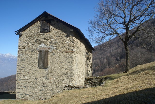 Bedolesso
Per trovare questa multicache bisogna effettuare un percorso ad anello abbastanza lungo sulle pendici occidentali del monte Legnone: più di 16km di lunghezza, una durata di circa 6/7 ore, più di 1000 metri di dislivello in salita. Naturalmente il trail può essere spezzato in più tappe a seconda del proprio tempo e delle proprie gambe. Alcuni stadi della multicache possono essere raggiunti in macchina e in meno di 5 minuti a piedi, altri richiedono 2/3 ore di cammino.
Lungo il percorso troverete acqua e nel punto più alto il ristoro di un rifugio (aperto stagionalmente).
Il trail si presta in buona parte ad essere percorso in mountain bike: per i dettagli consultate le pagine delle singole cache.
Lo scopo della multicache è quello di far conoscere alcuni "monti" (Sommafiume, Vercin, Vezzée, Bedolesso), alpeggi (Alpe Rossa, Alpetto, Roccoli Lorla) e manufatti di interesse storico (trincee della I Guerra Mondiale) e naturalistico (roccoli ad Artesso).
Se avete raccolto l'ultima parte di coordinata a Vezzée adesso potete proseguire per la strada sterrata agro-silvo-pastorale in direzione di Bedolesso inizialmente pianeggiante, poi leggermente in salita e poi nuovamente pianeggiante che vi condurrà alla bonus cache.
Le coordinate finali del multicache sono:
N 46° 06.UVW
E 009° 22.XYZ
Se volete un aiuto in più, alle coordinate N 46° 06,475 E 009° 22,686, pochi metri dopo l'indicazione del sentiero per Posallo, trovate una piccola stazione di monitoraggio:
- se il numero in basso a destra è IP65 la pietra che nasconde la cache è bianco-grigia;
- se il numero in basso a destra è IP76 la pietra che nasconde la cache è bianco-rossa;
- se il numero in basso a destra è IP87 la pietra che nasconde la cache è bianco-nera;
Dopo aver loggato si raccomanda la perfetta sistemazione dei sassi.

To find this multicache you have to walk through a quite long ring path on the western slopes of Mount Legnone: it's more than 16km long, it takes about 6/7 hours, there are more than 1000 meters of altitude difference. Of course, the trail can be broken into several stages depending on your own time and your own legs. Some multicache stages can be reached by car in less than 5 minutes on foot, others require 2/3 hours walk.
Along the way you will find water and at the highest altitude a mountain shelter (open seasonally).
The trail is suitable for the most part to be covered by mountain bike: for details see pages of each cache.
The purpose of this multicache is to discover some "half-mountain pastures" (a.k.a. "monti": Sommafiume, Vercin, Vezzée, Bedolesso), some pastures (Alpe Rossa, Alpetto, Roccoli Lorla) and artifacts of historical interest (the trenches of World War I) and natural interest (roccoli di Artesso).
If you have collected the sixth coordinates' part in Vezzée, now you can follow the forestry-road towards Bedolesso, initially flat, then slightly uphill and then again flat that will lead you to the bonus cache.
The final multicache stage coordinates are:
N 46° 06.UVW
E 009° 22.XYZ
If you want more help, at the coordinates N 46° 06,475 E 009° 22,686 you will find a small monitoring station:
- if the number in the lower right is IP65, the stone that hides the cache is white-gray;
- if the number in the lower right is IP76, the stone that hides the cache is white-red;
- if the number in the lower right is IP87, the stone that hides the cache is white-black;
Once you have logged in, it is recommended the perfect arrangement of the stones.

Sei in zona alto Lario e tra le moltissime cache qui presenti non sai da dove cominciare?
Questa bookmark list vuole esserti d'aiuto. Queste sono quelle che a me sono piaciute di più, magari ti divertirai anche tu a cercarle.
Are you in the upper Como Lake area and among the many caches present here you don't know which to first seek for?
This bookmark list wants to help you. These are the ones that I liked the most, maybe you'll have fun seeking for them too.