
Salt Pans from Zebbug and Marsalforn
Geology of the Region
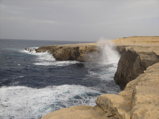
The Żebbuġ mesa and Marsalforn valley are located in the northern middle section of the small island of Gozo, the second largest island of the Maltese archipelago. The region is composed of marine tertiary sedimentary rocks which date their initiate deposition during the Oligo-Miocene epochs (between 30 to 38 million years ago). This northern section of the island exposes all the geological strata however the Blue Clay and the Upper Globigerina limestone outcrops dominate the area.
Globigerina Limestone: Overlying the Lower Coralline Limestone is the Globigerina Limestone. This is a softer fine grained rock layer than that below it and therefore, when weathered, it forms gentle slopes unlike the sheer cliffs formed by the former. The thickness of the Globigerina layer varies between 20 metres near Fort Chambray, Gozo to about 200 metres at Marsaxlokk, Malta. This layer’s texture is homogeneous, unlike the Lower Coralline. The composition of the Globigerina Limestone is entirely Globigerina and related deep-sea micro-organisms, which indicates that at the time of its formation 34 million years ago, a sinking of the land mass took place since the components suggest sea-depths of around 600 feet. The layer itself has three sub-layers, namely the Lower Globigerina Limestone, the Middle Globigerina Limestone and the Upper Globigerina Limestone. Lower Globigerina limestone is present at different locations with a varying thickness, this horizon thins out completely towards the North West of Malta. The layer itself often exhibits honeycomb weathering when exposed. Thickness variations within the Middle Globigerina Layer are similar to those within the Lower Globigerina. This layer is absent in Eastern Gozo. The Upper Globigerina Limestone layer is subdivided into a further three layers, namely an upper and lower horizon of yellow biomicrites, with an intermediate division of grey marls. The Upper Globigerina Layer is absent in East Central Malta as a result of erosion which took place within the post- Miocene period.
Blue Clay: Overlying the Globigerina Limestone is the Blue Clay layer which is the softest layer of the main rock strata. It is compact when dry and malleable when wet. Its colour varies from grey to yellow or brown, with lighter colour bands present in upper layers. It is easily weathered forming rounded slopes covered with landslip debris, with the stratum thickness being variable over the archipelago. The layer consists of fine lime grains, clay mineral content as well as skeletal material from planktonic organisms. The blue clay layers consist of variable proportions of calcium carbonate, with the amount increasing in regions where the clays progress to Globigerina. It is compact when dry, with its colour varying according to composition between grey, brown or yellow (Bonello, 1988). The paler clay bands such as those found abundantly in Xemxija, consist of a high proportion of carbonate of lime due to the sizeable content of fossil foraminiferal shells (Testa, 1989). The relatively homogeneous composition of the Blue Clay also hints at a deep sea deposition. Its thickness varies across the islands being absent in certain locations.
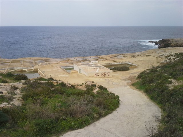
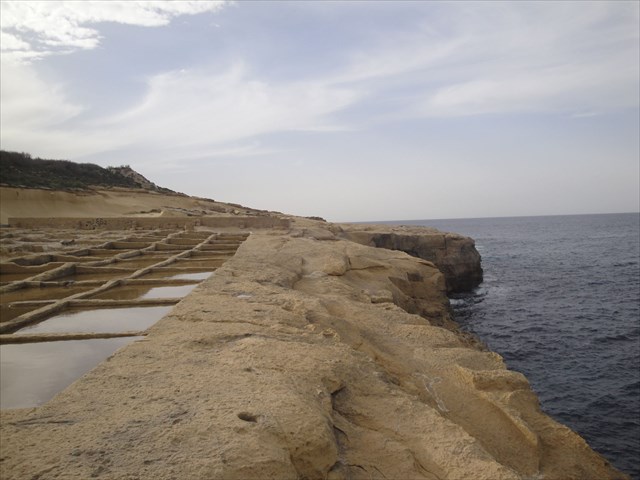
Geography of the salt pans
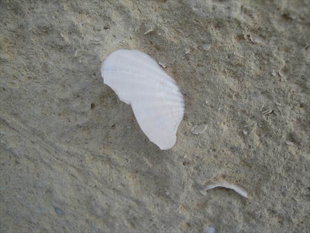
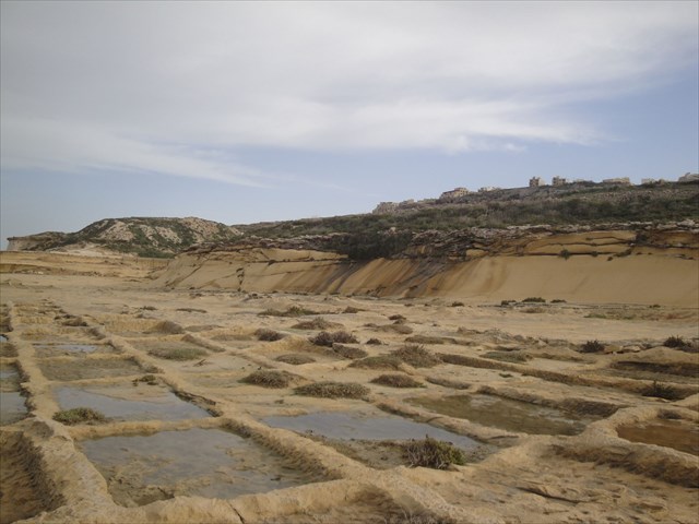
The pans are formed from the rocks they occupy, having been carved out by locals many years ago. The stone in which they are carved is made up of calcium carbonate, which is provided in many instances by the nearby marine environment (evidence of which can be seen in the stone if you look carefully - you will notice seashells), and it also contains silica, clay, silt and sand to varying degrees.
Usage of the pans
Salt production is still ongoing at these pans, but takes place in the spring and summer months. The pans are passed from generation to generation of workers on the island, and have been for the last 150 years.
History of the salt pans
It is believed that a rich watchmaker who lived in IżŻebbuġ, owned a lot of property in Gozo. His avidity was insatiable. At one stage the watchmaker decided that there was a fortune to be made through the production of salt. Therefore, one day he commissioned some workers to build the salt pans by digging them out in the soft coastal limestone. However, filling the salt pans with saltwater proved arduous as the sea level was over fifteen meters below.
As the ridged coastline is full of caves and tunnels, he decided to dig a shaft down to one of the tunnels. In this way when the waves hit the coast, water would rush up the shaft and fill the salt pans with sea water. Having dug the shaft during summer, he waited for the winter months to see if the idea would work. When winter arrived and the sea began to crash against the rocks, water was forced up the shaft and filled up all the salt pans. However, the area where he had dug his salt pans was composed of porous rock and the saltwater was absorbed by the rock instead of evaporating. To make matters worse, when the sea was very rough, the sea water spurted like a geyser and saltwater was sprayed over an area of several kilometers, destroying the crops in the neighbouring fields.
The farmers were angered by this threat to their livelihood and decided to fill up the shaft with large rocks.
The method of working
Salt water is pumped from the sea to what are known as "warming pans". From these warming pans, canals run through the rocks to each individual salt pan, to allow either any one, or all of the pans to be filled simultaneously. The process of forming salt crystals then begins, with the salt water warming in the sun, and evaporation taking place. As the water evaporates, the salinity of the remaining water in the pans increases until salt crystals begin to form. The whole process takes between 5 and 7 days to complete, after which time, the pans are cleared by hand, and the process starts again.
Attention
If you venture down to the salt pans, please remember not to step into the pans themselves, as they are kept as clean as possible to maintain salt purity.
How to log this cache
Please send the answers to the tasks one to three via e-mail to my profile. After sending your answers, no additional permission is needed to log this cache. In case I have troubles understanding or interpreting your answers, I will contact you. Please note, that logs without an appropriate e-mail cannot be accepted and will be deleted without further notice.
- 1) Give the name as well as the chemical formula of the table salt.
- 2) When entering ground zero (GZ) you see a small cliff behind you located between street level and the level of the salt pans. Have a look at it and describe the colour, the texture, and the surface of the stone.
- 3) In the first chapter (Geology of the Region), you can find a short description of Globigerina limestone and Blue Clay. It should be possible to identify the stone type of which the salts are formed from. What is the stone type the salt pans are formed from?
- 4) (optional) It would be nice to have a picture of you together with your GPS posted with your log.
Have fun and good luck.