St Catherine's, Artington
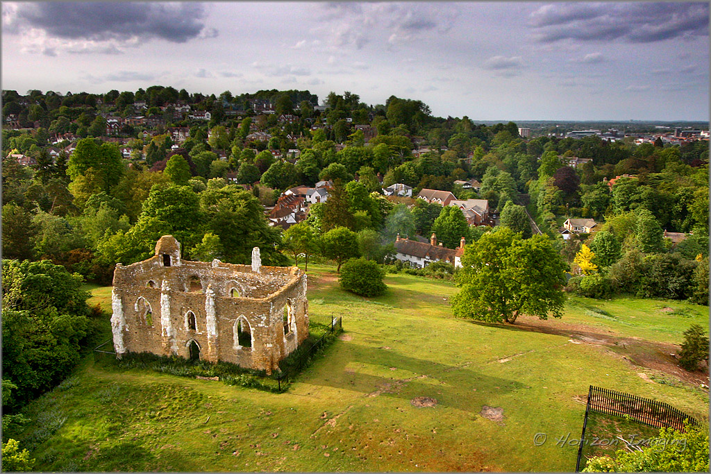
St Catherine's is a Chapel of ease, said to have been used by pilgrims traveling from Winchester to Canterbury between 1329 (its consecration) to around 1450 when it fell into disuse. In Victorian times a theory was put forward about the configuration of doors as they appeared by then. There seem to be 3 at ground level and 2 above in the centre of the North and South walls. They appear to have door jambs implying inward opening on the South and outward on the North, but no sign of a ramp or steps. So the image arrives that there was such a flow of pilgrims that they gushed through from South to North at ground level and to relieve congestion, took to entering by doors at high window level, crossing by means of a gallery and descending at the same level the other side. This would be by ladder as a temporary arrangement leaving no historic mark or step.
The chapel was only actively used as a chapel for around 150 years (although a service is still held at Easter to honour its consecration). There was thought to be a chapel to St Catherine as early as 1202 yet this had already fallen into a ruin or been destroyed by 1300.
Saint Catherine (or Katherine) is the saint associated with hills. This is said to be because she was carried by angels to mount Sinai, after her martyrdom by beheading. She is often associated with hills with a spring. The wheel with which she is associated was a spiked wheel which was to break her body as means of execution, however her goodness meant that the wheel broke and splintered into many pieces which flew out into the crowd killing those around, but leaving her unharmed.
The hill was originally called Drakehull or Dragonhill. This was for two reasons:
1) The serpentine shape of the mound and the spring at the bottom was seen as a dragon's residence in Saxon times. (The head has now been severed by the A3100 Road cutting.)
2) There were ancient legends of dragons guarding springs and there is still a spring at the base of this hill. In the past there were said to be 7 springs and that they could cure eye problems, which made this a very special site. St Catherine is a saint who was believed to protect people from dragons, which reinforces the reason for the Chapel's dedication to her, there was obviously a dragon here....
The Chapel and the Fair
There was a fair held around the Chapel from 1308 (though built in 1301 the chapel was not consecrated until 1329). The fair continued to be held annually, up to the first world war, without missing a year. The fair is the subject of a Turner watercolour kept at The Yale Centre for British Art in Heartford, Connecticut
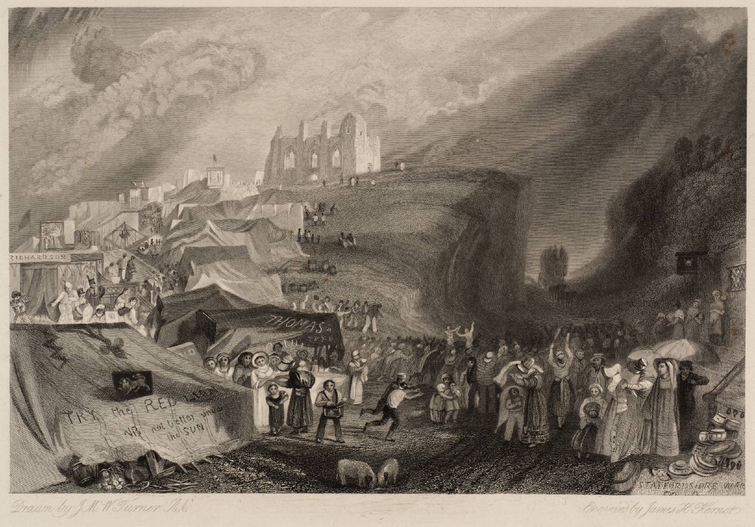
Fairs were held around religious festivals. This one was around St Matthews day 21st September, and later in October. There was revenue collected by the leaseholder for these fairs. In this case there was a dispute as the lease had not been paid when the chapel was built, and it was contested by another church only to be reclaimed later by St Nicolas'. The lease and ownership of the chapel were important to holding rights to the fair.
At the starting co-ordinates you will be at the north west corner of the chapel by the tower.
A = the number of windows you can you see on the outside of the tower (you may have to walk about a bit to see them all)
Proceed to the North East corner to the information board and look for the description of the
B = the number of days the fair lasted for in medieval times
C = the number of days the fair lasted at the time depicted
Go to stage 2 - N 51° 13.520 W 000° 34.681
What number is the bridge - DE/FG
How long is the tunnel - HJK yards
The cache can be found a short walk away at: N51 1J.(A+D)K(B-F) W0 3(C+H+D).(E-C)CJ
Wellies are recommended for the GZ and at some times (Christmas Day 2013 was a prime example) the GZ will be inaccessible without some additional equipment and no small about of risk. I strongly recommended that you avoid doing the final stage during floods.
****************** ********************
For full information on how you can expand the Church Micro series by sadexploration please read the Place your own Church Micro page before you contact him at churchmicro@gmail.com.
See also the Church Micro Statistics and Home pages for further information about the series.
****************** *******************