Orienteering
Orienteering is a rough sport that requires navigational skills using a map and compass to navigate from point to point in diverse and usually unfamiliar terrain, and normally moving at speed. Participants are given a topographical map, usually a specially prepared orienteering map, which they use to find control points. Originally a training exercise in land navigation for military officers, orienteering has developed many variations. Among these, the oldest and the most popular is foot orienteering. For the purposes of this article, foot orienteering serves as a point of departure for discussion of all other variations, but basically any sport that involves racing against a clock and requires navigation using a map is a type of orienteering.
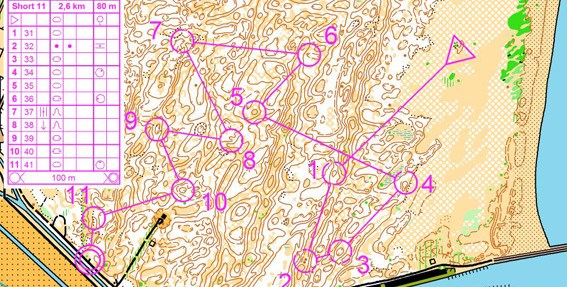
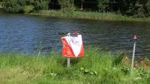
Example: Orienteering course
History
For the first public orienteering competition in Sweden, in 1901, control points included two historic churches, Spånga kyrka and Bromma kyrka (a round church). World Orienteering Championships 2007 in Kiev, Ukraine. Winners of middle-distance event: Simone Niggli-Luder, Switzerland, and Thierry Gueorgiou, France With the invention of inexpensive yet reliable compasses, the sport gained popularity during the 1930s. By 1934, over a quarter million Swedes were participants, and orienteering had spread to Finland, Switzerland, the Soviet Union, and Hungary. Following World War II, orienteering spread throughout Europe and to Asia, North America and Oceania. In Sweden in 1959, an international orienteering conference was held. Representatives from 12 countries (Austria, Bulgaria, Czechoslovakia, Denmark, Finland, East and West Germany, Hungary, Norway, Sweden, Switzerland, Yugoslavia) participated. In 1961, orienteering organizations representing 10 European nations founded the International Orienteering Federation (IOF). Since then, IOF has supported the founding of many national orienteering federations. By 2010, 71 national orienteering federations were member societies of the International Orienteering Federation.These federations enabled the development of national and world championships. World championships were held every two years until 2003, then every year.
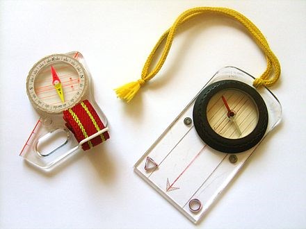
Example: Compass
Throughout this time, orienteering has remained most popular in Scandinavia. There, the two oldest recurring orienteering meets have been held since the 1940s (Jukola relay and Tiomila), and the single largest orienteering meet has been held every year since 1965 and attracts around 15,000 competitors (O-Ringen). Typically, orienteering is run in wild terrain. In its Scandinavian origins, this typically meant in the forest, but orienteering in open fell, heathland, moorland and other mixed terrain is also common. Orienteering in towns has been common for many years.
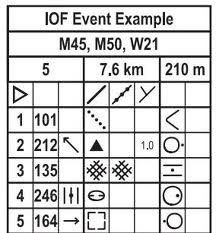
Example: Control description sheet
Street-O
Street-O has typically been a low-key affair; score events, often at night, normally as informal training events. The Venice street-O is notable for attracting a large international participation. With Park World Tour races and other (e.g. World championships) elite sprint races often being held in urban areas, and the development of a map specification for urban areas (ISSOM), from the mid-2000s, Street-O has been rebranded as urban orienteering, and has taken itself rather more seriously, with full colour maps and electronic punching, and may now be regarded as a serious competition with inclusion in national ranking lists. Such urban races are often much longer than the sprint distance.
Example: Street-O map
Orienteering maps
orienteering maps: Orienteering competitions use specially prepared orienteering maps. They are topographic maps although much more detailed than general-purpose maps. The ISOM map scales are 1:15,000 or 1:10,000, with grids aligned to magnetic north. Map symbols are standardized by the IOF, and designed to be readable by any competitor no matter his background or native tongue.
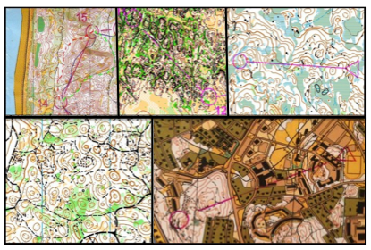
Example: maps from different parts of the world
Södertälje & sports
Sodertalje received the award 2013 year's elite sports city with the motivation: " For the ambition based on its population continuously support and develop competitive sports activities in several sports. Mainly in basketball, soccer, hockey, floor hockey , volleyball and orienteering".