A QUEDA DAS
ALMINHAS
Português

ACHADA
Achada é uma freguesia portuguesa do concelho de Nordeste, com 11,19 km² de área e com cerca de 500 habitantes. O principal meio de subsistência é a agricultura profissional através da cultura da batata e a plantação de milho para posteriormente ser transformado em ração para gado bovino assim como a criação de gado bovino. Ainda possui plantações de tabaco, de vinha (uva) característica dos Açores (junto ao mar) e castas madeirenses de vinha trazidas para os Açores da Ilha da Madeira por Jovino Dias.
Foi na freguesia da Achadinha que se deu o desembarque das tropas Liberais vindas da Terceira, no assalto final contra o último reduto Miguelista nos Açores, a 1 de agosto de 1831. Ao que consta, a população da freguesia terá recebido mal as tropas liberais.
Trilho das Terras de Nosso Senhor
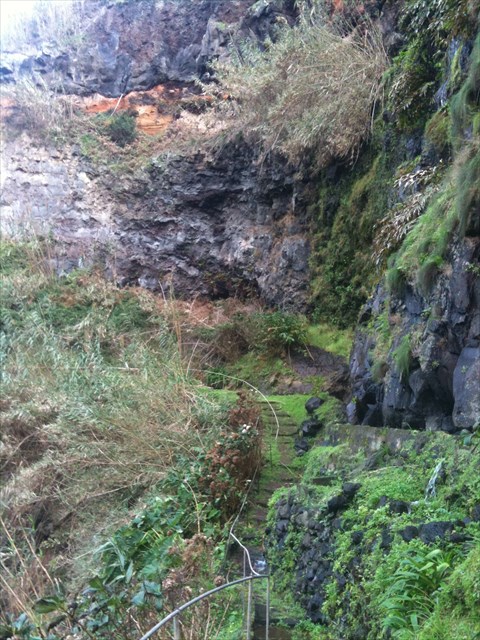
Um dos antigos caminhos rurais que ligava a freguesia ao povoado vizinho, foi recentemente adaptado a trilho pedestre e com o nome de Terras de Nosso Senhor. Este novo percurso pedestre, localizado na freguesia da Achadinha, apresenta diversos pontos de interesse, entre os quais diversas nascentes e linhas de água com cascatas, além da fauna e flora locais. O Trilho das Alminhas/Terras de Nosso Senhor, com uma extensão aproximada de três quilómetros, tem início no Jardim Público das Alminhas, onde também termina.
O TRILHO DAS ALMINHAS
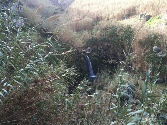
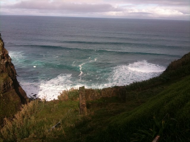
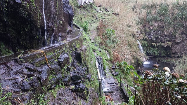
Perto da foz da ribeira (onde desembarcaram as tropas Liberais), que passa perto da freguesia da Achada, inicia-se um outro trilho, conhecido como das Alminhas, que passa perto de uma “levada” e junto a uma bonita queda de água. Quando este trilho encontra a ribeira do Cachaço, se seguirmos pela ribeira, para montante, iremos encontrar a espetacular queda de água do Cachaço. Mais acima existem outras quedas de água, estas de acesso mais difícil, só aconselhável por “canyoning”.

A CACHE:
A caixa tem um formato convencional.
Por favor, sejam discretos, não façam logs forçados, nem postem fotos que possam denunciar a cache.

ALMINHAS
WATERFALL
ENGLISH

ACHADA
Found in a Portuguese parish is the municipality of Nordeste, having a with of 11.19 km² in area and about 500 inhabitants. The main livelihood is professional agriculture through the potato crop and the planting of corn to later be turned into feed for cattle as well as cattle breeding. Still has the tobacco plantations of the vine (grape) characteristic of the Azores (by the sea) and Madeira vine varieties brought to the Azores from Madeira by Jovino Days.
The parish of Achadinha gave the Third landing of coming troops Liberals, the final assault against the last Miguelista stronghold in the Azores, on 1 August 1831. Reportedly, the population of the parish will have received the liberal troops poorly.
"Terras de Nosso Senhor" TRAIL
One of the old rural paths linking the town to the nearby village, was recently adapted to pedestrian path and the name of our Lord Lands. This new footpath, located in the village of Achadinha, has several points of interest, including several springs and streams with waterfalls, besides the local flora and fauna. The Trail of Alminhas / Land of Our Lord, with an approximate length of three kilometers, begins in the Public Garden of Alminhas where it also ends.
“ALMINHAS” TRAIL
Near the mouth of the river (where the Liberal troops landed), which passes near the town of Achada, starts another trail, known as the Alminhas trail, passing near a "levada" and next to a beautiful waterfall. When this trail meets the river Cachaço, if we follow the river upstream, will find the spectacular waterfall of Cachaço. Further up there are other waterfalls, of these, only advisable for "canyoning" more difficult to access.

THE CACHE:
The boxhas anconventionalformat.
Please be discreet, do not do logsforced, not to postpictures thatcan reportthecache.