About Village Sign Caches
|
 ⠀ ⠀ |
This cache belongs to the Village Sign Series, a series of caches based on ornate signs that depict the heritage, history and culture of the villages that put them up (generally on the village green!).
The signs can be made of different materials from fibreglass to wood, from forged steel to stone. They can depict anything from local industry to historical events. The tradition probably started in Norfolk or Suffolk and has now spread across most of the country so we thought we would base a series on them!
|
More information, bookmarks and statistics can be found at the Village Signs Website
If anybody would like to expand the Village Sign Series, please do.
I would ask that you request a number for your cache first at www.villagesignseries.co.uk
so we can keep track of the Village Sign numbers and names to avoid duplication.
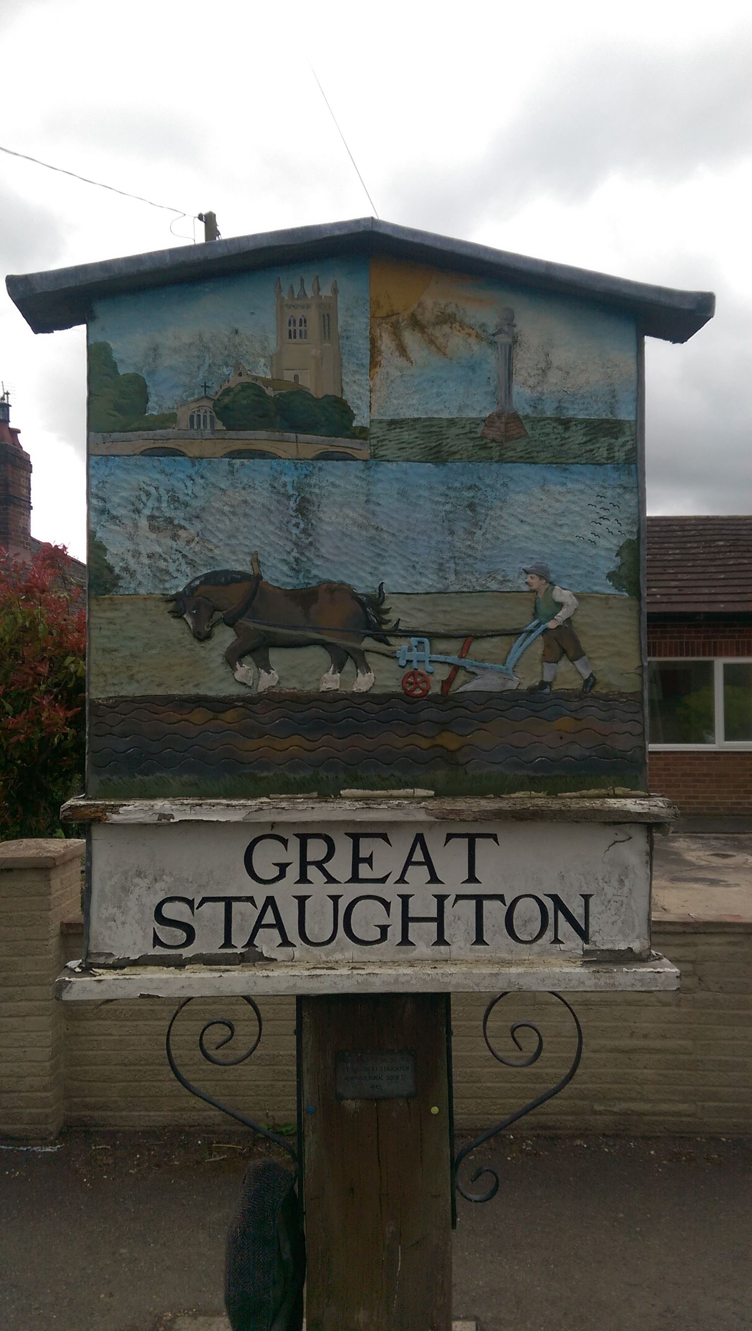
Great Staughton – in Huntingdonshire (now part of Cambridgeshire), England – is a village near Perry west of St Neots.
Great Staughton is divided into three distinct parts. The Highway straddles the B645 and is chiefly noted for the famous sundial, dating from 1637 and the White Hart, a 17th Century coaching inn. The historic heart of the village is the Town which lies half a mile from the sundial, down the minor road to Little Staughton. The Town is dominated by two celebrated buildings: the Church of St. Andrew, which dates from the 13th Century and Place House, built in 1539.
It was the Romans who were the first to leave their calling card here. In 1958/9 a substantial winged corridor-type Roman villa was excavated to the south of the village. The site was carefully chosen, being near to the Dorchester-on-Thames to Alconbury Roman road. Water from Whitley brook was used for heating the villa via hypocausts, and washing facilities for the similarly impressive bathhouse were built nearby. The occupants were probably important officials in the Roman administration, to judge by their lifestyle. It dates from between AD 130-370.
It was not until some 600 years after the departure of the Romans that Great Staughton appeared in historical documents. By a charter (actually a will) dated October AD 989 Aelfhelm Polga, a loyal knight of King Edgar, donated the church and parish of Stoctune to Ramsey Abbey.
Staughton’s most famous monument is the sundial which stands on the Highway near the White Hart Inn. Underneath the date of 1637, the initials E.I. have been carved into the stone. For many years a mystery (even the Victorian County History offers no explanation), it now seems fairly clear that the monument was erected by one Edmund Ibbutt, who was a major landowner in the village between the 1630s and the 1660s. In 1633 he donated a bell to the church which is still doing stalwart service. His name also features regularly in the churchwardens’ accounts: quite why he decided to build a sundial will probably always remain a mystery.
The cache is a short walk from the village sign, you'll need some info from it but you won't need to go climbing all over the it!
The geocache is not at the published coordinates. You will need to visit it, though, to gather the information required to discover the real GZ
The sign was presented to the village by the Great Staughton Horticultural Society in ABCD
Please note, the equation was wrong, it is now N52 15.BCB not N52 16.BCB
The cache can be found at N52 15.BCB W000 20.ADD
This cache is a 60ml tub