
Cache Information:
Cache #: 8
Location: Mansfield-Woods Point Road
Access: All Vehicles, 24/7
Facilities: Roadside Parking
Details:
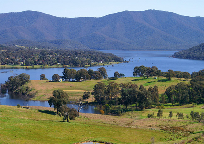
A geocache hidden above the Howqua Valley and Howqua River near Jamieson in an area known for is spectacular view.
Additional Information:
Howqua Lookout is located at Howqua in the Mansfield Shire and overlooks the beautiful Howqua valley, river and Lake Eildon. It is 73 km from Eildon, 15.5 km from Jamieson and 21 km from Mansfield on the Mansfield- Woods Point Road.
History:
The Howqua River is a tributary to the Goulbourn River located at the southern end of the Great Dividing Range. The headwaters of the Howqua River are found near Mount Howitt, on the western slopes of the Great Dividing Range. The Howqua River runs past the base of Mount Buller, which is one of Victoria's premier Alpine Snow Resorts with over 7,000 beds, cinema, gym and indoor sporting facilities. During the warmer months it is a preferred location for those active in mountain biking. In the shadow of Mount Buller on the Howqua River is the Howqua Hills Historic Area managed by Parks Victoria. This location includes Sheepyard Flat camping area and Fry's Flat, which includes a High Country Cattleman's Hut known as Fry's Hut. The Howqua River meets Lake Eildon National Park just below this small, highly prized vantage point.